Is Cyclone Montha Threatening Kakinada Port?

Synopsis
As Cyclone Montha nears the Andhra coast, Kakinada Port faces a severe threat with danger signals raised. Residents brace for heavy rain and high winds as the storm intensifies, prompting authorities to issue alerts across multiple districts.
Key Takeaways
Cyclone Montha is approaching the Andhra Pradesh coast.
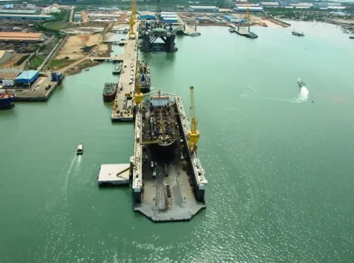
Danger signal number seven has been hoisted at Kakinada Port.
Residents are advised to prepare for heavy rainfall and strong winds.
INCOIS has issued high wave alerts for coastal areas.
Authorities emphasize the importance of safety and preparedness.
Visakhapatnam, Oct 28 (NationPress) As the ferocious cyclone 'Montha' approaches the Andhra Pradesh coastline, authorities have elevated the warning to danger signal number seven at Kakinada port.
The Cyclone Warning Centre, Visakhapatnam, has also issued danger signal number six for Visakhapatnam and Gangavaram ports.
Meanwhile, danger signal number five is in effect at Machilipatnam, Nizampatnam, and Krishnapatnam ports.
Informatory alerts have been dispatched to Kalingapatnam, Bheemunipatnam, and Vadarevu ports.
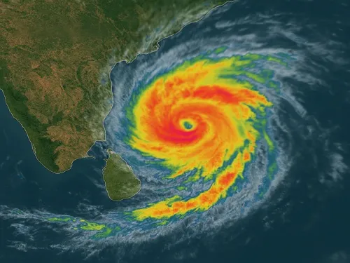
As per the India Meteorological Department (IMD), the cyclonic storm Montha has intensified into a severe cyclonic storm, moving north-northwestward at a speed of 15 kmph over the past six hours. It was located at 0530 hrs IST today, approximately 190 km south-southeast of Machilipatnam (Andhra Pradesh), 270 km south-southeast of Kakinada, 340 km south-southwest of Visakhapatnam, and 550 km south-southwest of Gopalpur (Odisha).
The IMD states that it is expected to continue its trajectory north-northwestward and is likely to make landfall along the Andhra Pradesh coast between Machilipatnam and Kalingapatnam near Kakinada this evening/night, packing maximum sustained winds of 90-100 kmph, with gusts reaching 110 kmph.
A red alert has been issued for coastal Andhra Pradesh. The bulletin indicates that heavy to very heavy rainfall, with extremely heavy downpours, is anticipated in select areas including Srikakulam, Parvathipuram Manyam, Vizianagaram, Visakhapatnam, Alluri Sitharama Raju, Anakapalli, Kakinada-Yanam, Dr. B. R. Ambedkar Konaseema, East Godavari, West Godavari, Eluru, NTR, Krishna, Guntur, Palnadu, Bapatla, and Prakasam districts of coastal Andhra Pradesh and Yanam.
Additionally, heavy to very heavy rainfall is forecasted for several areas over Sri Potti Sriramulu Nellore, Tirupati, Annamayya, YSR Kadapa, and Nandyal districts of Coastal Andhra Pradesh, Yanam, and Rayalaseema.
The Indian National Centre for Ocean Information Services (INCOIS) has issued high wave alerts for coastal districts, predicting wave heights of 3 - 4.7 meters. Small vessels are advised to stay away from the shore, and recreational activities should be suspended due to the cyclone's impact, which may cause erosion and wave surges.
Point of View
It is imperative to prioritize public safety and preparedness as Cyclone Montha approaches the Andhra coast. The government and local authorities are taking proactive measures to mitigate risks and ensure the safety of residents in affected areas. Continuous updates and adherence to safety protocols are crucial during this time.
NationPress
2 Jul 2026
Frequently Asked Questions
What is the current status of Cyclone Montha?
Cyclone Montha has intensified into a severe cyclonic storm, moving north-northwest at a speed of 15 kmph and is expected to make landfall on the Andhra Pradesh coast.
What precautions should residents take?
Residents should stay indoors, avoid travel, and follow local authorities' guidance. High wave alerts are in place, and recreational activities should be avoided.
What areas are under threat from heavy rainfall?
Heavy to very heavy rainfall is expected in several districts, including Srikakulam, Vizianagaram, Visakhapatnam, and many more along the coastal region.