Eruption of Mount Lewotobi in Indonesia Triggers Aviation Alert
Synopsis
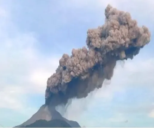
Mount Lewotobi in Indonesia's East Nusa Tenggara province erupted, leading to aviation warnings and safety advisories. The Volcanology Centre reported ash clouds reaching 3,500 meters, prompting restrictions on flights. Residents are cautioned to stay clear of the area due to potential hazards from volcanic activity.
Key Takeaways
Mount Lewotobi erupted, releasing ash up to 3,500 metres .
A Volcano Observatory Notice for Aviation has been issued.
Residents are advised to stay clear of a six km radius.
Potential risks include lava floods during heavy rains.
Protective measures such as facemasks are recommended.
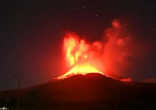
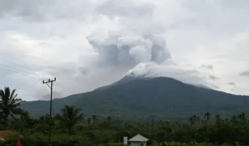
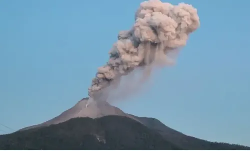
Jakarta, April 16 (NationPress) Mount Lewotobi, situated in Indonesia's East Nusa Tenggara province, erupted on Wednesday, leading to a flight warning and safety advisories as reported by the Volcanology and Geological Disaster Mitigation Centre.
The eruption sent a plume of ash soaring up to 3,500 metres into the atmosphere, with the dense gray cloud drifting to the west and northwest of the crater.
To address the dangers posed by the volcanic ash, a Volcano Observatory Notice for Aviation has been issued at the orange level, which is the second-highest alert, prohibiting aircraft from flying below 5,000 metres near Mount Lewotobi. Pilots are advised to be vigilant due to the potential disturbance from volcanic ash during their flights.
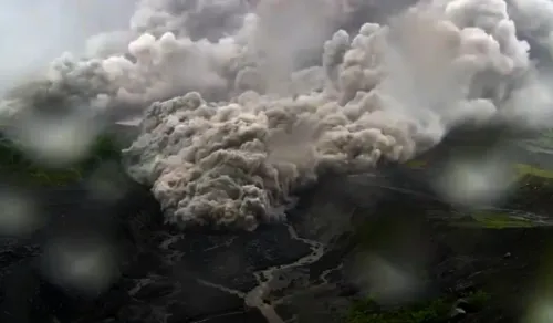
To safeguard the residents near the volcano from the threats of hot clouds and volcanic debris, the centre has shared safety advisories, according to Xinhua news agency. Residents, tourists, and visitors are urged to refrain from any activities within six km of the volcano.
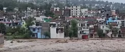
The communities residing close to the volcano should remain aware of the risk of lava floods that may occur due to river flows originating from the volcano's peak during heavy rainfall.
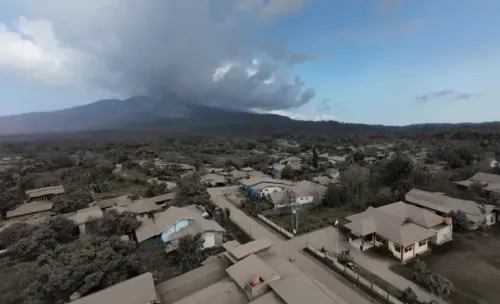
Residents in areas affected by the ash fallout are advised to wear facemasks or similar protective gear to shield themselves from respiratory health risks.
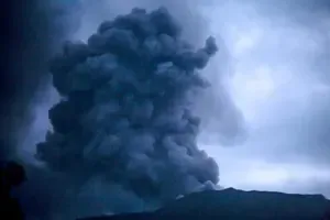
Previously, last month, the Centre for Volcanology and Geological Disaster Mitigation escalated the alert level to the highest tier following the eruption of Mount Lewotobi.
This eruption produced an ash column reaching as high as 8,000 metres before midnight on March 20.
Mount Lewotobi, which stands at 1,584 metres, is one of Indonesia's 127 active volcanoes. Indonesia, home to 270 million people, is known for its frequent seismic activity, boasting 120 active volcanoes and is positioned along the 'Ring of Fire', a horseshoe-shaped series of seismic fault lines encircling the Pacific Basin.
Indonesia is located at the intersection of several major tectonic plates: the Eurasian, Australian, and Pacific plates, and has witnessed some of the most deadly and powerful eruptions globally, such as the eruption of Mount Tambora in 1815, emphasizing the nation's susceptibility to volcanic threats.