Kerala ESA boundary: State pushes to exclude farms, homes from Western Ghats zone
Synopsis
Kerala's decade-long battle over the Western Ghats ESA boundary has reached a fresh flashpoint. The state wants to shrink the protected zone from 9,993.7 sq km to 8,590.69 sq km and exclude 33 villages entirely — but the Centre's latest draft notification left the benchmark unchanged, forcing another round of high-level negotiations.
Key Takeaways
Kerala is preparing a fresh submission to the Centre seeking to reduce the Western Ghats ESA from 9,993.7 sq km to 8,590.69 sq km , covering 98 villages .
The Kasturirangan report originally proposed 13,108 sq km across 123 villages ; the Centre's March 2014 draft cut this to 9,993.7 sq km .
A departmental report has been prepared proposing complete exclusion of 33 villages from the ESA.
Environment Minister Sunny Joseph reaffirmed on Tuesday that the government would protect farmers' and residents' interests.
Satheesan chaired high-level talks with central officials, arguing Kerala's high population density and limited land require special treatment.
The latest central draft notification did not incorporate Kerala's proposed changes, keeping the dispute unresolved after more than a decade.
Kerala is intensifying efforts to keep homes, farms, and plantations outside the proposed Ecologically Sensitive Area (ESA) of the Western Ghats, with the state government preparing a fresh submission to the Centre seeking a significant reduction in the area earmarked for protection. The push comes as the latest central draft notification left unchanged the 9,993.7 sq km benchmark that Kerala has long sought to revise downward.
Background: From Kasturirangan to Now
The ESA dispute traces back to the Kasturirangan Committee report, which initially proposed designating 13,108 sq km — spread across 123 villages in Kerala — as ecologically sensitive. The proposal set off widespread protests, with residents and farmers fearing that the classification would curtail agricultural activity and displace settled communities.
Kerala responded by commissioning a detailed study through the Oommen V. Oommen committee, whose recommendations were forwarded to the Centre. The Centre's March 2014 draft notification reflected a partial concession, reducing the proposed ESA to 9,993.7 sq km — of which 9,107 sq km comprised forest land and 886.7 sq km non-forest areas.
Kerala's Successive Proposals and the Centre's Response
Despite multiple rounds of negotiation and repeated draft notifications, the 9,993.7 sq km figure has remained the operative benchmark. Kerala subsequently submitted a revised proposal seeking to reduce the ESA further to 8,590.69 sq km covering 98 villages. The Centre requested additional spatial data and supporting files, which the state supplied — but the latest draft notification did not incorporate the changes Kerala sought.
The state government has now prepared a departmental report proposing the complete exclusion of 33 villages and is readying another detailed submission calling for amendments to the latest draft, with full exclusion of inhabited areas, agricultural land, and plantations.
What the Government Said
Environment Minister Sunny Joseph on Tuesday reaffirmed the government's position, stating that it was fully committed to protecting the interests of people — particularly farmers — while ensuring ecologically important areas remained safeguarded. The issue has since escalated to high-level inter-governmental talks, with a team of senior central officials visiting the state for discussions.
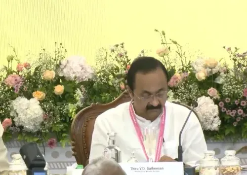
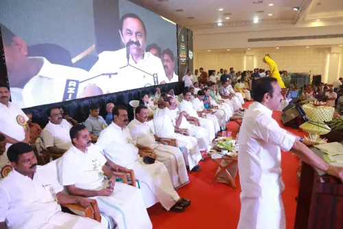
Chief Minister V.D. Satheesan chaired a meeting attended by the ministers of Environment, Forest, Revenue, and Agriculture, alongside the Chief Secretary and senior officials. Kerala argued that its circumstances are fundamentally distinct: the state has limited land, a high population density, and extensive human habitation that coexists with its forest cover.
The Core Argument: Geography and Livelihoods
Kerala's central contention is that it already operates under stringent environmental laws and that a blanket ESA designation fails to account for the reality of densely populated hillside communities. The state has consistently maintained that inhabited areas, agricultural land, and plantations must be completely excluded from the ESA perimeter — a position it has held since the first draft notification.
Notably, this is not a new confrontation. Kerala has been engaged in this negotiation for over a decade, and each successive draft has left the core dispute unresolved. The government has said it will continue pressing the Centre for a settlement that protects both the Western Ghats' fragile ecology and the livelihoods of communities that have farmed and lived on its slopes for generations.
Point of View
993.7 sq km figure essentially intact, despite repeated state submissions, suggests the Centre is either unconvinced by Kerala's data or unwilling to set a precedent that other Western Ghats states could invoke. That political calculus deserves more scrutiny than it typically receives in coverage that frames this purely as an environment-versus-development story.
NationPress
1 Sept 2026
Frequently Asked Questions
What is the Western Ghats Ecologically Sensitive Area (ESA) dispute in Kerala?
The ESA dispute concerns the boundaries of a protected ecological zone proposed for the Western Ghats. The Kasturirangan report originally proposed 13,108 sq km across 123 Kerala villages as ESA; the state has since fought to reduce this figure and exclude inhabited areas, farms, and plantations from the designation.
What area is Kerala currently proposing for the Western Ghats ESA?
Kerala has proposed reducing the ESA to 8,590.69 sq km covering 98 villages, down from the Centre's benchmark of 9,993.7 sq km. A departmental report also recommends the complete exclusion of 33 villages from the ESA perimeter.
Why does Kerala want farms and homes excluded from the ESA?
Kerala argues that its high population density, limited land area, and extensive human settlements alongside forests make a blanket ESA designation unworkable. The state contends that agricultural land, plantations, and inhabited areas must be excluded to protect the livelihoods of communities that have lived and farmed on the Western Ghats slopes for generations.
What has the Centre's position been so far?
The Centre reduced the proposed ESA from 13,108 sq km to 9,993.7 sq km in its March 2014 draft notification, but subsequent draft notifications have not incorporated Kerala's further reduction proposals. The latest draft left the 9,993.7 sq km benchmark unchanged despite Kerala supplying additional spatial data.
Who is leading Kerala's negotiations with the Centre on the ESA issue?
Environment Minister Sunny Joseph has been the government's public face on the issue. Chief Minister V.D. Satheesan chaired a high-level meeting with senior central officials, attended by the ministers of Environment, Forest, Revenue, and Agriculture, as well as the Chief Secretary.