Has the eco-sensitive zone map for TN's Pulicat sanctuary finally been finalized and sent for approval?
Synopsis
Discover how Tamil Nadu is advancing its environmental protection efforts with the finalization of the eco-sensitive zone map for Pulicat Bird Sanctuary. The submission to the Centre is a vital step in safeguarding this unique ecosystem while balancing community needs.
Key Takeaways
Draft ESZ map submitted for Pulicat Bird Sanctuary Union Ministry review pending Balancing conservation with community needs Default 10-km ESZ applies without specific mapping Significant implications for local livelihoods
Chennai, Dec 3 (NationPress) A major advancement has occurred in Tamil Nadu regarding the long-awaited demarcation of eco-sensitive zones (ESZs) around protected areas. The National Centre for Sustainable Coastal Management (NCSCM) has submitted a draft ESZ map specifically for the Pulicat Bird Sanctuary located in the Tiruvallur district. The state government has transmitted this proposal to the Union Ministry of Environment, Forest and Climate Change (MoEFCC) for their approval, indicating significant progress in adhering to a directive from the Supreme Court.
A senior official highlighted that the apex court had issued strict mandates after multiple states failed to meet previous deadlines for defining ESZs for all protected areas. The court required every sanctuary or national park to have a clearly defined buffer zone to manage activities that could jeopardize sensitive ecosystems.
In the absence of specific mapping, a default 10-km ESZ comes into effect, imposing extensive restrictions on development and any activity that could disturb wildlife.
Officials remarked that such blanket restrictions can be impractical, particularly around Pulicat, where fishing communities, agricultural lands, and long-established settlements are situated near the sanctuary’s borders.
The enforcement of a uniform 10-km zone, they noted, could significantly disrupt the lives and livelihoods of local residents. Acknowledging the socio-ecological intricacies of Pulicat, NCSCM scientists undertook a thorough assessment before establishing the ESZ boundaries.
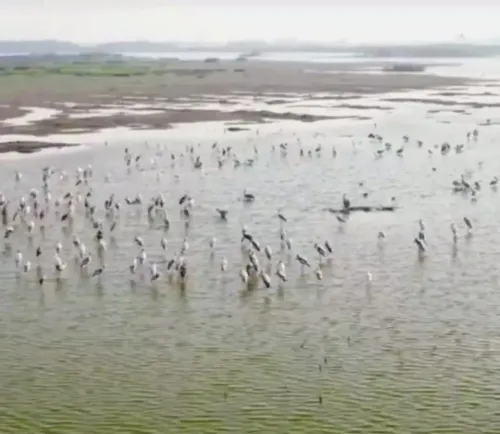
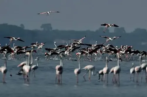
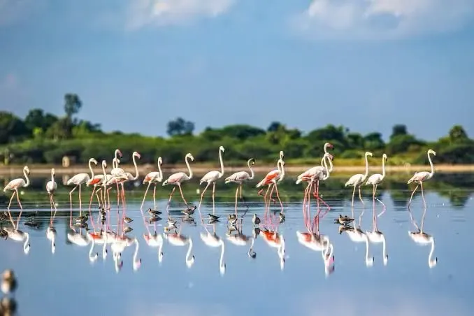
Pulicat, recognized as India’s second-largest brackish water lagoon, is surrounded by over 40 fishing villages whose inhabitants rely heavily on fishing and agriculture. In many areas, farmland is adjacent to the sanctuary’s boundary, making strict zoning impractical. Researchers emphasized that the mapping was guided by the need to balance ecological conservation with the rights and needs of communities that have inhabited the region for generations.
The aim was to create sufficient ecological buffers without obstructing traditional livelihoods closely linked to the wetland ecosystem.
A senior wildlife official noted that progress accelerated only after the state provided the necessary datasets earlier this year. Considering the coastal complexities and dense human populations in the Pulicat area, scientists devoted over six months to crafting a scientifically sound boundary for the proposed ESZ.
The MoEFCC will now evaluate the draft, after which it will be opened for public consultation before final notification.
Point of View
I believe that the submission of the draft ESZ map for Pulicat Bird Sanctuary reflects a necessary balance between environmental conservation and community livelihoods. This approach is essential for sustainable development, and it is crucial that we support initiatives that respect both nature and the local populations that depend on it.
NationPress
30 Jun 2026
Frequently Asked Questions
What is the purpose of the eco-sensitive zone map?
The eco-sensitive zone map aims to delineate protected buffer areas around sanctuaries and national parks to regulate activities that could harm fragile ecosystems.
What happens if no ESZ is defined?
If an ESZ is not defined, a default 10-km eco-sensitive zone automatically applies, imposing significant restrictions on development and activities that may disturb wildlife.
How does this affect local communities?
The mapping process aims to balance ecological conservation with the needs of local communities, ensuring that traditional livelihoods are not hindered.
Who approved the draft ESZ map?
The draft ESZ map has been submitted to the Union Ministry of Environment, Forest and Climate Change for their approval.
What is the significance of Pulicat Bird Sanctuary?
Pulicat Bird Sanctuary is India's second-largest brackish water lagoon, vital for biodiversity and the livelihoods of surrounding fishing communities.