Is Rain on the Horizon for TN and Puducherry?
Click to start listening
Synopsis
As the southwest monsoon approaches, the Regional Meteorological Centre has forecasted rain in Tamil Nadu, Puducherry, and Karaikal. With conditions becoming favorable for an early onset, this weather pattern could bring significant changes in the coming days. Stay tuned for updates on the evolving situation.
Key Takeaways
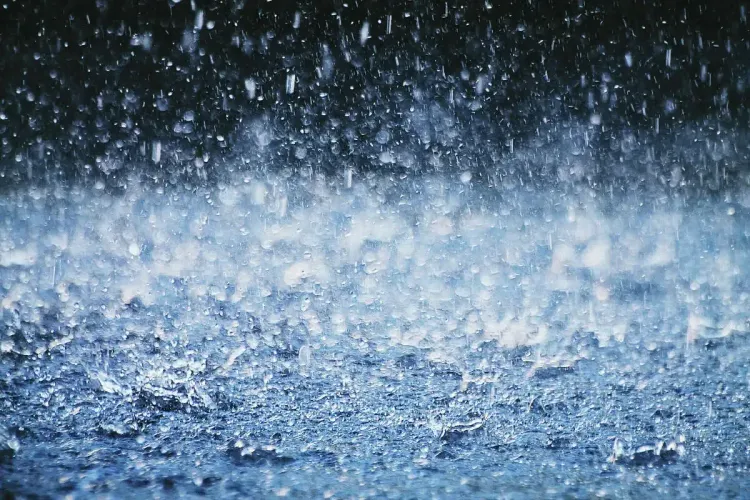
- Rain is forecasted in Tamil Nadu, Puducherry, and Karaikal until May 26.
- Conditions are favorable for an early onset of the southwest monsoon.
- Significant rainfall has already been recorded in various locations.
- An upper air cyclonic circulation is expected to form over the Arabian Sea.
- Authorities are monitoring the situation closely.
Chennai, May 21 (NationPress) The Regional Meteorological Centre (RMC) has predicted precipitation in certain areas of Tamil Nadu, Puducherry, and Karaikal until May 26, suggesting the potential early arrival of the southwest monsoon in these regions in the upcoming days.
According to the RMC, the meteorological conditions are increasingly becoming conducive for the monsoon to progress into sections of Tamil Nadu. This is attributed to an upper air cyclonic circulation expected to form over the east-central Arabian Sea near the Karnataka coast by Wednesday.
This system is anticipated to give rise to a low-pressure area over the same region by Thursday, which may strengthen as it moves northward.
On Tuesday, various locations in Tamil Nadu reported rainfall activity. While the northern districts saw rain in select areas, many locations in southern Tamil Nadu experienced more extensive showers.
However, dry conditions prevailed in Puducherry and the Karaikal area. From 8:30 a.m. to 5:30 p.m. on Tuesday, several weather stations across the state recorded considerable rainfall.
Tiruttani observed the highest rainfall at 56 mm, closely followed by the ISRO station in Tiruttani with 55.5 mm. R.K. Pet in Tiruvallur district received 43 mm, Salem 21 mm, and Chembarambakkam 20.5 mm.
Other significant rainfall figures included Dharmapuri (19 mm), Kalavai in Ranipet (18.5 mm), Mamallapuram (13.5 mm), Virinjipuram KVK in Vellore (10.5 mm), Tiruvannamalai (7.5 mm), Poonamallee (5 mm), Hindustan University (4.5 mm), VIT Chennai (4 mm), Yercaud (3.5 mm), and Coonoor (3 mm).
Chennai’s Meenambakkam and Nungambakkam stations recorded only minimal rainfall.
Additionally, the RMC reported that an upper air cyclonic circulation currently exists over the west-central Bay of Bengal, bordering south Andhra Pradesh and north Tamil Nadu. This system extends up to 1.5 km above mean sea level and is tilting southwestward, influencing the existing weather conditions.
The authorities are vigilantly monitoring the developing systems for further updates regarding the monsoon’s advancement.
Point of View
The evolving monsoon conditions in Tamil Nadu, Puducherry, and Karaikal highlight the importance of being prepared for the coming weather changes. The RMC's forecasts provide critical information for residents and authorities alike, ensuring everyone can effectively respond to the potential impacts of the southwest monsoon.
NationPress
01/06/2025
Frequently Asked Questions
What is the expected rainfall in Tamil Nadu?
The Regional Meteorological Centre has forecasted rain in isolated parts of Tamil Nadu until May 26, with significant rainfall already recorded in several areas.
When is the southwest monsoon expected to arrive?
Favorable conditions suggest that the southwest monsoon may arrive earlier than usual, with indications of its onset in the coming days.
How do upper air cyclonic circulations affect weather?
Upper air cyclonic circulations can lead to the formation of low-pressure areas, which often bring increased rainfall and can influence weather patterns significantly.
Where has the most rainfall been recorded in Tamil Nadu?
Tiruttani recorded the highest rainfall at 56 mm, with other notable stations also reporting significant amounts.
Why is monitoring weather patterns important?
Monitoring weather patterns is crucial for preparing for potential impacts, ensuring that residents and authorities can respond effectively to changing conditions.