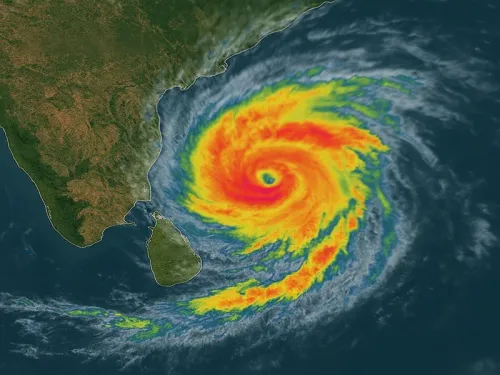
Cyclone alert: Very severe storm to hit Andhra coast on October 28, IMD warns
Synopsis
A Bay of Bengal depression is rapidly intensifying toward a very severe cyclonic storm, set to slam the Andhra Pradesh coast between Bapatla and Visakhapatnam on October 28 with winds gusting to 140 kmph. CM Chandrababu Naidu has put the state on high alert — and with landfall just three days away, the next 72 hours are critical.
Key Takeaways
The IMD warns a very severe cyclonic storm will cross the Andhra Pradesh coast between Bapatla and Visakhapatnam by the forenoon of 28 October 2026 .
Maximum sustained wind speed at landfall is forecast at 115–125 kmph , gusting up to 140 kmph .
As of Sunday morning, the depression was centred 880 km east-southeast of Visakhapatnam and moving at 5 kmph .
Chandrababu Naidu chaired an emergency review meeting and ordered the state machinery onto high alert .
Fishermen have been warned against venturing into the sea; residents of low-lying coastal areas are being alerted for possible evacuation.
Toll-free emergency helplines are being activated for public assistance across the impact zone.
A depression over the East-central and adjoining Southeast Bay of Bengal is likely to intensify into a very severe cyclonic storm and cross the Andhra Pradesh coast between Bapatla and Visakhapatnam by the forenoon of October 28, the India Meteorological Department (IMD) warned on Sunday, 25 October 2026. The system is forecast to make landfall with maximum sustained wind speeds of 115–125 kmph, gusting up to 140 kmph, posing a serious threat to coastal communities across the region.
Current Position and Projected Path
As of 5:30 am IST on Sunday, the depression lay centred approximately 440 km north-northwest of Sri Vijaya Puram (Andaman Islands), 880 km east-southeast of Visakhapatnam, 980 km east-southeast of Kakinada, 1,080 km east of Machilipatnam, and 1,150 km east of Bapatla. It was moving southeastwards at 5 kmph at the time of the bulletin.
According to the IMD, the system is expected to move nearly southwards before gradually recurving west-northwestwards over the East-central and adjoining Southeast Bay of Bengal through Sunday. It is projected to intensify into a deep depression on Sunday, a cyclonic storm by October 26 morning, and a severe cyclonic storm near the Westcentral Bay of Bengal by the morning of October 27. By October 28 morning, it is forecast to reach the Andhra Pradesh coast as a very severe cyclonic storm.
Landfall Zone and Expected Impact
The storm is very likely to cross the Andhra Pradesh and Yanam coasts between Bapatla and Visakhapatnam — a stretch encompassing several densely populated coastal districts. Coastal Andhra Pradesh is expected to experience heavy to very heavy rainfall on Tuesday and Wednesday, accompanied by gale-force winds. Low-lying coastal areas within the projected impact zone face the highest risk of flooding and storm surge.
Government Response and Precautionary Measures
Chief Minister N. Chandrababu Naidu convened an emergency review meeting with senior officials, including Chief Secretary Sai Prasad and representatives of the Real-Time Governance Society (RTGS). He directed the entire administrative machinery to remain on high alert and issue advance public advisories without delay.
The Chief Minister specifically instructed authorities to prevent fishermen from venturing into the sea given the likelihood of strong gale-force winds along the coast. He also ordered that residents in low-lying areas within the potential impact zone be alerted and evacuated where necessary. Toll-free emergency helpline numbers are to be made available for public access to assistance and information.
The Andhra Pradesh State Disaster Management Authority (APSDMA) has separately advised all residents to remain extremely vigilant and follow official updates closely.
Historical Context and Risk
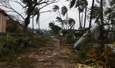
The Andhra Pradesh coastline — particularly the stretch between Bapatla and Visakhapatnam — has historically been one of India's most cyclone-exposed shorelines. The region was devastated by Cyclone Hudhud in 2014 and has faced recurring threats in subsequent years. A storm of this intensity category, classified as a very severe cyclonic storm, typically causes significant structural damage, uproots trees, disrupts power supply, and triggers storm surge in low-lying coastal belts. With landfall still three days away, the track forecast carries inherent uncertainty, and authorities are urging preparedness across the entire projected impact corridor.
What Happens Next
The IMD is expected to issue updated bulletins every three hours as the system intensifies. District administrations along the coast are mobilising National Disaster Response Force (NDRF) teams and pre-positioning relief supplies. All eyes are on the storm's exact landfall point, which will determine which districts bear the brunt of the impact when it crosses the coast on the forenoon of October 28.
Point of View
And the state's track record on evacuation has improved since Hudhud, but the test is always in execution, not in review meetings. The IMD's current forecast places the storm at 'very severe' intensity — one step below 'extremely severe' — which can still cause catastrophic damage if evacuation of low-lying areas is incomplete. The real accountability question is whether toll-free helplines and advisories translate into actual movement of vulnerable coastal populations before October 28 morning.
NationPress
25 Oct 2026
Frequently Asked Questions
When and where will the cyclone make landfall in Andhra Pradesh?
The IMD forecasts the very severe cyclonic storm will cross the Andhra Pradesh and Yanam coasts between Bapatla and Visakhapatnam by the forenoon of October 28, 2026. Wind speeds at landfall are expected to range from 115–125 kmph, with gusts up to 140 kmph.
What is the current status of the depression in the Bay of Bengal?
As of 5:30 am IST on Sunday, 25 October, the depression was centred about 880 km east-southeast of Visakhapatnam, moving southeastwards at 5 kmph. It is expected to intensify into a cyclonic storm by October 26 morning and a very severe cyclonic storm before reaching the Andhra coast on October 28.
What precautions has the Andhra Pradesh government announced?
Chief Minister N. Chandrababu Naidu has directed the administration to remain on high alert, prevent fishermen from going to sea, alert low-lying coastal residents for possible evacuation, and activate toll-free emergency helplines. The Andhra Pradesh State Disaster Management Authority has advised residents to remain extremely vigilant.
Which districts in Andhra Pradesh are most at risk from the cyclone?
The areas between Bapatla and Visakhapatnam — including coastal districts such as Bapatla, Prakasam, Krishna, West Godavari, East Godavari, and Visakhapatnam — are in the projected landfall corridor. Low-lying areas in these districts face the highest risk of storm surge and flooding.
What does 'very severe cyclonic storm' mean in terms of danger?
A 'very severe cyclonic storm' is an IMD classification for a system with sustained wind speeds of 89–117 kmph, though this particular system is forecast at 115–125 kmph with gusts to 140 kmph — near the upper end of this category. Such storms typically cause widespread structural damage, uproot trees, disrupt power and communications, and generate storm surge in low-lying coastal zones.