What Does SpaceX’s Launch of NASA’s Sentinel-6B Satellite Mean for Sea Level Monitoring?

Synopsis
Key Takeaways
- Sentinel-6B enhances our understanding of sea level changes.
- It provides critical data for weather forecasting and urban planning.
- The satellite supports disaster preparedness efforts.
- It represents a successful collaboration between NASA and SpaceX.
- Data will assist in protecting coastal military installations.
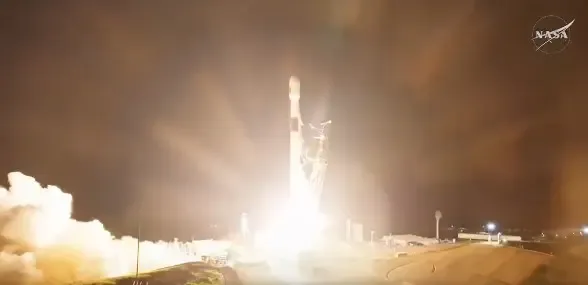
New Delhi, Nov 17 (NationPress) SpaceX successfully launched NASA’s Sentinel-6B satellite, which is designed to monitor changes in sea levels, as reported by the US space agency.
Sentinel-6B is a satellite focused on Earth observation, developed in collaboration with NASA and various US and European partners to track the ocean and assess sea level rise.
This satellite builds on over three decades of sea level data, aiming to enhance weather predictions. It will aid in coastal planning, protect vital infrastructure, and improve weather forecasting.
“Liftoff! The latest satellite in a series dedicated to tracking sea level changes, Sentinel-6B, was successfully launched at 12:21 AM ET (10:55 AM IST) on Monday, from Vandenberg Space Force Base,” NASA announced via social media.
“This marks the second Sentinel-6 satellite launched by Falcon 9, following the Sentinel-6 Michael Freilich satellite's deployment in November 2020. Together, these two satellites will monitor sea levels, enhance ocean current predictions, and improve both short- and long-term weather forecasts,” SpaceX stated.
Sentinel-6B will provide data covering around 90% of the Earth's oceans, offering direct advantages to humanity.
The insights gained will play a crucial role in enhancing public safety, urban planning, and safeguarding commercial and defense assets.
Data from this satellite will also assist NASA in preparing for future space exploration phases, including ensuring safe reentry for astronauts returning from Artemis missions.
The information collected will serve city planners and state governments in making informed choices regarding coastal infrastructure, real estate, and energy facilities.
Moreover, the satellite’s sea level data will refine meteorologists’ weather predictions, which are essential for both commercial and recreational navigation, and for forecasting hurricane developments, including the potential for storm intensification, aiding disaster preparedness and response.
Data from Sentinel-6B will enhance the protection of coastal military installations against challenges like nuisance flooding, while also supporting national defense by providing vital information about weather and ocean conditions.


