Kolkata temperature drops 7°C after thunderstorms, more rain forecast till Monday

Synopsis
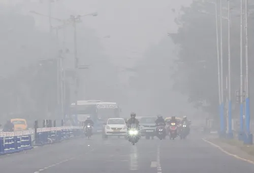
A single overnight thunderstorm slashed Kolkata's minimum temperature by 7 degrees Celsius — from 27.7°C to 20.4°C — on 30 April, as a cyclonic circulation system funnels Bay of Bengal moisture into West Bengal. The IMD has issued thunderstorm warnings across six south Bengal districts and a sea-ban for fishermen until 3 May, with the relief weather expected to last through Sunday.
Key Takeaways
Kolkata's minimum temperature fell 7 degrees Celsius overnight to 20.4°C on 30 April .
54 millimetres of rain with gusty winds was recorded on Wednesday night , coinciding with the final phase of voting.
Thunderstorm warnings issued for East Midnapore , Hooghly , Howrah , North 24 Parganas , South 24 Parganas , and Nadia districts.
Fishermen barred from the sea until 3 May due to rough weather conditions.
Five north Bengal districts including Darjeeling and Kalimpong to receive heavy rain over the next four days.
Weather may change from Monday , the day of vote counting.
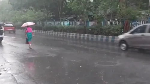
Thunderstorms accompanied by heavy rain brought Kolkata's minimum temperature down by 7 degrees Celsius on Thursday, 30 April, offering significant relief from the sweltering heat that had gripped the city and its surrounding areas. The minimum temperature was recorded at 20.4 degrees Celsius in the morning, sharply down from 27.7 degrees Celsius the previous day.
What Triggered the Temperature Plunge
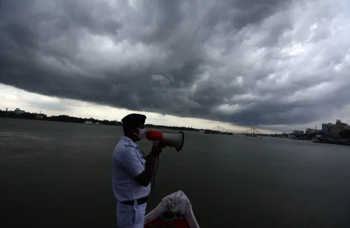
According to the India Meteorological Department (IMD), an east-west axis of a cyclonic circulation stretching from north Haryana to Manipur — passing through Uttar Pradesh, Bihar, West Bengal, Bangladesh, and Assam — is driving the weather change. This system is pulling a large volume of water vapour into West Bengal from the Bay of Bengal, creating sustained conditions favourable for rainfall across the state.
On Wednesday night, Kolkata recorded approximately 54 millimetres of rain accompanied by gusty winds — coinciding with the second and final phase of voting in the city. That overnight downpour set off the dramatic single-night mercury drop.
Forecast for Kolkata and South Bengal
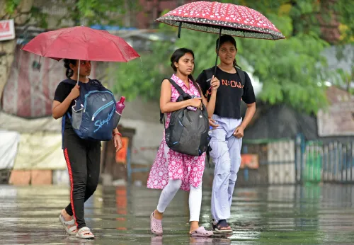
The IMD has forecast cloudy skies over Kolkata on Thursday, with light to moderate rain and thunderstorms expected by afternoon. The maximum temperature in the city is expected to remain at around 32 degrees Celsius. The pleasant conditions are likely to persist through Sunday, with the weather potentially shifting from Monday — the day votes are counted.
Thunderstorm warnings have been issued for East Midnapore, Hooghly, Howrah, North 24 Parganas, South 24 Parganas, and Nadia districts. As a precautionary measure, fishermen have been prohibited from venturing into the sea until 3 May.
North Bengal Also on Alert
Heavy rainfall is also likely across north Bengal, with five districts — including Darjeeling and Kalimpong — expected to receive significant rain over the next four days. Scattered hail and thundershowers have been forecast for the rest of the state as well.
Notably, the timing of this weather system coincides with the tail end of the election season in West Bengal, adding an unusual meteorological footnote to the voting cycle. With counting scheduled for Monday, weather conditions may ease — though forecasters have not ruled out residual activity.
What Happens Next
The IMD will continue to monitor the cyclonic circulation system as it evolves. Residents across southern and northern districts of West Bengal are advised to stay alert to local warnings, particularly given the active thunderstorm threat expected to persist through the weekend.
Point of View
But the more consequential detail is the cyclonic circulation axis stretching from Haryana to Manipur — a system large enough to affect multiple states simultaneously. For West Bengal specifically, the timing is striking: the rain arrived on the night of the final voting phase and is now forecast to ease precisely around counting day. The IMD's sea-ban for fishermen until 3 May signals the system carries real risk beyond urban discomfort. What mainstream weather coverage often undersells is the agricultural and livelihood dimension — sustained thunderstorms and hail across north Bengal can damage standing crops in Darjeeling's tea gardens at a critical pre-flush period.
NationPress
1 Aug 2026
Frequently Asked Questions
Why did Kolkata's temperature drop by 7 degrees Celsius overnight?
Kolkata's temperature fell from 27.7°C to 20.4°C due to heavy thunderstorms that brought 54 millimetres of rain with gusty winds on the night of 29–30 April. A cyclonic circulation system stretching from north Haryana to Manipur is pulling moisture from the Bay of Bengal into West Bengal, sustaining these conditions.
How long will the rain and thunderstorms continue in Kolkata?
According to the IMD, thunderstorms and rain are forecast to continue in Kolkata and south Bengal districts through Sunday. The weather may begin to change from Monday, 5 May, which is the day votes are counted.
Which districts in West Bengal have received thunderstorm warnings?
The IMD has issued thunderstorm warnings for East Midnapore, Hooghly, Howrah, North 24 Parganas, South 24 Parganas, and Nadia districts in south Bengal. Heavy rain is also expected in north Bengal districts including Darjeeling and Kalimpong.
Why are fishermen banned from going to sea until 3 May?
The IMD's active thunderstorm and rough weather warnings along the West Bengal coast have prompted authorities to prohibit fishermen from venturing into the sea until 3 May as a precautionary safety measure.
What is causing the heavy rainfall across West Bengal?
The rainfall is driven by an east-west cyclonic circulation axis extending from north Haryana to Manipur, passing through Uttar Pradesh, Bihar, West Bengal, Bangladesh, and Assam. This system is drawing large amounts of moisture from the Bay of Bengal into the region, creating persistent rain-favourable conditions.