Wellington hit by 11-metre swells, gale-force winds; evacuations ordered
Synopsis
Waves nearly twice the height of a three-storey building slammed Wellington on 9 June, forcing hundreds from their homes and shutting down air and sea links. Officials say the long-period swells could inflict more coastal damage than a 2020 storm that was itself severe enough to trigger mass evacuations — a sobering benchmark for a city already on edge.
Key Takeaways
Waves of up to 11 metres and wind gusts near 100 km/h struck Wellington on 9 June .
Mandatory evacuations were ordered in Owhiro Bay , Island Bay , Houghton Bay , and Breaker Bay .
Wind gusts of 137 km/h were recorded in the wider Wairarapa region.
Cook Strait ferry services by Interislander and Bluebridge were suspended; multiple flights cancelled.
Officials warned damage could exceed that of a 2020 storm with 5.5-metre waves .
Evacuation orders were set to remain in place until Wednesday morning .
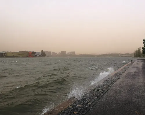
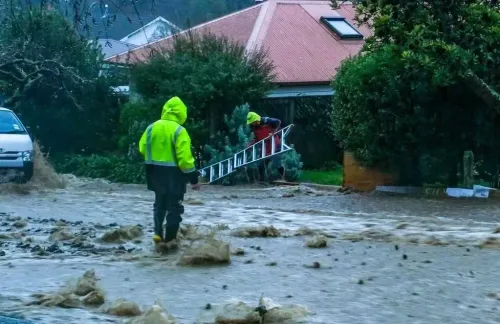
Wellington, New Zealand's capital, was battered by waves reaching up to 11 metres and gale-force winds on Tuesday, 9 June, as authorities ordered mandatory evacuations along parts of the south coast and transport services ground to a near-halt. The severe weather event is being compared to a 2020 storm that triggered widespread evacuations — with officials warning current conditions could exceed the damage seen then.
Evacuation Orders and Affected Areas
The Wellington Region Emergency Management Office issued mandatory evacuation orders for waterfront properties in Owhiro Bay, Island Bay, Houghton Bay, and Breaker Bay. Authorities warned that emergency services would not respond within evacuated zones, and hundreds of residents complied as conditions deteriorated rapidly.
Coastal roads along much of Wellington's south coast were closed as swells overtopped the roadway. The public was urged to stay well clear of exposed coastal areas throughout the day.
Wind and Wave Measurements
Wind gusts of nearly 100 km/h were recorded at Wellington Airport, while the wider Wairarapa region saw gusts reaching 137 km/h alongside similarly large waves. The national meteorological authority MetService reported average wave heights of around six metres, with peak waves nearly doubling that figure to approximately 11 metres.
The severe conditions were forecast to persist into Tuesday afternoon before gradually easing later in the day. However, evacuation measures were set to remain in place until Wednesday morning.
Transport Disruptions
Flights in and out of Wellington were significantly disrupted, with several cancellations recorded and at least one small aircraft blown over on the tarmac. Cook Strait ferry services operated by Interislander and Bluebridge were fully suspended, severing a key link between the North and South Islands.
Comparison With Past Storms and Why Wellington Is Vulnerable
Officials noted the long-period swells carried the potential for significant coastal damage, with projected impacts expected to exceed those of a 2020 storm that produced 5.5-metre waves and triggered widespread evacuations across the same coastline.
New Zealand's exposure to such events is structural. The country's island geography places it directly in the path of moisture-laden prevailing winds and deep low-pressure systems, which are further intensified by its rugged mountain ranges and rising sea surface temperatures. Situated in the southwest Pacific and surrounded by open ocean on all sides, Wellington in particular sits at the southern tip of the North Island — a natural funnel for Cook Strait weather systems that can amplify wind speeds dramatically.
As conditions ease, authorities are expected to conduct damage assessments along the south coast before lifting remaining evacuation orders.
Point of View
And events like this are not anomalies — they are the baseline risk. What is notable here is the official acknowledgement that damage could surpass the 2020 benchmark, suggesting either that sea conditions are intensifying or that the city's coastal exposure has grown. The suspension of Cook Strait ferry services is a significant economic and logistical signal, not just a safety measure — it severs the primary surface link between New Zealand's two main islands. The real question after the waters recede is whether coastal infrastructure planning is keeping pace with the frequency and severity of these events.
NationPress
26 Oct 2026
Frequently Asked Questions
What caused the severe weather in Wellington on 9 June?
Long-period ocean swells of up to 11 metres combined with gale-force winds of nearly 100 km/h struck Wellington on 9 June. The conditions were driven by deep low-pressure systems moving across the southwest Pacific, amplified by Wellington's position at the southern tip of the North Island.
Which areas were under mandatory evacuation orders?
The Wellington Region Emergency Management Office ordered mandatory evacuations in Owhiro Bay, Island Bay, Houghton Bay, and Breaker Bay. Authorities warned that emergency services would not respond within these zones while orders were active.
How do these conditions compare to past Wellington storms?
Officials said the long-period swells could cause coastal damage exceeding that of a 2020 storm which produced 5.5-metre waves and triggered widespread evacuations. Average wave heights on 9 June were around six metres, with peaks reaching approximately 11 metres.
Were transport services affected?
Yes. Multiple flights in and out of Wellington were cancelled and at least one small aircraft was blown over. Cook Strait ferry services operated by Interislander and Bluebridge were fully suspended, cutting the primary sea link between the North and South Islands.
When were evacuation orders expected to be lifted?
Severe conditions were forecast to ease by Tuesday evening, but evacuation measures were set to remain in place until Wednesday morning, after which authorities planned damage assessments along the south coast.