Emergency Evacuation Alerts Issued in New South Wales as Cyclone Approaches

Synopsis
New South Wales emergency services have issued evacuation alerts as tropical cyclone Alfred approaches, urging residents to evacuate by 9 p.m. to avoid flooding and hazardous conditions. The cyclone poses significant risks with heavy rain and strong winds, impacting millions in Queensland and NSW.
Key Takeaways
NSW State Emergency Service has issued evacuation warnings.
Tropical cyclone Alfred is nearing the east coast of Australia .
Residents in Northern Rivers must evacuate by 9 p.m. local time.
Severe flooding and strong winds are expected.
Over 4 million people have been warned.
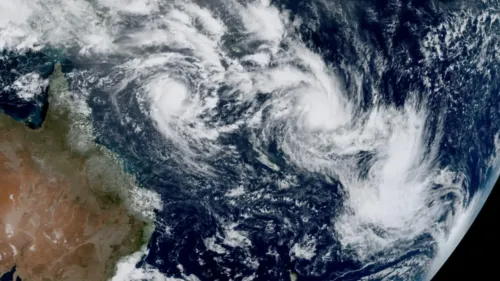
Sydney, March 6 (NationPress) The State Emergency Service of New South Wales (NSW) has activated emergency evacuation alerts on Thursday as tropical cyclone Alfred advances toward the eastern coast of Australia.
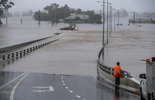
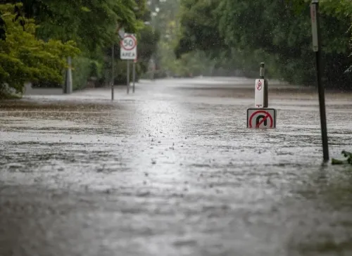
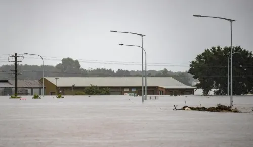
Residents in the Northern Rivers area of northeastern NSW are advised to evacuate by 9 p.m. local time on Thursday, as significant river rises and intense rainfall are anticipated, potentially leading to extensive flooding in local catchments. Additionally, downed trees may pose hazards, obstructing safe evacuation routes.
“If you choose to stay in the area, you could find yourself stranded without access to power, water, or other essential services,” warned Assistant Commissioner Nicole Hogan, the State Duty Commander of the NSW State Emergency Service.
Hogan cautioned that conditions could become perilous, making it difficult for emergency personnel to conduct rescues, and that structures may not endure the force of floodwaters.
Individuals have been encouraged to evacuate and find shelter with family, friends, or in alternative housing in areas unaffected by flooding, or to seek assistance at evacuation centers established throughout the region.
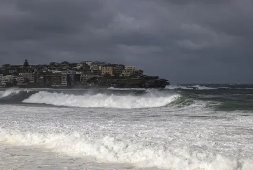
Residents in southeastern Queensland and northeastern NSW are preparing for the cyclone, which is expected to be the most severe weather event in the region since 1974.
“This is an extremely hazardous weather system,” stated the NSW State Emergency Service, highlighting that a mix of strong winds, heavy rainfall, and widespread flooding is forecasted in the upcoming days.
As per the Bureau of Meteorology (BOM), the category two system is projected to make landfall on Australia’s east coast Friday night or early Saturday morning, most likely between Noosa and Coolangatta, where the Gold Coast Airport is located.
Over 4 million residents of Brisbane, Gold Coast, Sunshine Coast, and several other cities in Queensland and NSW have received formal warnings from the BOM, as reported by Xinhua.
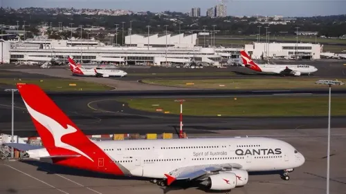
Major Australian airlines suspended operations in Brisbane on Thursday. The Gold Coast Airport in southern Queensland has been closed since Wednesday afternoon and will remain so until further notice, while Sunshine Coast Airport continues its regular operations.
Public transportation has been halted on Thursday and Friday, with additional updates expected.
Weather predictions indicate daily rainfall totals between 200 mm and 400 mm, with the possibility of exceeding 800 mm in total during the storm.