Japan's Aerospace Agency to Enhance Earthquake Damage Assessment Program

Synopsis
Japan's Aerospace Exploration Agency (JAXA) has partnered with Kumamoto Prefecture to improve a satellite imagery-based program for estimating earthquake damage. Utilizing data from the 2016 Kumamoto earthquake, the program aims for nationwide deployment and rapid assessment of structural damage post-quake.
Key Takeaways
JAXA collaborates with Kumamoto Prefecture.
Utilizes 200,000 data points from 2016 earthquake.
Rapid damage assessment within 2-3 hours.
Effective in nighttime and adverse weather.
Plans to establish a Disaster Management Agency by 2026.
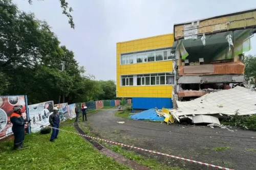
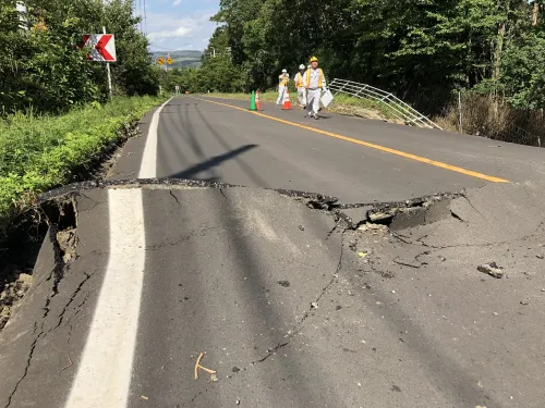
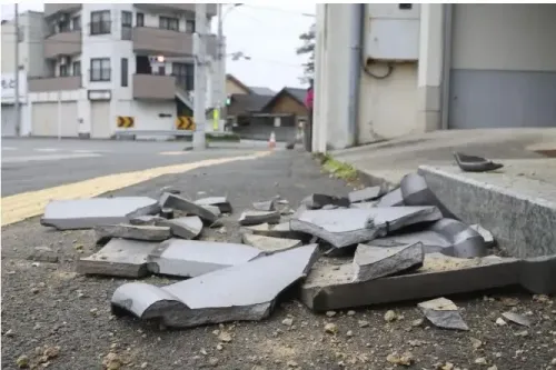
Tokyo, Jan 17 (NationPress) Japan's Aerospace Exploration Agency (JAXA) has entered into a partnership with Kumamoto Prefecture to enhance a program aimed at estimating structural damage from earthquakes through the use of satellite images, according to local media reports on Friday.
As part of this collaboration, JAXA will analyze around 200,000 data points related to building damage from the 2016 Kumamoto earthquake. This effort aims to improve and increase the precision of its technology, which is anticipated to be implemented across the nation, as reported by Kyodo News.
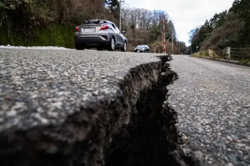
The initiative will compare satellite images captured before and after seismic events to evaluate the degree of structural damage within a 2-3 hour window of observation.
Notably, the program is designed to operate effectively even in nighttime and adverse weather conditions, according to the report.
JAXA expects the program to be operational in a few years.
Recently, Japanese media disclosed that the Cabinet Office's disaster management division is planning to assign designated officers to each prefecture starting next fiscal year to prepare for potential significant disasters such as a Nankai Trough megaquake or an earthquake in the Tokyo metropolitan area.
The Cabinet Office is advancing plans to deploy around 50 officers across prefectures to emphasize stockpile management and volunteer coordination during normal times while taking charge of damage assessment and organizing evacuation shelters during disasters, as reported by Xinhua news agency.
To bolster this initiative, the Cabinet Office aims to double its current workforce of 110 and pursue a corresponding budget increase for the upcoming fiscal year, according to national broadcaster NHK, citing discussions with government officials.
This latest initiative is part of a broader objective to establish a 'Disaster Management Agency' by the fiscal year 2026.
Recent calamities, such as the Noto Peninsula earthquake, have exposed challenges like inadequate supplies in municipal stockpiles and delays in setting up evacuation shelters throughout Japan.
The Japanese Government operates an emergency broadcasting system known as 'J-Alert'. This system guarantees that vital information reaches individuals in affected areas during various crises, including earthquakes, tsunamis, civil protection, and more. J-Alert employs multiple methods to communicate with the public.
Furthermore, since 2007, smartphones have been equipped with an early earthquake warning system that alerts users immediately before an earthquake occurs.
This pioneering system generates an alert based on initial minor tremors detected seconds or tens of seconds prior to a significant quake, encouraging individuals to prepare for evacuation.
The system utilizes seismometers and seismic intensity meters that measure tremors from the Japan Meteorological Agency (approximately 690 locations nationwide) and a seismographic observation network from the National Research Institute for Earth Science and Disaster Prevention (around 1000 locations nationwide).