Is the Bharat Forecast System Enhancing Extreme Rainfall Predictions by 30%?
Synopsis
Discover how India's newly launched Bharat Forecast System is revolutionizing weather predictions. With a 30% improvement in forecasting extreme rainfall events, this indigenous system is set to transform agriculture and disaster preparedness in the country.
Key Takeaways
30% improvement in extreme rainfall forecast accuracy.
Localized forecasts assist in crop management .
Enhanced disaster preparedness and response.
Indigenous development of high-resolution weather model.
Utilization of advanced supercomputing technology.
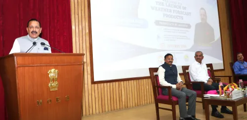
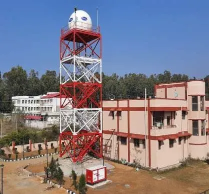
New Delhi, Aug 7 (NationPress) The recently initiated Bharat Forecast System (BharatFS) has achieved a remarkable 30 percent enhancement in accuracy for predicting extreme rainfall events, as reported to the Rajya Sabha on Thursday.
The Union Minister of State (Independent Charge) for Science and Technology, Earth Sciences, Jitendra Singh, in a written response, stated that the distinctive features of BharatFS have positioned India as the sole nation operating a global weather prediction model with such high resolution for real-time weather forecasting.
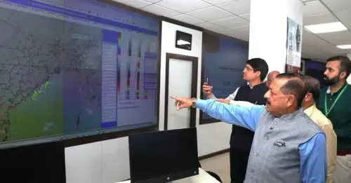
According to Jitendra Singh, the BharatFS has improved its horizontal resolution, enabling it to produce precise forecasts every 6 kilometers.
“This capability allows for the identification of local weather phenomena, thus providing forecasts tailored to specific clusters of panchayats/villages. These localized forecasts assist farmers with their crop planning, irrigation, and harvesting needs,” he elaborated.
The Minister further added that water management authorities can now enhance reservoir management during the monsoon season, thereby diminishing flood risks and boosting yield resilience.
“BharatFS has shown a substantial improvement in predicting rainfall in the core monsoon areas, with an accuracy boost of 30 percent for extreme rainfall forecasting. Such advancements are vital for swift and focused disaster response, enhancing the country’s disaster preparedness,” he explained.
Developed indigenously, the BharatFS is of great significance, not only for elevating India's scientific prowess but also for advancing national strategic and economic objectives.
This system signifies India's own high-resolution weather prediction model, meticulously designed by Indian scientists to address the unique forecasting challenges posed by the country's geography, including the Himalayas and Western Ghats.
The recently acquired supercomputing resources, Arka (IITM-Pune) and Arunika (NCMRWF-Noida), have facilitated the use of the BharatFS model for real-time weather predictions, reducing processing time from 12 hours to merely 3–6 hours.
With its aim of generating forecasts at the panchayat cluster level and enhancing extreme event predictions, the BharatFS has shown significant improvements in rainfall forecasting over the core monsoon region, achieving a 30 percent increase in accuracy compared to the previous operational model, he concluded.
Point of View
The Bharat Forecast System stands as a testament to India's commitment to enhancing its scientific capabilities. This advancement is pivotal for national interests, enabling better agricultural planning and disaster management, ultimately fostering resilience in the face of climate challenges.
NationPress
2 Jul 2026
Frequently Asked Questions
What is the Bharat Forecast System?
The Bharat Forecast System (BharatFS) is an indigenous weather prediction model that significantly enhances the accuracy of extreme rainfall forecasts in India.
How much has the accuracy improved?
The BharatFS has achieved a remarkable 30 percent improvement in the accuracy of forecasting extreme rainfall events.
What benefits does BharatFS provide to farmers?
BharatFS offers localized weather forecasts that assist farmers in crop planning, irrigation, and harvesting.
How does it impact disaster management?
The improvements in rainfall prediction allow for better disaster preparedness and response, reducing flood risks and enhancing resilience.
What technology supports BharatFS?
The BharatFS utilizes advanced supercomputing facilities, reducing forecasting run time from 12 hours to just 3-6 hours.