Bihar floods: 8 rivers above danger mark, 13 districts hit on 3 Sep
Synopsis
Eight major rivers in Bihar simultaneously breached their danger marks on 3 September, inundating 13 districts and stranding hundreds. With the Ganga running 127 cm above the danger level at Gandhi Ghat and over 5.54 lakh cusecs released from the Indrapuri Barrage, the scale of this monsoon flood is one of the most severe the state has faced this season.
Key Takeaways
Eight rivers — Ganga, Son, Punpun, Kosi, Gandak, Burhi Gandak, Bagmati, and Ghaghara — are flowing above danger marks as of 3 September .
13 districts across Bihar are flood-affected, spanning both north and south Bihar.
The Ganga is 127 cm above the danger mark at Gandhi Ghat , Patna, and 61 cm above at Digha Ghat .
More than 5.54 lakh cusecs of water released from Indrapuri Barrage have flooded areas including Maner, Danapur, and Mokama.
Around 100 people are stranded on river islets in Nauhatta, Rohtas ; 12 government boats are deployed for evacuations.
The Disaster Management Department has ordered damage assessments covering crops, livestock, and houses for relief disbursement.
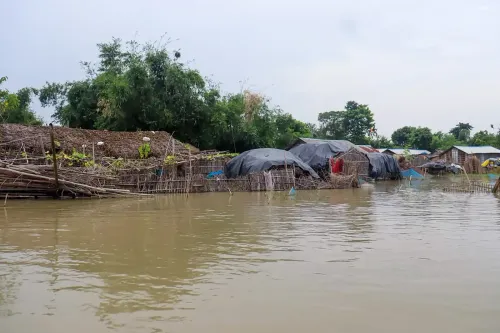
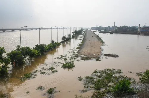
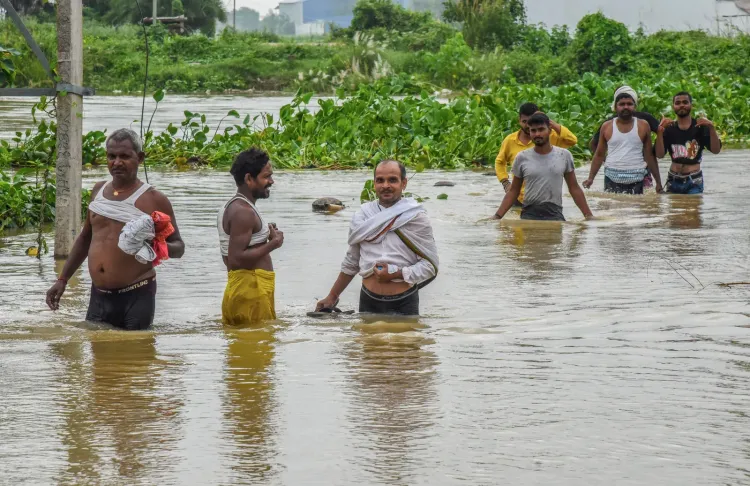
The flood situation in Bihar deteriorated sharply on Thursday, 3 September, with eight major rivers — the Ganga, Son, Punpun, Kosi, Gandak, Burhi Gandak, Bagmati, and Ghaghara — breaching their respective danger marks, disrupting normal life across 13 districts of the state. Authorities have placed the administration in Patna on high alert as floodwaters continue to rise.
Situation in Patna and Surrounding Areas
In the state capital, the Ganga is flowing 127 cm above the danger mark at Gandhi Ghat and 61 cm above it at Digha Ghat. The Punpun River at Shripalpur has surged 2.01 metres above the danger mark, with floodwaters already entering homes in the vicinity.
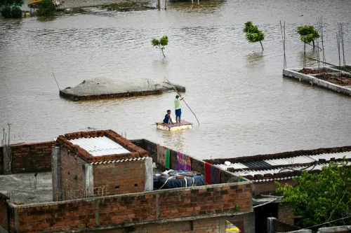
More than 5.54 lakh cusecs of water have been released into the Son River from the Indrapuri Barrage, causing rapid inundation across the riverine stretches of Maner, Danapur, Bakhtiyarpur, and Mokama. The administration has deployed 12 government boats to evacuate stranded residents.
Crisis Points Across the State
In Mohiuddinnagar, Samastipur, the Ganga is running approximately 1.50 metres above the danger mark. The river has also crossed the danger level at Hathidah and Kahalgaon, and breached the warning level in Munger.
In Bhagalpur, severe erosion along the Ganga has raised alarm over the structural safety of the Raghopur-Kazikoraiya embankment and a railway tagging dam. Authorities are working around the clock on anti-erosion operations, deploying around 200 tractors and three steamers to transport and dump sandbags at vulnerable points.
In Nauhatta, Rohtas, rising waters of the Son have left approximately 100 people stranded on river islets, where they had been engaged in farming. Evacuation efforts are under way.
Affected Districts
The 13 flood-affected districts are Darbhanga, Madhubani, West Champaran, Katihar, Madhepura, Purnea, Saharsa, Khagaria, Vaishali, Begusarai, Bhagalpur, Samastipur, and Munger. The spread reflects the scale of the crisis, which now encompasses both north and south Bihar.
Relief and Disaster Response
The Disaster Management Department has directed district officials to compile lists of flood-affected families, covering damage to crops, livestock, and houses, to ensure prompt delivery of relief assistance. Authorities are continuously monitoring river levels and vulnerable embankments as the situation remains fluid. With the monsoon still active, further deterioration cannot be ruled out in the coming days.
Point of View
But it addresses the aftermath, not the cause. Until Bihar's flood-management framework moves from reactive relief to pre-positioned prevention, these numbers — 13 districts, 8 rivers, hundreds stranded — will recur every monsoon season.
NationPress
18 Oct 2026
Frequently Asked Questions
Which rivers are above the danger mark in Bihar on 3 September?
Eight rivers — the Ganga, Son, Punpun, Kosi, Gandak, Burhi Gandak, Bagmati, and Ghaghara — are flowing above their respective danger marks as of 3 September. The Ganga is the most critical, running 127 cm above the danger level at Gandhi Ghat in Patna.
How many districts are affected by the Bihar floods?
Thirteen districts are currently flood-affected: Darbhanga, Madhubani, West Champaran, Katihar, Madhepura, Purnea, Saharsa, Khagaria, Vaishali, Begusarai, Bhagalpur, Samastipur, and Munger. The affected zone spans both northern and southern Bihar.
What is the flood situation in Patna specifically?
Patna is on high alert, with the Ganga flowing 127 cm above the danger mark at Gandhi Ghat and 61 cm above at Digha Ghat. The Punpun River at Shripalpur is 2.01 metres above the danger mark, with floodwaters entering nearby homes.
What relief measures are under way in Bihar?
Authorities have deployed 12 government boats for evacuations, and around 200 tractors and three steamers are engaged in anti-erosion operations in Bhagalpur. The Disaster Management Department has directed officials to prepare damage assessment lists covering crops, livestock, and houses to expedite relief payments.
Why is the Son River flooding so severe this time?
More than 5.54 lakh cusecs of water have been released into the Son River from the Indrapuri Barrage, causing rapid and widespread inundation across Maner, Danapur, Bakhtiyarpur, and Mokama. The large discharge volume has accelerated the spread of floodwaters into low-lying riverine areas.