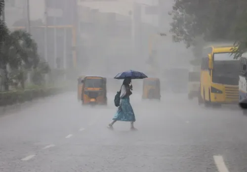
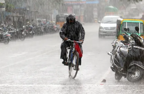
Chennai rain forecast 24 Aug: Thunderstorms, gusty winds across TN districts

Synopsis
A weak low-pressure system over the Tamil Nadu coast is triggering moderate to heavy rain, thunderstorms, and gusty winds across more than a dozen districts on 24 August. With squally winds up to 65 km/h forecast over the Gulf of Mannar for four days, the warning extends well beyond land — fishermen have been told to stay off the sea.
Key Takeaways
Chennai Regional Meteorological Centre has forecast moderate rain with thunderstorms across Chennai , Chengalpattu , and several Tamil Nadu districts on 24 August .
A weak low-pressure system over the Tamil Nadu coast is driving unsettled weather, also affecting Puducherry .
Coimbatore and Nilgiris hill regions face heavy rain on Monday and Tuesday ; residents and travellers advised to stay alert.
Daytime temperatures are expected to remain near normal until 27 August .
Squally winds up to 65 km/h forecast along the Tamil Nadu coast, over the Gulf of Mannar , and the Comorin Sea for the next four days .
Fishermen and small boat operators have been urged to avoid venturing into affected waters.
The Chennai Regional Meteorological Centre has forecast moderate rain with thunderstorms and gusty winds across Chennai, Chengalpattu, and several other districts of Tamil Nadu on Monday, 24 August, while heavy showers are expected at isolated locations in the hill regions of Coimbatore and the Nilgiris. A weak low-pressure system persisting in the lower atmospheric levels over the Tamil Nadu coast is driving the unsettled conditions, which are also expected to affect neighbouring Puducherry.
Districts Under Weather Alert
Moderate rain accompanied by thunderstorms is likely at isolated places in the Western Ghats districts, as well as in Chengalpattu, Chennai, Tiruvallur, Kancheepuram, and Ranipet on Monday. Strong surface winds alongside similar weather have been predicted across parts of Vellore, Tiruvannamalai, Villupuram, Kallakurichi, Cuddalore, Salem, Madurai, Tirupattur, and Puducherry.
The weather office noted that rainfall distribution is expected to be scattered, with considerable variation from one locality to another. Hill areas of Coimbatore and the Nilgiris could receive heavier spells, with heavy rain and thunderstorms likely at one or two places on both Monday and Tuesday. Residents and travellers in these hill districts have been advised to remain alert to sudden weather changes, particularly during periods of intense rainfall and thunder.
Temperature Outlook Through 27 August
Daytime temperatures across Tamil Nadu and Puducherry are expected to remain close to seasonal norms until 27 August. No significant departure from the normal temperature pattern has been forecast during this period, though cloudy skies and intermittent showers may offer temporary relief from the heat in some areas.
Rough Sea Warning for Fishermen
The Meteorological Department has issued a warning of rough sea conditions along the Tamil Nadu coast for the next four days. Squally winds with speeds reaching up to 65 km per hour are likely along and off the Tamil Nadu coast, over the Gulf of Mannar, and adjoining parts of the Comorin Sea.
Fishermen and operators of small boats have been urged to exercise caution and follow official marine weather advisories before venturing into the affected waters. Those already at sea have been advised to remain alert to sudden wind strengthening and reduced visibility during rain or thunderstorms. Isolated showers may also occur elsewhere in the state during the forecast period.
Point of View
But its reach across more than a dozen Tamil Nadu districts — from coastal Chennai to the Western Ghats — signals a broad weather disruption rather than a localised shower event. The four-day rough-sea advisory is the detail that deserves more attention: the Gulf of Mannar fishing community is among the most economically vulnerable to sudden marine weather shifts, and advisories issued this late in the monsoon season often catch smaller operators off-guard. The absence of a red alert for any district suggests the system is not intensifying sharply, but the combination of squally winds, scattered heavy spells in the hills, and an active coast warrants close monitoring through Tuesday.
NationPress
8 Oct 2026
Frequently Asked Questions
Which districts in Tamil Nadu are under rain alert on 24 August?
Districts including Chennai, Chengalpattu, Tiruvallur, Kancheepuram, Ranipet, Vellore, Tiruvannamalai, Villupuram, Kallakurichi, Cuddalore, Salem, Madurai, Tirupattur, and Puducherry are expected to see moderate rain with thunderstorms on 24 August. Western Ghats districts and the hill areas of Coimbatore and the Nilgiris may receive heavier spells.
What is causing the rain in Tamil Nadu on 24 August?
A weak low-pressure system persisting in the lower levels of the atmosphere over the Tamil Nadu coastal region is the primary driver. According to the Chennai Regional Meteorological Centre, this system is expected to bring unsettled weather to parts of Tamil Nadu and neighbouring Puducherry.
Is there a warning for fishermen along the Tamil Nadu coast?
Yes. The Meteorological Department has warned of rough sea conditions for the next four days, with squally winds up to 65 km/h forecast along and off the Tamil Nadu coast, over the Gulf of Mannar, and adjoining parts of the Comorin Sea. Fishermen and small boat operators have been urged to avoid venturing into these waters and to follow official marine advisories.
Will temperatures in Tamil Nadu be affected during this period?
Daytime temperatures across Tamil Nadu and Puducherry are expected to remain close to seasonal norms until 27 August. No significant departure from the normal temperature pattern has been forecast, though cloudy skies and intermittent showers may provide temporary relief from the heat in some areas.
How long will the unsettled weather continue in Tamil Nadu?
Heavy rain and thunderstorms in the Nilgiris and Coimbatore hill regions are forecast for Monday and Tuesday. The rough sea warning extends for four days from 24 August. Isolated showers may continue elsewhere in the state throughout the forecast period.