

Cyclone Akwan may turn severe by Tuesday; Chennai braces for very heavy rain Nov 18-19
Synopsis
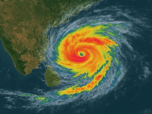
Cyclone Akwan is set to form over the Bay of Bengal on Monday and may rapidly intensify into a severe cyclonic storm by Tuesday. Chennai, Tiruvallur, and Chengalpattu are on course for very heavy rainfall on two consecutive days — 18 and 19 November — while fishermen have been warned off the north Tamil Nadu coast as winds could touch 60 km/h.
Key Takeaways
Cyclone Akwan is likely to form over the Bay of Bengal on Monday, 17 November and may intensify into a severe cyclonic storm by Tuesday.
The system is forecast to move northwestwards toward the Andhra Pradesh coast .
Chennai , Tiruvallur , and Chengalpattu are expected to receive very heavy rainfall on 18 and 19 November .
Heavy rain is additionally forecast on Wednesday for Kancheepuram , Ranipet , Tiruvannamalai , Villupuram , Cuddalore , Mayiladuthurai , and Puducherry .
Fishermen have been advised against venturing into the sea along the north Tamil Nadu coast , the southwest Bay of Bengal , and the Andaman Sea ; winds may reach 60 km/h .
A separate cyclonic circulation over the southeast Arabian Sea off the Kerala coast is also active.
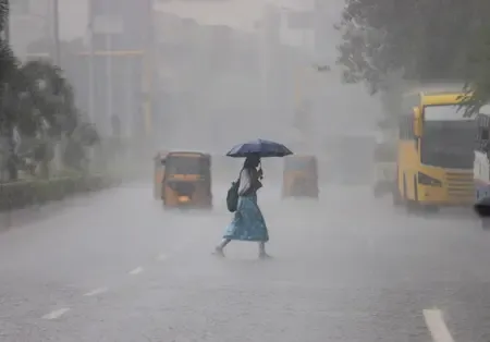
Cyclone Akwan, likely to form over the Bay of Bengal on Monday, 17 November 2025, may intensify into a severe cyclonic storm by Tuesday, the Chennai Meteorological Department warned on Sunday, forecasting heavy to very heavy rainfall across Chennai and neighbouring districts over the coming days. Wednesday, 18 November and Thursday, 19 November have been identified as the peak period of concern.
How the system is expected to develop
According to the department's weather bulletin, the low-pressure system will gather strength over the next two days and track northwestwards toward the Andhra Pradesh coast. A separate cyclonic circulation is also persisting over the southeast Arabian Sea off the Kerala coast, compounding the broader moisture environment across the region.
Isolated moderate showers are forecast along northern coastal Tamil Nadu, Puducherry, and Karaikal on Monday. Light rain is expected at one or two places in southern Tamil Nadu during the same period.
Peak rainfall alert for Chennai, Tiruvallur, Chengalpattu
Rainfall intensity is expected to ramp up sharply from Tuesday, with heavy showers forecast at isolated places in Chennai, Tiruvallur, and Chengalpattu districts. All three districts are then projected to receive very heavy rainfall on 18 and 19 November — the two consecutive days that form the core of the department's warning.
Heavy rainfall is additionally forecast for Wednesday across Kancheepuram, Ranipet, Tiruvannamalai, Villupuram, Cuddalore, and Mayiladuthurai districts, as well as Puducherry. This broadens the zone of concern well beyond the immediate Chennai metropolitan area to much of northern Tamil Nadu.
Marine warning and fishermen advisory
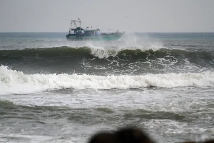
The department has also issued a marine warning, cautioning of winds reaching up to 60 kilometres per hour. Fishermen have been strongly advised against venturing into the sea along the north Tamil Nadu coast, the southwest Bay of Bengal, and the Andaman Sea during this period.
The marine alert covers the waters most directly in the path of the developing system and runs concurrently with the rainfall advisories for coastal and adjoining districts.
What this means for the region
While Cyclone Akwan's projected landfall track points toward Andhra Pradesh, meteorologists note that such systems routinely bring heavy outer-band rainfall to northern Tamil Nadu during their approach. The combination of the Bay of Bengal system and the Arabian Sea circulation means moisture supply to the region will remain elevated through mid-week.
This comes amid the ongoing northeast monsoon season, when Tamil Nadu and Puducherry are historically the most rainfall-active states in peninsular India — making a storm-intensification event during this window particularly impactful. Residents in low-lying areas of Chennai, Tiruvallur, and Chengalpattu have been implicitly cautioned to prepare for waterlogging and disruption on 18 and 19 November. All eyes are now on how rapidly Akwan intensifies over the next 48 hours.
Point of View
When the state's drainage infrastructure is already under seasonal stress. What stands out is the double-barrelled threat: a Bay of Bengal cyclone tracking toward Andhra Pradesh that will still deliver very heavy outer-band rainfall to Chennai for two consecutive days, amplified by a concurrent Arabian Sea circulation. Historically, Chennai's most catastrophic flood events — 2015 being the defining case — have involved not just peak rainfall but saturated catchments unable to absorb successive heavy spells. The 48-hour window before landfall is therefore critical for civic preparedness, not just meteorological monitoring.
NationPress
16 Nov 2026
Frequently Asked Questions
What is Cyclone Akwan and where is it forming?
Cyclone Akwan is a weather system likely to form over the Bay of Bengal on Monday, 17 November 2025. It is expected to intensify into a severe cyclonic storm by Tuesday and track northwestwards toward the Andhra Pradesh coast, according to the Chennai Meteorological Department.
Which districts in Tamil Nadu will be most affected by Cyclone Akwan?
Chennai, Tiruvallur, and Chengalpattu face the most severe impact, with very heavy rainfall forecast on both 18 and 19 November. Heavy rain is additionally expected in Kancheepuram, Ranipet, Tiruvannamalai, Villupuram, Cuddalore, Mayiladuthurai, and Puducherry on 18 November.
Why is Tamil Nadu affected if the cyclone is heading toward Andhra Pradesh?
Cyclones approaching the Andhra Pradesh coast routinely generate heavy outer-band rainfall across northern Tamil Nadu during their approach phase. The active northeast monsoon and a separate Arabian Sea cyclonic circulation are further amplifying the moisture supply to the region.
What is the marine warning issued for Cyclone Akwan?
The Chennai Meteorological Department has warned fishermen not to venture into the north Tamil Nadu coast, the southwest Bay of Bengal, or the Andaman Sea, as winds could reach up to 60 kilometres per hour. The marine alert runs alongside the rainfall advisories for coastal districts.
When is the peak rainfall period expected in Chennai?
Wednesday, 18 November and Thursday, 19 November are identified as the peak rainfall days, with very heavy showers forecast for Chennai, Tiruvallur, and Chengalpattu. Rainfall is expected to begin intensifying from Tuesday, 18 November, with the heaviest spells on the two days that follow.