Delhi-NCR rain, thunderstorms forecast on 5 Sep; temps to stay below normal
Synopsis
A near-stationary low-pressure system over northern Madhya Pradesh is keeping Delhi-NCR drenched — with two thunderstorm spells forecast for 5 September and temperatures running below seasonal norms. The wet spell is expected to ease only from 6 September, with dry conditions returning by 7 September.
Key Takeaways
IMD has forecast light to moderate rain with thunderstorms across Delhi-NCR on 5 September , in two spells — morning and afternoon/evening.
A well-marked low-pressure area over northern Madhya Pradesh and south Uttar Pradesh is driving the wet conditions and is expected to stay nearly stationary for two days.
Delhi maximum temperature likely between 29°C and 31°C ; minimum between 24°C and 26°C — below previous day's levels.
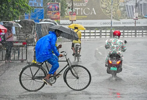
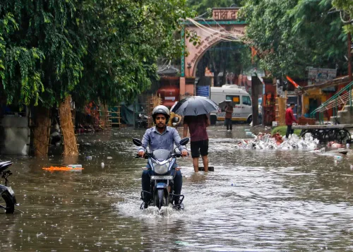
Friday's rain brought gusts of nearly 60 kmph and caused waterlogging and traffic disruption across the city.
Faridabad recorded 4.5 mm of rainfall in the past 24 hours; Ghaziabad logged a maximum of 34.9°C .
Rainfall expected to taper from 6 September , with mainly dry weather forecast from 7–10 September .
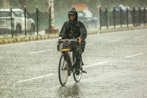
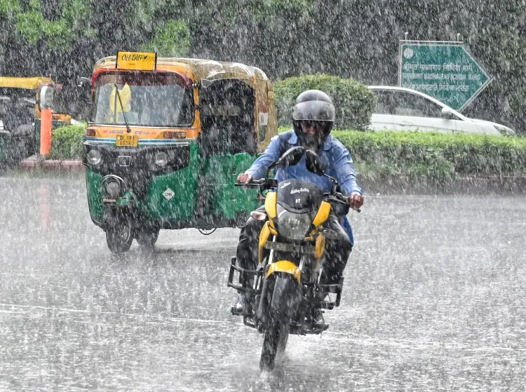
The India Meteorological Department (IMD) has forecast light to moderate rain with thunderstorm and lightning activity across Delhi-NCR on 5 September, as the national capital and its satellite cities brace for another unsettled day. Overcast skies and cooler-than-usual temperatures are expected to persist through the day, with two distinct spells of showers likely — one in the morning and another in the afternoon and evening.
What Triggered the Wet Spell
The IMD has attributed the continuing wet conditions to a well-marked low-pressure area positioned over central parts of northern Madhya Pradesh and adjoining areas of south Uttar Pradesh. The weather system is expected to remain nearly stationary for the next two days, sustaining moisture-laden conditions over the region. This comes a day after Delhi recorded heavy rainfall accompanied by strong winds, with gusts reaching nearly 60 kmph in some parts of the city.
Friday's Downpour: Waterlogging and Traffic Chaos
Friday's heavy rain caused waterlogging at several locations across Delhi, disrupting traffic movement and inconveniencing commuters. The combination of strong winds and standing water led to widespread travel delays. The IMD has warned that similar disruptions remain possible on Saturday during periods of intense rainfall.
City-by-City Forecast
Delhi is expected to remain generally cloudy, with the maximum temperature likely to range between 29°C and 31°C and the minimum between 24°C and 26°C — both below the previous day's readings. Noida is likely to see intermittent rain with thunderstorms in two spells. Gurugram faces a similar outlook, with thunderstorm activity expected from early morning through the forenoon and again in the afternoon or evening. Ghaziabad, which recorded a maximum of 34.9°C and a minimum of 27.1°C in the preceding 24 hours, is also expected to receive rain with lightning at different points during the day. Faridabad, which logged 4.5 mm of rainfall and a maximum of 34.4°C in the past 24 hours, will remain under the influence of the same system, with rain and thunderstorms likely in the morning and evening.
When Will the Rain Ease?
According to the extended forecast, rainfall is expected to gradually decline from 6 September, when only very light showers are likely. From 7 September to 10 September, conditions are expected to turn mainly dry with partly cloudy skies. Wind direction is forecast to shift from southeasterly to northwesterly, signalling the gradual retreat of the rain-bearing system. As it moves away, maximum temperatures are expected to climb back to the 33°C–35°C range.
IMD Advisory for Commuters
The IMD has advised residents to exercise caution, citing risks of traffic disruptions, water accumulation in low-lying areas, and a heightened likelihood of road accidents during heavy rain spells. Commuters have been urged to check traffic conditions before setting out and to follow official traffic advisories throughout the day.
Point of View
Yet waterlogging and traffic chaos repeat with each heavy spell, pointing to a drainage infrastructure deficit that outlasts any single monsoon. The IMD's two-spell forecast is precise; the city's preparedness is the variable that matters. With dry weather returning by 7 September, the window for damage is short — but so is the window for accountability.
NationPress
5 Sept 2026
Frequently Asked Questions
Will it rain in Delhi-NCR on 5 September 2024?
Yes, the IMD has forecast light to moderate rain with thunderstorms and lightning across Delhi-NCR on 5 September, in two spells — one from early morning to the forenoon, and another in the afternoon and evening.
Why is Delhi-NCR receiving continuous rain this week?
A well-marked low-pressure area over central northern Madhya Pradesh and adjoining south Uttar Pradesh is sustaining moisture-laden conditions over the region. The system is expected to remain nearly stationary for two more days before moving away.
What will Delhi's temperature be on 5 September?
Delhi's maximum temperature is expected to remain between 29°C and 31°C, while the minimum is forecast to range from 24°C to 26°C — both below the previous day's levels due to continuing rainfall.
When will the rain stop in Delhi-NCR?
Rainfall is expected to gradually ease from 6 September, with only very light showers likely. From 7 September to 10 September, conditions are forecast to turn mainly dry with partly cloudy skies and temperatures rising back to the 33°C–35°C range.
Which areas in NCR are affected by the rain forecast?
Noida, Gurugram, Ghaziabad, and Faridabad are all expected to experience cloudy skies, intermittent rain, and thunderstorms on 5 September. Faridabad recorded 4.5 mm of rainfall in the preceding 24 hours, while Ghaziabad logged a maximum of 34.9°C.