Delhi govt demolishes 143 illegal structures in Shalimar Bagh to widen Road No. 320
Synopsis
More than four decades after the Delhi government acquired the land, 143 pucca structures built on a 10.5-metre strip of Road No. 320's Right of Way in Shalimar Bagh were finally demolished — following a Supreme Court clearance on 29 May 2026. The drive highlights how encroachments on legally acquired public land can persist for generations, blocking emergency vehicles and choking a key north Delhi corridor.
Key Takeaways
The Delhi government demolished 143 unauthorised pucca structures in Haiderpur village, Shalimar Bagh on 1 June 2026 .
The action complies with a Supreme Court order cleared on 29 May 2026 and a Delhi High Court ruling dated 6 April 2026 .
The land was government-acquired through notifications in 1959 and 1961 ; possession was taken in July 1980 and compensation deposited by 1981 .
Of the 30-metre Right of Way, 10.5 metres was blocked by encroachments; demolition is restricted to this strip in the current phase.
320 connects the Shalimar Bagh RUB to the Outer Ring Road and is critical for emergency vehicle movement.
The drive will continue until all illegal structures in the designated area are cleared for the road-widening project.
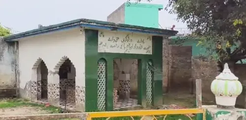
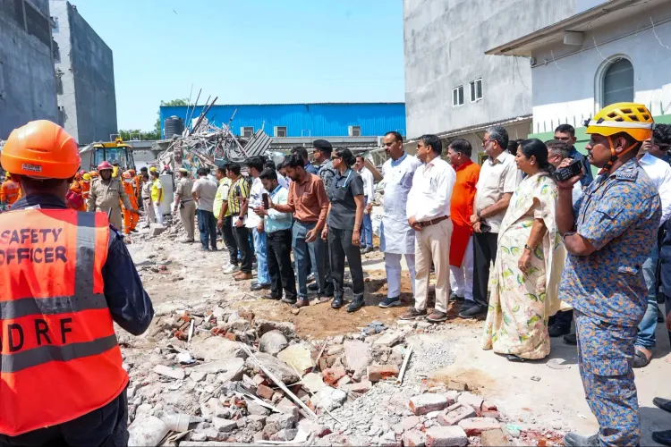
The Delhi government on Sunday, 1 June 2026, launched a large-scale demolition drive in the Haiderpur village area of Shalimar Bagh, razing 143 unauthorised permanent (pucca) constructions that had encroached upon the designated 30-metre Right of Way of Road No. 320. The action was carried out in compliance with a Supreme Court order cleared on 29 May 2026, following years of legal proceedings over land that has been government-acquired for over four decades.
What the Survey Found
District Magistrate (DM) of Central-North District S.S. Parihar said that a joint survey conducted on 10 January 2026 identified 143 unauthorised pucca structures standing within the prescribed Right of Way. Of the total 30-metre corridor, the existing road occupies approximately 19.5 metres, while the remaining 10.5 metres has been blocked by encroachments. The administration has clarified that demolition in the current phase is restricted to this 10.5-metre encroached strip — not the full Right of Way — to minimise displacement while serving public interest.
Decades of Acquisition, Years of Encroachment
The land in question was acquired by the government through notifications issued in 1959 and 1961, with the formal acquisition declaration issued in 1966. Award Nos. 40/1980-81 and 50/1980-81 were announced in 1980, possession was taken in July 1980, and the remaining compensation was deposited by 1981 — completing the acquisition process more than four decades ago. Despite this, structures were gradually built on the acquired land over the years.
In 2025, a scientific demarcation was jointly carried out by the Delhi Development Authority (DDA), the Revenue Department, the Land and Building Department, and the Public Works Department using Total Station Method (TSM) technology to establish precise boundaries before any action was taken.
Legal Battles and Court Clearances
A public notice was issued in January 2026, inviting objections from affected residents, with notices also published in prominent newspapers. After considering all objections, the Land Acquisition Collector passed an order on 20 March 2026. Some residents subsequently filed a petition in the Delhi High Court, seeking a declaration that the land acquisition had lapsed under Section 24(2) of the Land Acquisition Act, 2013.
The Delhi High Court dismissed the petition on 6 April 2026, observing that the petitioners did not possess valid documents of pre-acquisition ownership, that the land acquisition was valid, and that a road project of public importance could not be stalled. The Supreme Court subsequently cleared the way for encroachment removal on 29 May 2026.
Why This Road Matters
Road No. 320 forms a vital traffic corridor linking the Shalimar Bagh Railway Under Bridge (RUB) to the Outer Ring Road, connecting the Ring Road, Azadpur, Shalimar Bagh, and surrounding residential, commercial, and institutional zones. According to DM Parihar, the current width of the road has been severely compromised by encroachments, leading to persistent traffic congestion and hampering the movement of ambulances, fire brigade vehicles, and other emergency services. The road also provides access to hospitals and government offices in the area.
What Happens Next
The administration has stated that the demolition drive will continue until all illegal structures within the designated area are cleared and the land is made available for the road-widening project. The drive is being conducted under the principle of 'minimum displacement' — targeting only the encroached 10.5 metres in this phase to preserve as many structures as possible while restoring the public Right of Way. The road widening is expected to significantly ease traffic flow across one of north Delhi's busiest corridors.
Point of View
Requiring Supreme Court intervention to clear. The 'minimum displacement' framing is administratively prudent, but it also raises an uncomfortable question: if the full 30-metre Right of Way was legally acquired, why has the state repeatedly stopped short of enforcing it? The legal history — a High Court dismissal, a Supreme Court clearance, and a Land Acquisition Collector order — suggests this was never a grey area, only an unexercised right. Delhi's road infrastructure deficit is not just a planning problem; it is an enforcement problem, and Shalimar Bagh is one of dozens of corridors where the same pattern repeats.
NationPress
18 Oct 2026
Frequently Asked Questions
Why did the Delhi government demolish structures in Shalimar Bagh?
The Delhi government demolished 143 unauthorised pucca structures in Haiderpur village, Shalimar Bagh, to implement a Supreme Court order and reclaim the 10.5-metre encroached portion of Road No. 320's 30-metre Right of Way. The land was legally acquired by the government over four decades ago and is designated as a public road in the DDA Master Plan.
What is Road No. 320 and why does it matter?
Road No. 320 is a key traffic corridor in north Delhi connecting the Shalimar Bagh Railway Under Bridge (RUB) to the Outer Ring Road, linking Ring Road, Azadpur, Shalimar Bagh, and surrounding areas. Encroachments had severely narrowed the road, causing regular traffic jams and obstructing ambulances and fire brigade vehicles.
When was the land for Road No. 320 acquired by the government?
The land was acquired through notifications issued in 1959 and 1961, with the formal declaration in 1966. Award Nos. 40/1980-81 and 50/1980-81 were announced in 1980, possession was taken in July 1980, and compensation was fully deposited by 1981 — completing the acquisition more than four decades ago.
What did the Delhi High Court and Supreme Court rule?
The Delhi High Court dismissed a residents' petition on 6 April 2026, ruling that petitioners lacked valid pre-acquisition ownership documents, the land acquisition was valid, and a public road project could not be halted. The Supreme Court subsequently cleared the way for encroachment removal on 29 May 2026.
How many structures will be demolished in total and will more action follow?
A total of 143 unauthorised permanent structures were identified in the joint survey of 10 January 2026 within the Right of Way. The administration has stated that the demolition drive will continue until all illegal structures in the designated area are removed and the land is made available for the road-widening project.