Tamil Nadu to Implement Drone Mapping for Ramsar Site Conservation
Synopsis
The Tamil Nadu government plans to leverage drone mapping technology for the conservation and analysis of Ramsar sites, as part of its Wetlands Mission aimed at restoring 100 wetlands. This initiative will utilize advanced technologies to assess and protect vital ecosystems.
Key Takeaways
Drone mapping technology will be used for Ramsar site conservation.
Part of the Tamil Nadu Wetlands Mission to restore 100 wetlands.
Collaboration with Tamil Nadu Wetlands Department and TNUAVC .
Use of LiDAR and RGB technologies for ecological analysis.
Focus on biodiversity and invasive species monitoring.
Chennai, Jan 27 (NationPress) The Tamil Nadu government has revealed its plans to utilize drone mapping technology for the analysis and conservation of Ramsar sites throughout the state.
This endeavor is a component of the Tamil Nadu Wetlands Mission, which aims to rejuvenate 100 wetlands in the region.
Wetlands serve as vital ecosystems, playing a crucial role in sustaining ecological balance, fostering biodiversity, and offering various ecosystem services necessary for human existence.
The Ramsar Convention on Wetlands, an international agreement initiated in 1971, establishes a framework for the global conservation and judicious use of wetlands.
Presently, Tamil Nadu boasts 18 Ramsar sites, with 17 of them gaining international recognition post-2021.
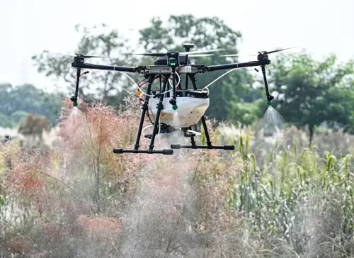
The Tamil Nadu Unmanned Aerial Vehicle Corporation (TNUAVC), operating under the Higher Education Department, will lead this initiative.
TNUAVC has partnered with the Tamil Nadu Wetlands Department to deploy drones featuring advanced RGB and LiDAR technologies for this mission.
The drones, equipped with RGB sensors, will acquire high-resolution images to produce comprehensive 3D maps.
Moreover, LiDAR technology will yield precise data for enhanced ecological assessments.
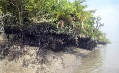
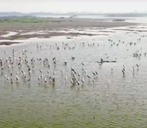
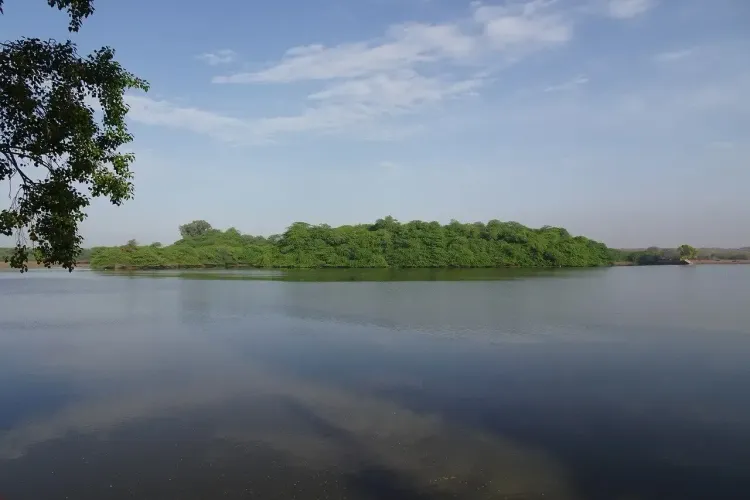
A senior official from the Higher Education Department mentioned that the project will also encompass Geographic Information System (GIS) analyses and surveys in 15 Ramsar sites, including Vedanthangal Bird Sanctuary, Pichavaram Mangrove, Longwood Shola Reserve Forest (Nilgiris), Nanjarayan Bird Sanctuary (Tirupur), Kazhuveli Bird Sanctuary (Villupuram), and Karaivetti Bird Sanctuary (Ariyalur).
The mapping efforts will create land-use and land-cover classification maps for wetlands and their 300-meter buffer zones.
Bathymetric surveys, performed before and after the monsoon season, will examine sedimentation trends to pinpoint areas with high silt or sludge accumulation.
This initiative will also involve studies on hydrology and water flow to assess evapotranspiration rates, sedimentation, groundwater interactions, flood mapping, and risk evaluation.
Machine Learning methods will be utilized to identify and track invasive species within the wetlands.
Biodiversity evaluations will also take place, focusing on flora, fauna, vegetation health, and biomass assessment.
The Tamil Nadu State Environment and Climate Change Department is already formulating integrated management plans for Ramsar sites, including the Pallikaranai marshland in Chennai.
Ramsar sites are essential for biodiversity, water purification, groundwater replenishment, and managing both droughts and floods.
Conserving these areas is also critical for food security and supports the livelihoods and cultural practices of local communities.
An official from the Tamil Nadu State Wetland Authority indicated that numerous Ramsar sites near urban zones are threatened by human encroachment and land acquisition.
These areas will be prioritized for mapping and conservation initiatives.
In collaboration with the Wildlife Institute of India, the state government is developing comprehensive management strategies for these wetlands.
The mapping data will bolster these efforts and contribute to the enduring preservation of Tamil Nadu's ecological legacy.