How is Drone Technology and Digital Records Transforming Village Property Records?
Click to start listening
Synopsis
In a groundbreaking initiative, the Delhi government is leveraging drone technology to address property ownership issues in village areas, promising legal security and better land management for residents. This innovative approach aims to create accurate digital records, ensuring fair dispute resolution and safeguarding individual rights.
Key Takeaways
- Drone-assisted surveys enhance property record accuracy.
- The initiative supports legal proof of ownership for villagers.
- It aims to resolve land disputes in a transparent manner.
- The SVAMITVA Scheme is pivotal for rural property management.
- Digital records will streamline land management processes.
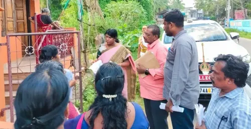
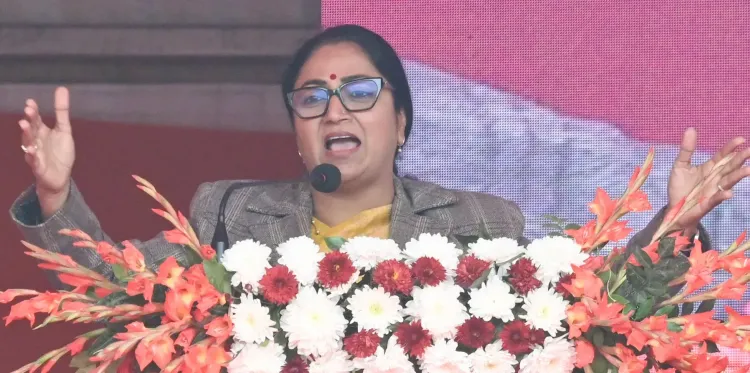
New Delhi, Dec 19 (NationPress) In a significant move to tackle challenges surrounding the identification, ownership, and documentation uncertainties of populated regions in Delhi's villages, the city administration has initiated drone-assisted surveys aimed at updating property ownership records, announced Chief Minister Rekha Gupta on Friday.
This initiative is designed to not only enhance the land management system but also to provide villagers with vital legal proof of ownership and ensure financial security.
The term Abadi Deh translates to the ‘inhabited area of a village’, indicating the specific land within a village's revenue boundary where rural residences, threshing floors, cowsheds, and other essential structures are situated.
The Chief Minister revealed that the Revenue Department entered into a Memorandum of Understanding with the Survey of India in April 2022 to implement the Central government’s SVAMITVA Scheme across 48 rural villages in Delhi.
Drone surveys have been finalized in 31 villages to date, with ‘Map 2.0’ for 25 villages verified and submitted to the Survey of India for the provision of land parcel maps and geo-based identification numbers, she stated.
To effectively execute the SVAMITVA Scheme, launched by Prime Minister Narendra Modi on National Panchayati Raj Day in 2020, the Delhi Government has crafted a draft of the Delhi Abadi Deh Survey and Record Management Rules, 2025, she added.
This draft establishes a comprehensive operational framework, encompassing drone-based aerial surveys, field verification, public objection procedures, dispute resolution, creation of digital records, and issuance of property cards.
The primary aim is to ensure that no individual’s rights are compromised and that land disputes are addressed in a transparent, time-bound, and fair manner, she noted.
According to government guidelines, the Abadi Deh survey will be conducted under the direct oversight of the Revenue Department. Survey teams and technical agencies will collaboratively perform surveys in Abadi Deh areas, extended Abadi Deh areas, and other notified zones using advanced technologies, as stated in an official announcement.
Digital information will be gathered through drones and aerial photography, which will enable precise recording of each plot’s exact location, size, and boundaries.
In addition to technology-driven surveys, ground truthing will be compulsory. Initial maps produced via drone surveys will undergo physical verification on-site to ensure that the depicted boundaries accurately reflect the ground reality.
Point of View
This initiative by the Delhi government highlights an innovative approach to resolving long-standing issues in rural property management. Leveraging technology, such as drones, not only enhances transparency but also empowers villagers by providing them with legal validation of their land ownership. This progressive move aligns with national goals of improving rural infrastructure and governance.
NationPress
20/12/2025
Frequently Asked Questions
What is the Abadi Deh survey?
The Abadi Deh survey refers to the assessment of inhabited areas within a village's revenue boundary, focusing on documenting residential properties and ancillary structures.
How does drone technology help in property record management?
Drone technology assists in capturing accurate aerial imagery, enabling precise mapping of land boundaries and ensuring reliable property records.
What is the SVAMITVA Scheme?
The SVAMITVA Scheme, launched by the Prime Minister, aims to provide legal ownership of property in rural areas through accurate mapping and documentation.
What are the benefits of this initiative for villagers?
Villagers benefit from enhanced legal proof of ownership, improved financial security, and a transparent process for resolving land disputes.
How will disputes be resolved under this initiative?
Dispute resolution will be handled through a transparent and time-bound process as delineated in the draft of the Delhi Abadi Deh Survey and Record Management Rules, 2025.