Heavy rain alert for 4 Tamil Nadu districts as low-pressure system persists

Synopsis
A low-pressure circulation stretching from Karnataka to the Kanyakumari Sea is pushing heavy rain, thunderstorms, and gusty winds into four Tamil Nadu districts on 29 June — with Nilgiris and Coimbatore hills facing a two-day alert. Disaster response teams are on standby as the system shows no sign of easing before Tuesday.
Key Takeaways
The RMC has forecast heavy rainfall for Coimbatore hills , Nilgiris , Dindigul , and Theni on 29 June .
An atmospheric circulation at 1.5 km above sea level extending from Karnataka to the Kanyakumari Sea is driving the weather system.
Heavy rain is expected to continue in Coimbatore hills and Nilgiris through Tuesday .
Moderate rainfall is forecast across 13 additional districts , including Chennai, Madurai, Salem, and Tiruchirappalli.
Chennai is forecast to hit a maximum of 39°C with partly cloudy skies and scattered showers.
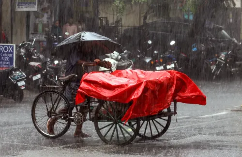
Disaster response teams are on alert; residents near rivers, streams, and hill slopes have been advised to follow official safety updates.
The Regional Meteorological Centre (RMC) has issued a heavy rainfall forecast for four districts of Tamil Nadu on Monday, 29 June, as a persistent low-pressure atmospheric circulation continues to drive widespread rain activity across the state. The weather system, centred at roughly 1.5 km above mean sea level, stretches from Karnataka to the Kanyakumari Sea.
Districts on High Alert
The RMC has identified Coimbatore (hill areas), Nilgiris, Dindigul, and Theni as the four districts most likely to receive heavy rain accompanied by thunderstorms, lightning, and gusty winds on Monday. These areas, characterised by hilly terrain and landslide-prone slopes, face the greatest risk from the prevailing circulation.
Heavy rainfall is expected to persist in the hill areas of Coimbatore and the Nilgiris through Tuesday as well, with other districts reverting to light-to-moderate activity thereafter, according to the RMC.
Wider Impact Across Tamil Nadu
Beyond the four high-alert districts, moderate rainfall is forecast for a broad sweep of the state. In the north, Chennai, Chengalpattu, Kancheepuram, Tiruvallur, Ranipet, and Vellore are expected to receive scattered showers. Central and southern districts — including Tiruchirappalli, Thanjavur, Pudukkottai, Namakkal, Erode, Salem, and Madurai — are also in the forecast zone.
Meteorologists noted that atmospheric conditions remain favourable for widespread rain throughout the day, with no immediate signs of the circulation weakening.
Chennai Weather Outlook
In Chennai, skies are expected to remain partly cloudy with moderate rainfall likely at a few locations during the day. The city is forecast to record a maximum temperature of around 39 degrees Celsius and a minimum of approximately 28 degrees Celsius.
This comes as the state capital has seen intermittent spells of rain in recent days, consistent with the broader monsoon-season pattern across peninsular India.
Advisories and Preparedness Measures
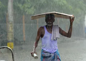
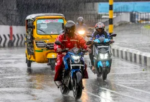
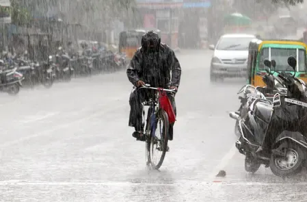
The weather department has urged residents — particularly those in hilly and low-lying areas — to remain vigilant, warning that heavy rain, thunderstorms, and strong winds could trigger localised disruptions. Motorists have been advised to exercise caution due to the risk of waterlogging and reduced visibility during intense spells.
Officials confirmed that local administrations have been directed to closely monitor developments and maintain readiness for rain-related emergencies. Disaster response teams are on alert in vulnerable zones, and people residing near rivers, streams, and landslide-prone slopes have been advised to follow official safety advisories. Authorities are expected to remain on heightened watch through at least Tuesday.
Point of View
But the geography here demands attention — Nilgiris and Coimbatore hills are perennially landslide-prone during active monsoon circulations, and a two-day heavy-rain window is not trivial. What is missing from the official advisory is any quantified rainfall threshold or historical comparison: how does this circulation compare to past June systems that caused fatalities or displacement? Disaster teams being 'on alert' is standard language; what matters is whether early-warning communication reaches communities on hill slopes before, not after, conditions deteriorate.
NationPress
29 Jun 2026
Frequently Asked Questions
Which Tamil Nadu districts are under heavy rain alert on 29 June?
The RMC has placed Coimbatore hill areas, Nilgiris, Dindigul, and Theni under a heavy rain alert on 29 June. These districts are expected to experience thunderstorms, lightning, and gusty winds alongside heavy rainfall.
What is causing the heavy rain in Tamil Nadu?
A low-pressure atmospheric circulation persisting at about 1.5 km above mean sea level, extending from Karnataka to the Kanyakumari Sea, is driving the heavy rain across Tamil Nadu. Meteorologists say conditions remain favourable for widespread rain activity throughout the day.
How long will the rain continue in Tamil Nadu?
Heavy rainfall is expected to continue through Tuesday in the hill areas of Coimbatore and the Nilgiris. Other districts are forecast to experience light-to-moderate rain from Tuesday onwards, as the circulation's influence is expected to gradually ease.
What precautions have authorities advised?
The weather department has urged residents in hilly and low-lying areas to stay vigilant. Motorists are advised to drive carefully due to waterlogging and poor visibility risks. Local administrations have been directed to monitor conditions closely, and disaster response teams are on standby in vulnerable areas.
What is the weather forecast for Chennai on 29 June?
Chennai is expected to have partly cloudy skies with moderate rainfall at a few locations on 29 June. The city's maximum temperature is forecast at around 39 degrees Celsius and the minimum at approximately 28 degrees Celsius.