Will Jammu and Kashmir Experience Moderate to Heavy Rain and Snow from January 22 to 28?
Click to start listening

Synopsis
Jammu and Kashmir is bracing for significant weather changes as the Meteorological Department forecasts moderate to heavy rain and snow from January 22 to 28. Travelers and residents are advised to stay alert and plan accordingly. The region's unique geographical features make it susceptible to severe weather patterns.
Key Takeaways
- Significant weather changes expected in J&K.
- Potential disruptions to transport and safety.
- Advisories issued for residents and travelers.
- Heavy rain and snow forecasted from January 22.
- Stay informed and prepared for adverse conditions.
Srinagar, Jan 20 (NationPress) The minimum temperature in Jammu and Kashmir's ski haven of Gulmarg plummeted to -5.5 degrees Celsius on Tuesday, as the Meteorological (MeT) Department anticipates moderate to heavy rain and snow beginning on the evening of January 22.
In Srinagar, the minimum temperature registered at -3.4 degrees Celsius, while Pahalgam noted -4.4 degrees Celsius and Gulmarg recorded -5.5 degrees Celsius.
Jammu city and Katra both reported a minimum of 7.4 degrees Celsius, Batote 2.5 degrees Celsius, Banihal -1.6 degrees Celsius, and Bhaderwah -1.2 degrees Celsius.
The MeT Department has issued a weather advisory detailing potential adverse conditions from January 22 through January 28.
This advisory indicates a significant shift in weather patterns, with two Western Disturbances predicted to affect J&K in quick succession in the coming days.
The initial and more severe system is expected to impact J&K and nearby areas between January 22 and 24, with peak activity on January 23.
The second, less intense system is anticipated from the night of January 26 to the morning of January 28, peaking on January 27, according to the weather advisory.
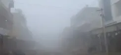
These systems are likely to bring widespread light to moderate rainfall and snowfall throughout the region, with isolated areas experiencing heavy precipitation, particularly during peak days.
The first system is expected to result in significant snowfall and rainfall over the Pir Panjal range, impacting the Chenab Valley in Jammu Division and the middle and higher elevations of South Kashmir, affecting areas such as Anantnag, Pahalgam, Kulgam, Shopian, Gulmarg, and the Sonamarg-Zojila region.
Similar effects, albeit of moderate to heavy intensity, are forecasted for the second system as well.
The advisory notes potential disruptions to both surface and air transport, including the Jammu-Srinagar Highway and other crucial routes in the higher elevations of the union territory.
There is also a risk of landslides, mudslides, and gusty winds ranging from 40 to 60 km/h in vulnerable areas.
In light of the forecast, travelers, tourists, and transport operators are urged to carefully plan their journeys.
Residents in snow-affected regions are advised to avoid risky and avalanche-prone zones, while farmers should refrain from irrigation, fertilizer application, and chemical spraying during this period.
A Western Disturbance, an extratropical storm originating from the Mediterranean, brings sudden winter rain to northwestern parts of the Indian subcontinent, influencing agricultural prospects across India, Pakistan, Nepal, and Bangladesh.
Point of View
We believe in keeping our audience informed and prepared. The weather forecast for Jammu and Kashmir is a crucial update for residents and travelers alike. The potential disruptions to transport and safety concerns warrant immediate attention. We encourage everyone to stay vigilant and heed the advisories issued by the Meteorological Department.
NationPress
20/01/2026
Frequently Asked Questions
What is the expected weather in Jammu and Kashmir from January 22 to 28?
The MeT Department forecasts moderate to heavy rain and snow during this period, particularly from January 22 evening.
What precautions should travelers take?
Travelers are advised to plan their journeys carefully, considering potential disruptions on roads and air transport.
Are there any safety warnings for residents?
Residents are cautioned against venturing into avalanche-prone areas and are advised to take precautions against landslides.