Will Jaipur Experience More Rain as Western Disturbances Approach?
Synopsis
Jaipur experiences light drizzle while Rajasthan remains predominantly dry. A strong Western Disturbance is expected to bring winter rains and significant changes in weather patterns in the coming days. Visibility issues due to fog and the potential impact on agriculture make this development noteworthy.
Key Takeaways
Jaipur experienced light drizzle while most of Rajasthan remained dry.
A strong Western Disturbance is set to bring winter rains.
Fog is expected to impact visibility, so caution is advised.
The rainfall could be beneficial for Rabi crops .
Temperatures may drop following the rain.
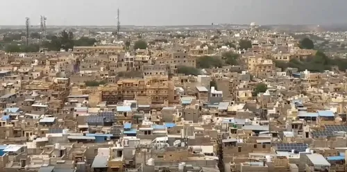
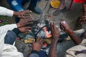
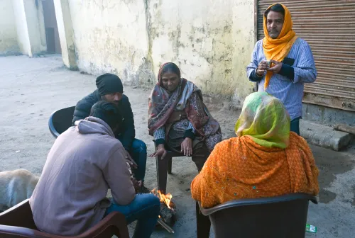
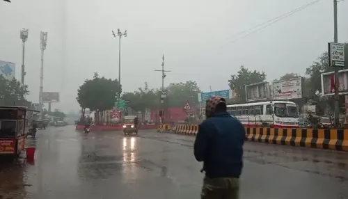
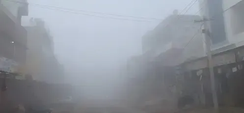
Jaipur, Jan 20 (NationPress) On Tuesday, light drizzle was observed in the capital city of Jaipur, while the rest of Rajasthan generally remained dry. However, several areas in the state reported moderate to dense fog, which impacted visibility in the early morning hours and signaled a shift in winter weather patterns.
As per the Meteorological Centre, Jaipur, temperature variations were significant across the state. The highest recorded temperature in the past 24 hours was 30.4 degrees Celsius at Jawai Dam in Pali district, while the lowest was 4.6 degrees Celsius in Pali (AWS), indicating the persistence of chilly nights despite some daytime warmth.
Director of the Jaipur Meteorological Centre, Radheshyam Sharma, indicated that a robust Western Disturbance is expected to become active over parts of Rajasthan from January 22 to 24, potentially bringing winter rains (Mawath).
Additionally, another consecutive Western Disturbance is anticipated to impact the region from January 26 to 28, likely affecting temperature trends and precipitation.
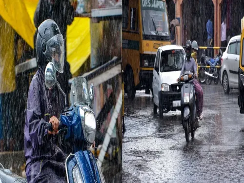
Forecasts suggest that January 22 could bring light to moderate rainfall, along with thunderstorms and lightning in certain areas of the Jodhpur and Bikaner divisions, as well as the Shekhawati region. Similar weather conditions are expected on January 23 across the Bikaner division, Shekhawati region, and parts of Jaipur, Ajmer, and Bharatpur divisions, heightening the likelihood of widespread winter showers.
From January 24 to 25, the weather is projected to become relatively dry again, with most of the state experiencing clear skies. However, a decrease of 2 to 4 degrees Celsius in minimum temperatures is anticipated, coupled with the formation of dense fog in isolated locations during late nights and early mornings.
The Meteorological Centre has advised residents to exercise caution, particularly in foggy conditions that may disrupt road and rail travel. Farmers are also encouraged to remain vigilant, as the upcoming winter rainfall could significantly benefit Rabi crops in many areas.
Point of View
It is essential to highlight the implications of weather changes on both daily life and agriculture. The expected winter rains brought by the Western Disturbances could be a boon for farmers, while also posing challenges for visibility and travel. Our commitment to accurate and timely reporting will keep our audience informed during these changing conditions.
NationPress
26 Jun 2026
Frequently Asked Questions
What is a Western Disturbance?
A Western Disturbance is an extratropical storm that originates in the Mediterranean region and brings moisture to the Indian subcontinent, leading to precipitation.
How will the expected rainfall affect agriculture in Rajasthan?
The anticipated winter rains are likely to benefit Rabi crops, providing much-needed moisture for growth during this crucial agricultural season.
What precautions should be taken during foggy conditions?
Drivers should use fog lights, reduce speed, and maintain a safe distance from other vehicles. It’s advisable to avoid unnecessary travel during dense fog.
When is the best time to expect the rain?
Light to moderate rainfall is expected from January 22 to 24, with varying impacts across different divisions in Rajasthan.
Will temperatures drop after the rain?
Yes, there is a forecasted drop of 2 to 4 degrees Celsius in minimum temperatures following the rain, along with the likelihood of fog formation.