How is the TN Forest Dept Enhancing Wildlife Monitoring with Drones?
Click to start listening
Synopsis
In an exciting leap towards modern conservation, the Tamil Nadu Forest Department is deploying advanced drones that will revolutionize wildlife monitoring and forest fire management. Discover how this initiative aims to safeguard both nature and human communities.
Key Takeaways
- Advanced drones are being deployed for wildlife monitoring.
- Real-time elephant tracking will help reduce human-wildlife conflicts.
- Drones feature thermal sensors for fire management.
- Training programs will develop skilled drone operators.
- A separate class of drones will be used for mapping and ecological studies.
Chennai, May 31 (NationPress) In a significant technological advancement, the Tamil Nadu Forest Department is set to roll out state-of-the-art drones to enhance its capabilities in wildlife monitoring, forest fire management, and anti-poaching initiatives.
Supported by the Tamil Nadu Biodiversity Conservation and Greening Project Climate Change Response (TBGPCCR), this initiative will see the use of drones across 13 territorial forest circles throughout the state.
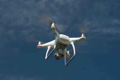
I. Anwardeen, Chief Project Director of TBGPCCR, stated that these newly acquired drones come with advanced features including a 48-megapixel wide-angle camera, a thermal sensor with zoom capabilities, and GPS integration, making them exceptionally effective for operations both during the day and at night.
A key goal of deploying these drones is to facilitate real-time tracking of elephants. By observing their movements, the drones can alert nearby communities when elephants approach human habitats, thereby minimizing the chances of human-wildlife conflicts.
The GPS features allow for precise and timely notifications, significantly improving response times for forest officials. Additionally, these drones will play a crucial role in combating forest fires. Their thermal sensors can pinpoint the source of fires, assess their spread, and evaluate the accessibility of affected areas for ground teams.
Aerial surveys conducted post-fire will yield vital information regarding damage to various tree species, wildlife, and small mammals, aiding in effective restoration and rehabilitation efforts.
Moreover, the drones can be equipped with various add-ons such as searchlights, loudspeakers, and laser range finders—tools that enhance their functionality in challenging terrains and emergency situations. These capabilities empower forest teams to execute a wide range of operations with improved efficiency and precision.
“These drones are revolutionizing our fieldwork. Tasks that used to take up to 20 days of manual labor can now be accomplished in merely a few hours,” Anwardeen remarked.
To maximize the effective utilization of this new technology, the department will train three personnel from each forest circle to operate the drones. This initiative is aimed at developing a proficient in-house team of drone pilots across the state.
Additionally, the department plans to acquire a different class of drones exclusively for mapping forest terrains, studying ecological diversity, modeling topography, and analyzing various forest types.
Point of View
I firmly believe that the introduction of drone technology by the Tamil Nadu Forest Department marks a pivotal moment in wildlife conservation. It showcases a proactive approach towards addressing human-wildlife conflict and forest fires, emphasizing the need for innovative solutions in ecological management.
NationPress
12/11/2025
Frequently Asked Questions
What are the primary uses of the newly introduced drones?
The drones will be primarily used for wildlife monitoring, forest fire management, and anti-poaching efforts.
How will the drones help in tracking elephants?
The drones will monitor the movements of elephants and provide alerts to nearby villages to prevent human-wildlife conflicts.
What advanced features do the drones possess?
The drones are equipped with a 48-megapixel camera, thermal sensors, and GPS integration for enhanced operational efficiency.
How will the drones contribute to fire management?
They can identify fire origins, assess spread, and provide aerial surveys to analyze the damage caused by fires.
Will there be training for operating these drones?
Yes, the department will train three staff members from each forest circle to ensure effective operation of the drones.