Is Unstable Weather Taking Over MP with Heatwaves, Thunderstorms, and Cyclonic Activities?

Synopsis
As the weather in Madhya Pradesh undergoes significant fluctuations this May, a mix of heatwaves and thunderstorms poses challenges to residents. Learn how this complex atmospheric system is affecting various districts and what to expect in the coming days as temperatures rise.
Key Takeaways
Unstable weather patterns are affecting Madhya Pradesh.
Isolated thunderstorms are forecasted in many districts.
Gusty winds of 40-50 km/h are expected.
Temperatures are predicted to rise significantly post-May 22.
Residents should remain vigilant and prepared for sudden weather changes.
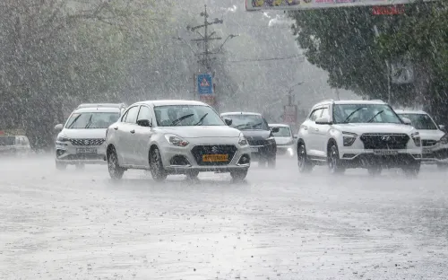
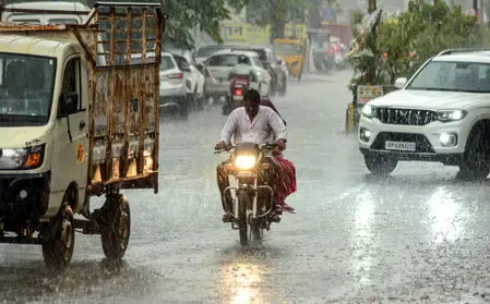
Bhopal, May 19 (NationPress) A complex atmospheric system is currently influencing the weather across northern and central India, resulting in an unusual combination of rainfall, thunderstorms, and heatwaves.
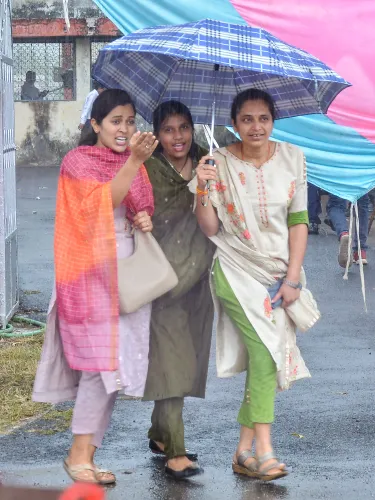
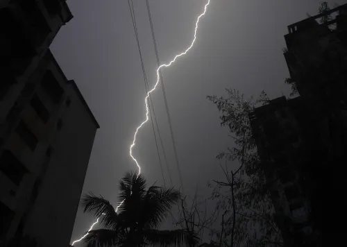
Isolated rainfall and thunderstorms accompanied by lightning are anticipated in Betul, Harda, Narmadapuram, Rajgarh, Burhanpur, Khandwa, Khargone, Barwani, Alirajpur, Jhabua, Dhar, Indore, Ratlam, Ujjain, Agar, Mandsaur, Neemuch, Guna, Ashoknagar, Shivpuri, Gwalior, Datia, Bhind, Morena, Sheopur, Anuppur, Dindori, Chhindwara, Seoni, Mandla, Balaghat, and Pandhurna districts.
Gusty winds reaching speeds of 40 to 50 km/h, along with lightning, are expected across western and northern Madhya Pradesh.
Additionally, slightly weaker winds of 30 to 40 km/h may accompany thunderstorms in Anuppur, Dindori, Chhindwara, Seoni, Mandla, Balaghat, and Pandhurna districts, according to the weather department.
This May, Madhya Pradesh is experiencing erratic weather patterns, with fluctuating temperatures and unexpected storms disrupting the usual heatwave.
Similarly, light to moderate rain is likely to occur across Chhattisgarh, accompanied by thunderstorms, lightning, and gusty winds of 30-60 km/h until May 23, as reported by the local weather department.
Historically, this month has brought extreme temperatures, often exceeding 40 to 45 degrees Celsius in various cities. However, the initial weeks of May have been characterized by strong storms, rainfall, and hailstorms.
The Meteorological Department forecasts that this trend will continue for the next four days before temperatures rise significantly.
The Western Disturbance, manifesting as a trough in the middle tropospheric westerlies, extends its axis at approximately 5.8 kilometers above sea level.
Additionally, an upper-air cyclonic circulation persists over southern Haryana and northeastern Rajasthan at around 1 km above mean sea level, influencing weather patterns in adjacent regions including Madhya Pradesh, according to the weather department.
A trough system extends from central Punjab to central Madhya Pradesh, maintaining instability in the region.
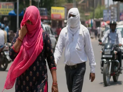
High temperatures are expected to intensify in Gwalior, Chhatarpur, Narsinghpur, Niwari, Maihar, Tikamgarh, Bhind, Datia, Khargone, Barwani, Khandwa, Morena, Rajgarh, Raisen, Shajapur, Sheopurkalan, Shivpuri, and Vidisha districts.
Meteorologists predict an intensifying heatwave post-May 22, with northern districts facing severe temperatures while central and southern regions may continue to experience storm activity.
Point of View
I emphasize the importance of understanding the evolving weather patterns in Madhya Pradesh. The erratic climate this season not only disrupts daily life but also poses potential risks to agriculture and public safety. Our commitment is to provide accurate information to help citizens navigate these challenges effectively.
NationPress
3 Jul 2026
Frequently Asked Questions
What is causing the unstable weather in Madhya Pradesh?
The unstable weather in Madhya Pradesh is primarily due to a complex atmospheric system, including a Western Disturbance and cyclonic circulations affecting the region.
What areas are expected to experience thunderstorms?
Thunderstorms are expected in several districts, including Betul, Harda, Narmadapuram, and Gwalior, among others.
How long will these weather conditions last?
The Meteorological Department forecasts that the erratic weather will continue for at least four more days before temperatures start rising significantly.
What temperatures can we expect in the coming days?
High temperatures are anticipated to intensify, particularly in districts like Gwalior, Chhatarpur, and Bhind, following the current weather disturbances.
Should residents be concerned about these weather changes?
Yes, residents should stay informed and take precautions, as the combination of heatwaves and thunderstorms can pose risks to safety and health.