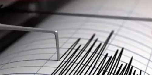


Four earthquakes hit Jammu & Kashmir in 12 hours, Doda-Kishtwar belt at epicentre
Synopsis
Four earthquakes rattled Jammu and Kashmir's Doda-Kishtwar belt in under 12 hours on 14 November — a stark reminder that the region sits atop one of the world's most seismically volatile zones. The strongest tremor reached magnitude 3.8. No casualties were reported, but experts warn the cluster underscores an urgent, unfinished agenda on earthquake-resistant construction.
Key Takeaways
Four earthquakes struck the Doda-Kishtwar belt in Jammu and Kashmir within 12 hours on 14 November 2026 .
The strongest tremor measured magnitude 3.8 at a depth of 5 km , recorded at 8.48 am .
No loss of life or property damage was reported, according to officials.
Jammu and Kashmir lies along the Indian-Eurasian tectonic plate boundary ; large parts fall under Seismic Zones IV and V , India's highest hazard categories.
The 2005 Muzaffarabad earthquake (magnitude 7.6 ) killed more than 80,000 people and remains the region's most recent catastrophic seismic event.
Experts are calling for stricter enforcement of earthquake-resistant building codes and improved public preparedness.
Four earthquakes struck Jammu and Kashmir within roughly 12 hours on Saturday, 14 November 2026, with all tremors originating from the Doda-Kishtwar belt, according to disaster management authorities. No casualties or property damage have been reported from anywhere in the region.
The Four Tremors: A Timeline
The sequence began at 2.38 am with a magnitude 3.3 quake at a depth of 15 km. A second tremor of magnitude 2.7 followed at 8.31 am, with its focus at 10 km below the surface. The third and strongest earthquake — magnitude 3.8 at a depth of 5 km — was recorded at 8.48 am. The fourth and final tremor struck at 1.09 pm in the Doda region, measuring magnitude 2.9 at 10 km depth. According to data released by disaster management authorities, all four epicentres fell within the Doda-Kishtwar corridor.
Why This Region Is Among the World's Most Seismically Active
Scientists attribute the persistent seismic activity to Jammu and Kashmir's position along the collision boundary of the Indian and Eurasian tectonic plates. The Indian plate continues to push northward at nearly five centimetres a year, and the pressure periodically releases as earthquakes. Major fault systems — including the Main Boundary Thrust and the Main Central Thrust — run beneath the region, with stress accumulating along each. Seismologists note that expanding urban settlements in the Kashmir Himalaya have amplified exposure to seismic risk.
Seismic Zoning: Kashmir's Hazard Classification
Large parts of Jammu and Kashmir and Ladakh fall under Seismic Zones IV and V on India's national hazard map — the country's two highest earthquake-risk categories. The Kashmir Valley, the Chenab Valley, and parts of Ladakh are classified in Zone V, the most hazardous tier. This classification has long underscored the urgency of quake-resistant construction and public preparedness across the belt.
The Shadow of 2005: A Region That Has Not Forgotten
The memory of the 8 October 2005 earthquake — magnitude 7.6, with its epicentre near Muzaffarabad in Pakistan-occupied Kashmir — still weighs heavily on residents. That catastrophic event killed more than 80,000 people across the affected region, flattened entire villages, and caused sweeping destruction in Uri, Tangdhar, and other border areas of north Kashmir. Thousands were left homeless.
What Experts Are Urging
Seismologists and disaster management experts stress that the recurring tremors are a reminder of the region's underlying vulnerability. They have called for stricter compliance with earthquake-resistant building codes, sustained public awareness campaigns, and enhanced early-warning infrastructure. This is not the first cluster of back-to-back tremors in the Doda-Kishtwar belt, and experts warn it is unlikely to be the last — making preparedness the only credible long-term mitigation strategy.
Point of View
But the cluster is a useful stress test for how prepared the region actually is — and the answer, two decades after the 2005 catastrophe, remains uncomfortable. Earthquake-resistant construction codes exist on paper, but enforcement in rural Jammu and Kashmir has been inconsistent. The Indian plate is not slowing down at five centimetres a year, which means the question is never if a major event occurs but when — and whether the built environment will be ready.
NationPress
14 Nov 2026
Frequently Asked Questions
How many earthquakes hit Jammu and Kashmir on 14 November 2026?
Four earthquakes struck Jammu and Kashmir on 14 November 2026, all within approximately 12 hours and all centred in the Doda-Kishtwar belt. The tremors ranged from magnitude 2.7 to magnitude 3.8, according to disaster management authorities.
Was there any damage or casualties in the Jammu and Kashmir earthquakes?
No loss of life or damage to property was reported from anywhere in Jammu and Kashmir following the four tremors. Officials confirmed the region was unaffected in terms of casualties.
Why does Jammu and Kashmir experience so many earthquakes?
Jammu and Kashmir sits along the collision boundary of the Indian and Eurasian tectonic plates, where the Indian plate pushes northward at nearly five centimetres a year. This ongoing movement builds pressure that is periodically released as earthquakes, compounded by major fault systems such as the Main Boundary Thrust and Main Central Thrust running beneath the region.
What is Seismic Zone V and does Jammu and Kashmir fall in it?
Seismic Zone V is India's highest earthquake hazard category on the national seismic zoning map. Large parts of Jammu and Kashmir — including the Kashmir Valley and the Chenab Valley — are classified in Zone V, making them among the most seismically vulnerable areas in the country.
What was the 2005 Kashmir earthquake and how deadly was it?
The 8 October 2005 earthquake, measuring magnitude 7.6 with its epicentre near Muzaffarabad in Pakistan-occupied Kashmir, killed more than 80,000 people across the affected region. It flattened entire villages in Uri, Tangdhar, and other areas of north Kashmir, and left thousands homeless, making it the most devastating seismic event in the region's recent history.