IIT Madras Unveils Groundbreaking Indoor Mapping Technology to Enhance Disaster Relief Efforts
Synopsis
Researchers at IIT Madras have developed UbiqMap, a cutting-edge real-time indoor mapping technology. This solution creates accurate maps under any conditions, significantly aiding disaster relief operations by enhancing first responders' efficiency.
Key Takeaways
UbiqMap creates real-time indoor maps.
It functions under any lighting or environmental conditions.
The system is portable and cost-effective.
Integrates with existing tools for enhanced mapping.
Potential future applications in smart cities and autonomous systems.
Chennai, April 7 (NationPress) Researchers at the Indian Institute of Technology (IIT) Madras have introduced a groundbreaking real-time indoor mapping solution capable of generating accurate maps under any lighting or environmental conditions, requiring minimal reliance on existing infrastructure.
The innovative technology, named UbiqMap, is crucial for first responders during disaster relief operations since conventional infrastructure often becomes inaccessible or unreliable in public safety emergencies.
Its cost-effective and portable design makes it available to a broader audience. The system can integrate with existing tools, such as cameras, offering a more comprehensive solution for indoor mapping and localization.
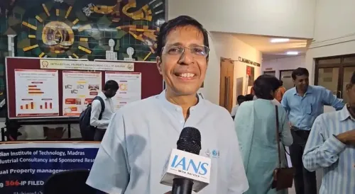
“Public safety incidents, especially search and rescue operations, are frequently obstructed by the absence of accurate indoor building plans. Even when maps are provided, they generally do not reflect the real-time dynamics necessary for effective mission planning during disasters,” explained Dr. Ayon Chakraborty, Assistant Professor at the Department of Computer Science and Engineering, IIT Madras.
“Our technology equips first responders with a robust and portable tool to image indoor environments without the need for visual line of sight or extensive computational resources. This makes it an essential asset in complex, time-sensitive situations,” he added.
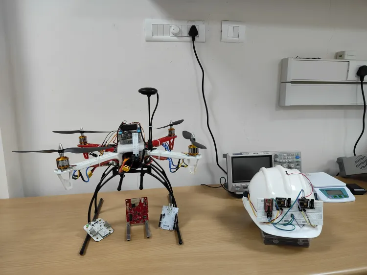
UbiqMap utilizes radio frequency-based imaging to construct detailed maps of indoor environments through a method known as Radio Tomographic Imaging (RTI).
Traditionally, RTI systems depend on a network of wireless transceivers set up at fixed, known locations. As these transceivers communicate, the wireless signal strength diminishes when obstructed by structures. This reduction in signal power is then analyzed to reconstruct the structural layout or floor plan of the area.
The technology introduces a dynamic and portable method by eliminating the need for pre-installed infrastructure.
Instead, it employs wearable transceivers that can be easily carried by rescue personnel. As team members navigate through the environment, these devices automatically ascertain their positions and continuously update the floor map, delivering an accurate and real-time layout of the area.
In the long run, UbiqMap has the potential to serve as a foundational technology for smart cities and autonomous systems, facilitating advanced mapping operations in intricate indoor environments, as stated in a paper published in the journal IEEE Transactions on Mobile Computing.
“Public safety incidents, particularly search and rescue operations, are often hindered by lack of accurate and up-to-date indoor building plans. Even when maps are available, they typically fail to capture real-time dynamics essential for effective mission planning during disasters. Our technology offers first responders a robust and portable tool to image indoor environments without dependence on visual line of sight or extensive computational resources, making it an invaluable asset in complex, time-critical scenarios,” Chakraborty reiterated.