How is the US-India satellite mission NISAR monitoring Earth?
Synopsis
The recent launch of the NISAR satellite symbolizes a transformative step in Earth observation, as it embarks on its mission to monitor our planet's land and ice surfaces. This collaboration between NASA and ISRO is set to enhance global environmental monitoring and disaster management efforts.
Key Takeaways
NISAR represents a significant collaboration between NASA and ISRO .
The satellite can provide continuous imagery regardless of weather.
It employs SweepSAR technology for enhanced imaging.
NISAR will aid in monitoring natural disasters.
It will track subtle changes in the Earth’s surface and crust.
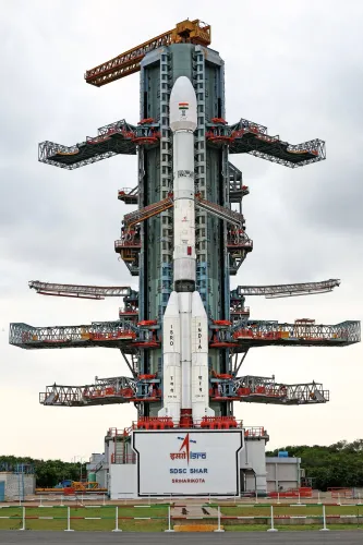
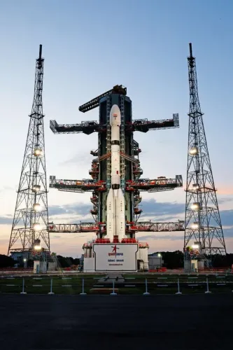
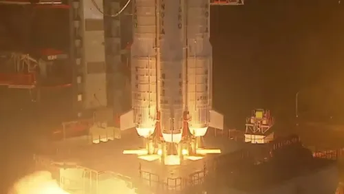
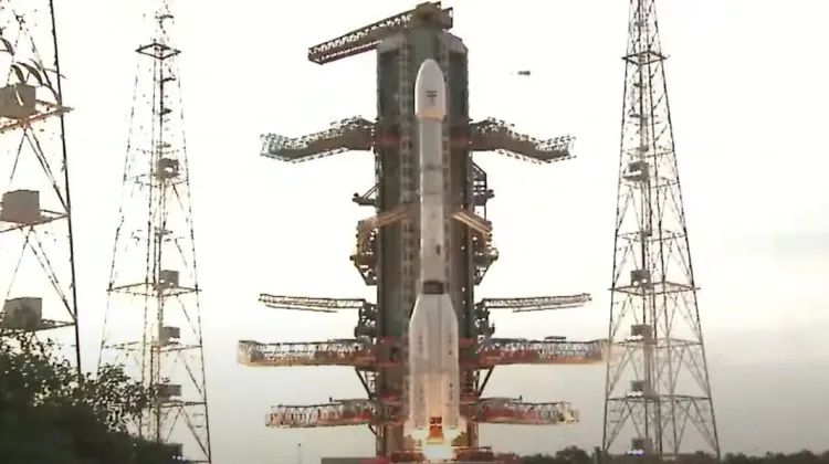
New Delhi, July 30 (NationPress) Celebrating a remarkable achievement in the India-US alliance, the NASA-ISRO Synthetic Aperture Radar (NISAR) satellite was successfully launched on Thursday.
The satellite ascended aboard India’s GSLV-F16 rocket from the Satish Dhawan Space Centre in Sriharikota, Andhra Pradesh, at 5:40 PM.
"We have liftoff! GSLV-F16 has successfully launched with NISAR onboard," ISRO announced via social media.
"#GSLV-F16 lifts off with the NASA–#ISRO NISAR Earth Observation Satellite," Union Minister of State for Science and Technology, Jitendra Singh noted on social media.
Approximately 19 minutes post-launch, the GSLV-F16 rocket will place the NISAR satellite into a 743-km sun-synchronous orbit. Notably, this is the Geosynchronous Satellite Launch Vehicle’s (GSLV) inaugural launch into a Sun-Synchronous Orbit (SSO).
NISAR represents the first collaborative Earth observation initiative between ISRO and NASA, merging the strengths and capabilities of both organizations.
"Go NISAR! The joint NASA-India satellite aboard @ISRO's Geosynchronous Launch Vehicle lifted off from the southeastern Indian coast at 8:10 AM ET (1210 UTC) to monitor the planet's changing land and ice surfaces," stated NASA.
With an investment of $1.5 billion, this mission is set to transform our approach to monitoring the Earth’s surface, especially in relation to natural disasters and environmental shifts.
The satellite will deliver 24/7 imagery under all weather conditions.
“It can capture images of the Earth continuously, regardless of weather or light, helping to detect landslides, facilitate disaster management, and monitor climate change,” said Dr. V Narayanan, ISRO Chairman.
This launch underscores the strengthening collaboration between India and the US in the field of space exploration. Following a bilateral summit between Prime Minister Narendra Modi and President Trump in Washington, DC, in February, both leaders declared 2025 as a landmark year for US-India civil space cooperation.
With a mass of 2,392 kilograms, the satellite will be positioned in a sun-synchronous orbit at an altitude of 740 km, where it will conduct scans of the Earth’s land and ice-covered surfaces every 12 days, utilizing high-resolution imagery over a swath of 242 kilometers through the innovative SweepSAR technology.
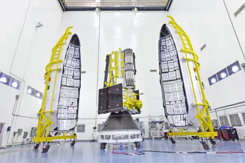
NISAR marks a groundbreaking moment as the first Earth observation mission employing dual-frequency Synthetic Aperture Radar. The satellite is equipped with two radars: the L-band and S-band.
NASA provided the L-Band Synthetic Aperture Radar (SAR) along with a high-rate telecommunication subsystem, GPS receivers, and a deployable 12-meter unfurlable antenna.
The S-Band SAR payload, the spacecraft bus for both payloads, the GSLV-F16 launch system, and all associated launch services were developed by ISRO.
The two radars will be operated with NASA’s 12-meter unfurlable mesh reflector antenna, mounted on the customized I-3K satellite bus from ISRO.
NISAR will enable ongoing monitoring of ecosystem disturbances and assist in evaluating natural hazards like earthquakes, tsunamis, volcanic eruptions, and landslides. It will track subtle shifts in the Earth’s crust and surface movement.
The satellite’s data will also facilitate sea ice classification, ship detection, shoreline monitoring, storm tracking, crop mapping, and analyzing soil moisture changes.
Point of View
I believe that the successful launch of NISAR is not only a remarkable technological achievement but also a testament to the strengthening ties between India and the United States in the field of space exploration. This mission promises to provide invaluable insights into environmental changes and natural disasters, ultimately benefiting humanity.
NationPress
20 Jun 2026
Frequently Asked Questions
What is the purpose of the NISAR satellite?
The NISAR satellite aims to monitor Earth's changing land and ice surfaces, providing data to track natural disasters and assess environmental changes.
Who are the collaborators behind the NISAR mission?
The NISAR mission is a joint project between NASA and ISRO, combining their expertise in Earth observation.
What technology does NISAR utilize?
NISAR employs dual-frequency Synthetic Aperture Radar (SAR) using L-band and S-band radars to capture high-resolution images.
When was NISAR launched?
NISAR was successfully launched on July 30 from the Satish Dhawan Space Centre in Andhra Pradesh, India.
What is the significance of NISAR?
NISAR is expected to transform global monitoring of the Earth, especially in relation to climate change and disaster management.