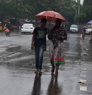
Bay of Bengal low-pressure area likely by Oct 23 as northeast monsoon intensifies over Tamil Nadu

Synopsis
A weather system brewing over the Gulf of Thailand and Myanmar could consolidate into a low-pressure area over the Southeast Bay of Bengal by 23 October — and possibly intensify further. With the northeast monsoon already delivering heavy rain across Tamil Nadu's coastal and delta districts, the emerging system adds real uncertainty to the rainfall outlook for one of India's most flood-prone seasons.
Key Takeaways
A low-pressure area is likely to form over the Southeast Bay of Bengal around 23 October 2026 .
An upper-air circulation over the Gulf of Thailand and Myanmar is expected to reach the north Andaman Sea by Wednesday.
The system may intensify into a depression ; possibility of a cyclonic storm has not been ruled out but remains unconfirmed.
The northeast monsoon has brought widespread rain to Tamil Nadu's coastal belts, Cauvery delta , and Western Ghats districts.
Very heavy rainfall was warned for seven districts on Tuesday; Chennai recorded continuous rain on 17 October .
Further IMD bulletins will clarify the system's track, intensity, and impact on Tamil Nadu rainfall.
A low-pressure area is likely to form over the Southeast Bay of Bengal and adjoining central parts of the sea around 23 October, the India Meteorological Department (IMD) said on 20 October, even as the northeast monsoon strengthens its grip across Tamil Nadu. The forecast adds a fresh layer of concern to an already active weather pattern that has been delivering widespread rain across coastal and delta districts.
How the System Is Developing
An upper-air circulation currently positioned over the Gulf of Thailand and Myanmar is expected to push into the north Andaman Sea by Wednesday morning. This shift is anticipated to set the stage for the low-pressure area to consolidate over the Southeast Bay of Bengal by 23 October. The developing system is subsequently likely to track westwards and northwestwards, according to the department.
Meteorologists have indicated the system could intensify into a depression, though its eventual strength remains uncertain at this stage. Whether it could further develop into a cyclonic storm will be assessed in subsequent bulletins — the present outlook points to the possibility of further intensification without confirming cyclone formation.
Northeast Monsoon Brings Widespread Rain
The strengthening northeast monsoon has already brought substantial rainfall to several parts of Tamil Nadu. Coastal belts, Cauvery delta districts, and areas adjoining the Western Ghats have all recorded showers in recent days. Chennai saw continuous rain on 17 October, reflecting the increasingly active weather conditions across the state.
The weather department issued a warning of very heavy rainfall in seven districts on Tuesday, though the specific districts were not identified in the information made available. This comes against a backdrop of sustained monsoon activity that has kept large parts of Tamil Nadu on alert.
What Remains Uncertain
The system's precise track, intensity, and likely influence on rainfall over Tamil Nadu have yet to be established. Further movement from the vicinity of the north Andaman Sea towards the central Bay of Bengal — and its potential strengthening after 23 October — will be monitored closely. Subsequent IMD bulletins are expected to provide a clearer picture of the rainfall outlook for the region.
What Residents and Authorities Should Watch
This is a period of typically elevated weather activity for Tamil Nadu, which receives the bulk of its annual rainfall during the October–December northeast monsoon season. The simultaneous presence of an active monsoon and a developing Bay of Bengal system historically increases the risk of flooding, particularly in Chennai and delta districts. Officials and residents are advised to monitor updates closely as the system evolves over the next 48–72 hours.
Point of View
Not reassurance. Historically, such systems that form in the central Bay during October have tracked toward the Tamil Nadu-Andhra coast, and Chennai's notorious flood vulnerability means that even a depression-level system can cause outsized damage. The seven-district heavy rainfall warning without named districts is an information gap that state authorities and the public need addressed urgently.
NationPress
20 Oct 2026
Frequently Asked Questions
When is the low-pressure area expected to form over the Bay of Bengal?
The low-pressure area is likely to form over the Southeast Bay of Bengal and adjoining central parts of the sea around 23 October 2026. An upper-air circulation currently over the Gulf of Thailand and Myanmar is expected to first influence the north Andaman Sea before the system consolidates.
Could the Bay of Bengal system develop into a cyclone?
The IMD has not confirmed cyclone formation but has not ruled it out either. The current outlook indicates the possibility of further intensification beyond a depression, with specific assessments to be issued in subsequent bulletins as the system evolves.
How is the northeast monsoon affecting Tamil Nadu right now?
The northeast monsoon is currently active across Tamil Nadu, bringing widespread rainfall to coastal belts, the Cauvery delta, and districts adjoining the Western Ghats. Chennai recorded continuous rain on 17 October, and very heavy rainfall has been warned for seven districts.
Which districts in Tamil Nadu are under a heavy rainfall warning?
The IMD issued a very heavy rainfall warning for seven districts on Tuesday, but the specific district names were not identified in the information available at the time of reporting. Further bulletins are expected to provide district-level details.
What is the expected track of the developing weather system?
After forming over the Southeast Bay of Bengal around 23 October, the system is likely to move westwards and northwestwards. Its precise track and intensity will become clearer through subsequent IMD observations and forecasts over the coming days.