Is a Low Pressure Area Forming Over the Bay of Bengal?
Synopsis
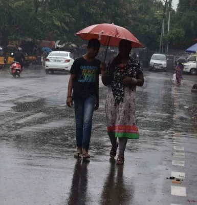
A low-pressure area is expected to form over the Bay of Bengal, potentially bringing heavy rainfall to Tamil Nadu and Puducherry. This weather change may provide relief to drought-prone areas while raising concerns about flooding and waterlogging. Stay updated and prepared as local authorities brace for possible disruptions.
Key Takeaways
Low-pressure area predicted over the Bay of Bengal.
Heavy rainfall expected in Tamil Nadu and Puducherry .
Local authorities advised to prepare for disruptions.
Strong winds may reach speeds of 50 km/h .
Residents urged to stay alert and follow safety guidelines.
Chennai, Aug 17 (NationPress) The Regional Meteorological Centre in Chennai has forecasted that a low-pressure system is expected to develop over the northwestern Bay of Bengal and the adjacent west-central Bay of Bengal by August 18. This occurrence is anticipated to significantly impact weather patterns across Tamil Nadu, Puducherry, and Karaikal in the upcoming days.
As per the weather bureau, numerous regions in both northern and southern Tamil Nadu, including Puducherry and Karaikal, are likely to face light to moderate rainfall, accompanied by thunderstorms this Sunday.
"A few locations may experience strong surface winds reaching speeds of 40 to 50 km per hour," the announcement indicated.
The department has also issued warnings for heavy rainfall in certain hilly regions.
"In the Nilgiris district and mountainous parts of Coimbatore, one or two areas may receive substantial rainfall," officials remarked.
In addition, rough weather has been forecasted for the Arabian Sea.
Strong squally winds, with speeds of 45 to 55 kmph, are likely to impact the west-central and adjacent southwest Arabian Sea, the Konkan-Goa coast, and areas near the east-central and northeast Arabian Sea.
Similar turbulent conditions are predicted along the coasts of Karnataka and Kerala, as well as in the adjoining central and southeast Arabian Sea, and around the Lakshadweep islands. Here, wind speeds may reach 40 to 50 kmph, occasionally gusting up to 65 kmph. Fishermen in these areas have been advised against venturing into the sea during this time due to the risk of turbulent conditions and squalls.
Meteorologists emphasized that monsoon activity is likely to intensify further once the low-pressure system forms over the Bay of Bengal. This could lead to widespread rainfall across many districts of Tamil Nadu later this week, offering much-needed relief to drought-stricken areas while simultaneously raising concerns about waterlogging and flooding in susceptible regions.
Authorities have urged residents in hilly and coastal areas to stay vigilant and adhere to safety guidelines.
Local administrations have been instructed to prepare for potential disruptions due to heavy rain, strong winds, and rising water levels in rivers and reservoirs. The weather department will closely monitor the formation of the low-pressure system and provide updated alerts and warnings to ensure timely preparedness across the state.
Point of View
It's crucial to remain focused on providing accurate and timely information to our audience. The imminent low-pressure area over the Bay of Bengal presents both challenges and opportunities for Tamil Nadu and Puducherry. Our commitment is to keep the public informed and prepared as we navigate these weather developments together.
NationPress
20 Jun 2026
Frequently Asked Questions
What areas are expected to be affected by the low-pressure system?
The low-pressure system is expected to impact regions in Tamil Nadu, Puducherry, and Karaikal.
What kind of weather changes can we anticipate?
Residents can expect light to moderate rainfall, thunderstorms, and strong winds in the affected areas.
Are there warnings issued for fishermen?
Yes, fishermen are advised not to venture into the sea due to rough conditions and squalls expected in the Arabian Sea.