Delhi-NCR rain, dust storm slash mercury to 38°C from 44.5°C
Synopsis
Delhi-NCR's brutal heatwave hit a sudden pause on 29 April as western disturbances unleashed dust storms and rain, slashing expected highs from 41°C to 38°C — but the relief comes with a caveat: the city's AQI still sits at a 'poor' 260, meaning the air remains far from clean even as the heat eases.
Key Takeaways
Delhi-NCR experienced intense dust storms followed by rainfall on 29 April , triggered by western disturbances.
Maximum temperature expected to drop to approximately 38°C , down from an earlier forecast of 41°C and a weekly high of 44.5°C .
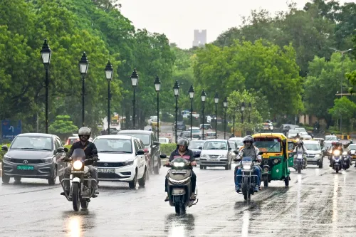
The Regional Weather Forecast Centre (RWFC) predicted light to moderate rain with gusty winds of 30–40 kmph across Delhi-NCR.
Similar weather conditions forecast for parts of Haryana , Uttar Pradesh , and Rajasthan .
Air Quality Index (AQI) in Delhi stood at 260 — in the 'poor' category — despite rainfall, according to the Central Pollution Control Board (CPCB) .
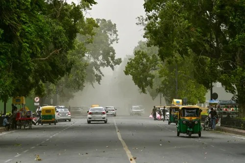
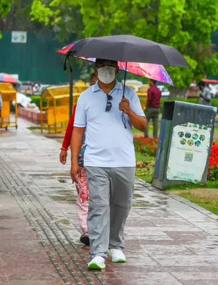
Delhi-NCR woke up to a dramatic weather reversal on Wednesday, 29 April, as intense dust storms gave way to spells of rain, delivering much-needed relief from a punishing heatwave that had pushed temperatures to 44.5 degrees Celsius earlier this week. The sudden atmospheric shift, triggered by western disturbances, pulled the expected maximum temperature down from 41°C to approximately 38°C within hours.
What Triggered the Sudden Change
Meteorological officials attributed the rapid weather shift to western disturbances interacting with elevated surface temperatures — a pattern common during the pre-monsoon period across northern India. Dark clouds blanketed large parts of the region in the early morning hours, bringing thunderstorms, lightning, and gusty winds. The entire atmospheric turnaround reportedly occurred within an hour of the storm activity beginning.
Notably, Delhi was already under a
Point of View
But Delhi's AQI at 260 — firmly 'poor' — is a reminder that a dust storm followed by rain is not an air quality solution. Dust-laden winds typically spike particulate matter before rainfall briefly suppresses it; the net effect on public health is marginal. More structurally, the frequency of such extreme pre-monsoon heat spikes — 44.5°C in late April — fits a pattern of intensifying urban heat in the Indo-Gangetic Plain that episodic western disturbances cannot address. The yellow alert-to-rain cycle will repeat; the underlying trajectory will not reverse without systemic intervention.
NationPress
2 Aug 2026
Frequently Asked Questions
Why did Delhi-NCR experience rain and dust storms on 29 April?
The rain and dust storms were triggered by western disturbances interacting with high surface temperatures, a common pre-monsoon weather pattern across northern India. The atmospheric shift brought thunderstorms, lightning, and gusty winds of 30–40 kmph to Delhi-NCR.
How much did temperatures drop after the rain in Delhi?
The expected maximum temperature fell from around 41°C to approximately 38°C following the rainfall activity on 29 April. Earlier this week, temperatures in Delhi-NCR had peaked at 44.5°C.
Which other regions were affected by the storm system?
The Regional Weather Forecast Centre (RWFC) forecast similar weather for parts of Haryana — including Sonipat, Rohtak, and Hisar — as well as Meerut, Hapur, and Bulandshahr in Uttar Pradesh, and Alwar and Kotputli in Rajasthan.
What is Delhi's air quality after the rain?
Despite the rainfall, Delhi's Air Quality Index (AQI) remained at 260, categorised as 'poor' by the Central Pollution Control Board (CPCB), indicating persistent pollution levels in the national capital.
Was Delhi under any weather alert before the rain?
Yes, Delhi was under a 'yellow alert' for heatwaves before the western disturbance brought rain and dust storms on the morning of 29 April.