Meteorological Department Anticipates Intense Rainfall in Select Regions of Tamil Nadu

Synopsis
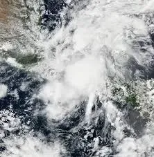
The Regional Meteorological Centre (RMC) has issued a forecast for heavy rainfall in isolated areas of Tamil Nadu this weekend, attributed to a cyclonic circulation over the southeast Bay of Bengal, along with a yellow alert for several districts.
Key Takeaways
Heavy rainfall expected in Tamil Nadu.
Yellow alert issued for multiple districts.
Thunderstorms and gusty winds anticipated.
Significant rainfall recorded in recent days.
Government assistance for disaster recovery approved.
Chennai, April 6 (NationPress) The Regional Meteorological Centre (RMC) has predicted significant rainfall in isolated regions of Tamil Nadu on Sunday and Monday, linking these weather patterns to a cyclonic circulation situated over the southeast Bay of Bengal.
A yellow alert has been issued for the Ghat regions of Coimbatore, along with the districts of Nilgiris, Theni, Dindigul, and Tenkasi.
Thunderstorms, lightning, and gusty winds are anticipated across several areas of the state on Sunday.
The RMC reports that the prevailing weather situation is a result of a cyclonic circulation reaching up to 3.1 km above mean sea level, accompanied by a trough extending from Central Maharashtra to North Tamil Nadu across Interior Karnataka.
A low-pressure trough over the southeast Bay of Bengal and nearby regions is also facilitating the rainfall. Southern Tamil Nadu experienced widespread precipitation on April 5.
Tiruppur North recorded 11 cm of rainfall, while Kozhiporvilai in Kanyakumari noted 19 cm.
In Chennai, residents can look forward to partly cloudy skies and sporadic light rain on Sunday.
The forecast indicates a maximum temperature between 33 and 34 degrees Celsius, while the minimum is expected to remain around 27-28 degrees Celsius.
The RMC has indicated that the previous cyclonic circulation over Tamil Nadu has diminished. No significant alterations in maximum temperatures are anticipated over the next two days. However, a gradual increase of 2-3 degrees Celsius is possible in isolated areas between April 7 and 9 across Tamil Nadu, Puducherry, and Karaikal.
During this timeframe, daytime temperatures may exceed the seasonal average, particularly in interior regions. Tamil Nadu has recorded 14 degrees Celsius more rainfall than the seasonal average during the ongoing northeast monsoon.
The state has received 447 mm of rainfall, surpassing the seasonal norm of 393 mm. Chennai alone received 845 mm — 16 percent above average — while Coimbatore reported a 47 percent increase in rainfall compared to the norm.
These occurrences follow the effects of Cyclone Fengal, which impacted Tamil Nadu and Puducherry between November 29 and December 1. The cyclone brought heavy rains and was succeeded by additional showers from a low-pressure system over the southern Bay of Bengal. This disaster resulted in 12 fatalities and inflicted considerable damage, inundating 2,11,139 hectares of agricultural and horticultural land and affecting 1.5 crore individuals.
To aid in recovery from the recent natural disasters, the Government of India has sanctioned an additional assistance of Rs 522.34 crore for Tamil Nadu. The Union Territory of Puducherry has also been allocated Rs 33.06 crore as part of the relief efforts.