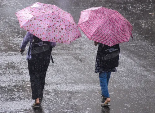
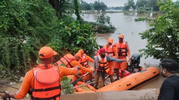
Surat floods: 4,000+ evacuated as heavy rain triggers Red Alert, SDRF deployed
Synopsis
Surat district is in the grip of a serious flood emergency — over 4,000 residents evacuated, SDRF teams rushed in, and a Red Alert still active. With Ambika taluka recording a staggering 565 mm of rain in just 24 hours and the Kim River still rising, the next 48 hours will be critical for tens of thousands living along Gujarat's flood-prone riverbanks.
Key Takeaways
More than 4,000 people evacuated from flood-prone villages in Surat district as of 1 August .
IMD has issued a Red Alert ; SDRF teams deployed in Olpad and Mandvi talukas.
Ambika taluka recorded the highest rainfall at 565 mm ( 22.5 inches ) in a single 24-hour period.
The Kim River has overflowed, causing waterlogging in Olpad and Mangrol talukas.
Ukai Dam stands at 320 feet against a rule level of 333 feet — within safe limits for now.
District Collector Tejas Parmar has urged riverside residents to relocate immediately and avoid outdoor movement.
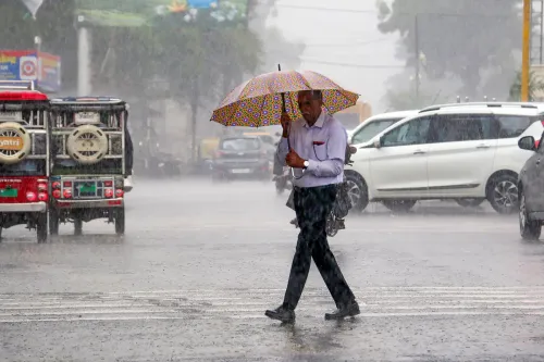
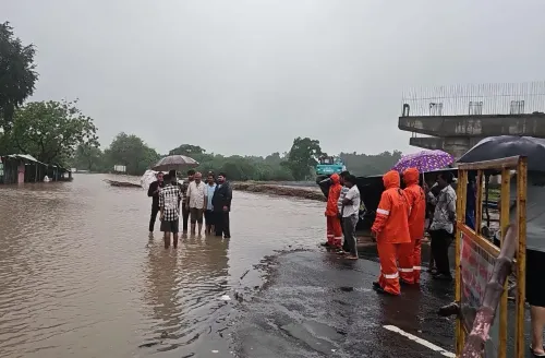
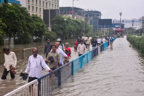
More than 4,000 people have been evacuated from flood-prone villages across Surat district in Gujarat as relentless rainfall and swelling river levels forced authorities to escalate rescue and relief operations on 1 August. The India Meteorological Department (IMD) has issued a Red Alert for the region, with State Disaster Response Force (SDRF) teams deployed in Olpad and Mandvi talukas.
Scale of Rainfall and Evacuation
Surat district recorded an average of 222 mm (approximately 8 inches) of rainfall in the 24-hour period between 6 am on Friday and 6 am on Saturday. Ambika taluka bore the heaviest brunt, logging 565 mm — roughly 22.5 inches — the highest in the district. The remaining talukas recorded between 5 and 12 inches, while Surat city itself received around 5 to 6 inches during the same window.
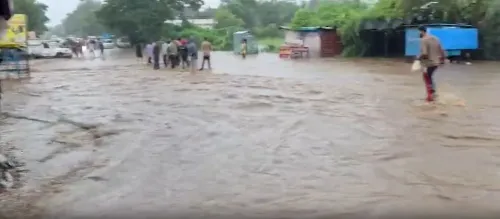
Residents from villages along the Ambika River and other low-lying rural areas have been shifted to safer locations. The overflowing Kim River caused widespread waterlogging in low-lying villages of Olpad and Mangrol talukas, with evacuation efforts that began on Friday continuing into Saturday.
What the Administration Said
District Collector Tejas Parmar confirmed that the administration was operating in full alert mode following continuous heavy rainfall since Saturday morning. 'All necessary precautionary measures have been taken for the safety of citizens. More than 4,000 people from villages along the Ambika River and other affected rural areas have been safely evacuated,' Parmar said.
Parmar also warned residents along the Kim River banks to relocate without delay. 'There is every possibility that the Kim River's water level will continue to increase. Residents living along the river should move to safe locations in time,' he said. He added that all concerned agencies — including the Sub-Divisional Magistrate (SDM), Taluka Development Officer (TDO), SDRF, and police teams — were deployed in the field and monitoring the situation closely.
SDRF Deployment and River Levels
One SDRF team had already been stationed at Mandvi, while an additional team was dispatched to Olpad on Saturday morning to bolster rescue capacity. Despite rising water levels at some locations on Friday, the administration confirmed that major creeks in Surat city remained below the danger mark.
The Singanpor Causeway on the Tapi River has overflowed. The Ukai Dam, which has a rule level of 333 feet, stood at 320 feet — within the prescribed safe limit as of Saturday.
Ongoing Risk and Official Advisory
Although rainfall briefly eased during the morning, heavy showers resumed across all talukas from around 10 am, prompting authorities to maintain heightened preparedness. The Collector noted that the possibility of heavy to extremely heavy rainfall at isolated places remained. Residents have been urged to stay indoors, follow official advisories, and avoid unnecessary movement until conditions improve.
This comes amid a broader pattern of intense monsoon activity across Gujarat in early August, with multiple districts on alert. The situation in Surat will depend heavily on inflows into the Ukai Dam and the trajectory of the Kim and Ambika rivers over the next 48 hours.
Point of View
But the 565 mm rainfall in Ambika taluka in a single day underscores how rapidly localised cloudbursts can overwhelm river systems. The Ukai Dam remains within safe limits for now, but any significant upstream inflow could change that calculus fast. What this event also highlights is the recurring vulnerability of low-lying villages along the Kim and Ambika rivers — communities that face the same risk each monsoon season with limited permanent flood-mitigation infrastructure in place.
NationPress
16 Sept 2026
Frequently Asked Questions
How many people have been evacuated in Surat due to flooding?
More than 4,000 people have been evacuated from flood-prone villages across Surat district as of 1 August, following heavy rainfall and rising river levels. Residents from areas along the Ambika River and waterlogged villages in Olpad and Mangrol talukas have been moved to safer locations.
Why has a Red Alert been issued for Surat?
The India Meteorological Department issued a Red Alert for Surat district due to extremely heavy rainfall, with Ambika taluka recording 565 mm in a single 24-hour period. The alert signals a high probability of continued heavy to extremely heavy rain at isolated locations, posing serious flood risk.
Where are SDRF teams deployed in Surat?
State Disaster Response Force teams have been deployed in Olpad and Mandvi talukas of Surat district. One team was already stationed at Mandvi, and an additional team was dispatched to Olpad on Saturday morning to strengthen rescue operations.
Is the Ukai Dam at risk of overflowing?
As of Saturday, the Ukai Dam stood at 320 feet against a rule level of 333 feet, remaining within the prescribed safe limit. However, authorities are monitoring the situation closely given ongoing heavy rainfall and potential upstream inflows.
Which rivers are causing flooding in Surat district?
The Kim River and Ambika River are the primary sources of flooding. The Kim River has overflowed into low-lying villages of Olpad and Mangrol talukas, while villages along the Ambika River were among the first to be evacuated. The Singanpor Causeway on the Tapi River has also overflowed.