Aftermath of Cyclone Alfred: Flooding Persists in Queensland and New South Wales, Australia
Synopsis
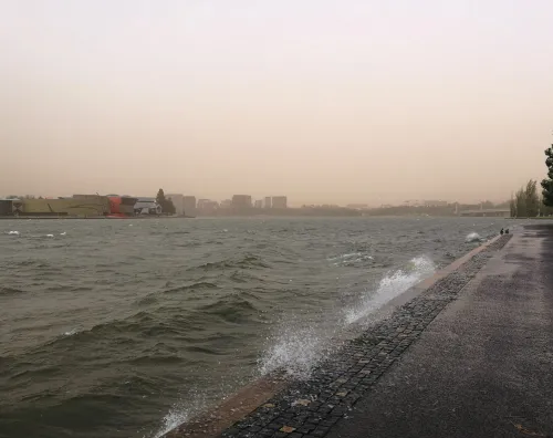
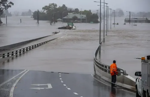
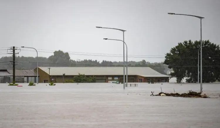
On March 10, Ex-Tropical Cyclone Alfred continued to wreak havoc in Queensland and New South Wales, Australia, causing flooding and heavy rains. Meteorologists anticipate a gradual improvement in conditions starting today.
Key Takeaways
Ex-Tropical Cyclone Alfred impacts Queensland and NSW.
Flooding and power outages affect thousands.
Emergency warnings remain in place for many homes.
Prime Minister announces income support for affected workers.
Heavy rainfall persists but is expected to ease.
Sydney, March 10 (NationPress) The remnants of Ex-Tropical Cyclone Alfred continued to affect the Australian states of Queensland and New South Wales (NSW) on Monday, leading to significant flooding and heavy rainfall. However, meteorological authorities predict that conditions will steadily improve starting today.
Efforts to restore electricity in impacted regions proceeded on Monday, with the latest reports indicating that approximately 160,000 homes and businesses remained without power in southeast Queensland and northern NSW, a decrease from the peak of over 300,000 outages recorded on Sunday.
The Bureau of Meteorology (BoM) announced on Monday afternoon that the intense rainfall in NSW has diminished, and severe weather alerts for several areas have been lifted. Nonetheless, there remains a localized threat of severe thunderstorms that could generate heavy rainfall in northern NSW later in the day. Updates will be provided as needed.
The NSW State Emergency Service (SES) reported that about 3,400 homes, affecting nearly 7,900 individuals, are still under emergency warnings in northern NSW, with over 3,200 SES members actively engaged in response efforts.
Rain and thunderstorms overnight on Sunday led to widespread rainfall totals of 200-400 mm across Brisbane, the Gold Coast, and the Scenic Rim, as reported by the Australian Broadcasting Corporation (ABC). Brisbane recorded 275.2 mm of rain within 24 hours up to 9 am local time on Monday, marking the city's wettest day since 1974.
The BoM advised that heavy rainfall, which poses a risk of flash flooding, remains in effect for parts of southeast Queensland, including Brisbane, Ipswich, and the Sunshine Coast. Rainfall totals between 60 and 100 mm are anticipated throughout Monday, with a potential 24-hour total reaching up to 150 mm, although conditions are expected to improve by late afternoon and evening.
More than 800 schools across the cyclone-affected regions of NSW and Queensland remained closed on Monday, but NSW education officials expect that most will reopen on Tuesday.
Prime Minister Anthony Albanese announced during a press conference on Monday that eligible workers and sole traders in 31 local government areas in southeast Queensland and NSW who have experienced income loss due to Ex-Tropical Cyclone Alfred will qualify for support payments. They can apply online for up to 13 weeks of income support starting Tuesday.
As of Monday afternoon, many regions in southeast Queensland and northern NSW are still under alerts for severe thunderstorms, adverse weather, and significant flooding.
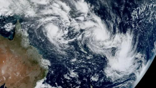
Ex-Tropical Cyclone Alfred made landfall on Australia's east coast Saturday evening and has since weakened into a trough. The system continues to deliver heavy and locally intense rainfall, which is expected to diminish today, according to the BoM.