Did INS Sutlej Complete a Hydrographic Survey at Mauritius?
Synopsis
On October 26, INS Sutlej marked a milestone by concluding a significant hydrographic survey in collaboration with the Mauritius Hydrographic Service. Covering a vast area, this mission not only aims to bolster regional maritime security but also enhances the mutual relationship between India and Mauritius. Discover the impact of this endeavor on marine charting and environmental planning!
Key Takeaways
INS Sutlej completed a joint hydrographic survey with Mauritius.
The survey covered an area of 35,000 square nautical miles .
It supports Mauritius’s Blue Economy objectives.
Joint training was provided to Mauritian personnel.
The mission reinforces regional maritime security.
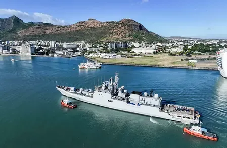
New Delhi, Oct 26 (NationPress) INS Sutlej has triumphantly completed a collaborative hydrographic survey alongside the Mauritius Hydrographic Service, encompassing a vast area of approximately 35,000 square nautical miles, as confirmed by an official from the Indian Navy on Sunday.
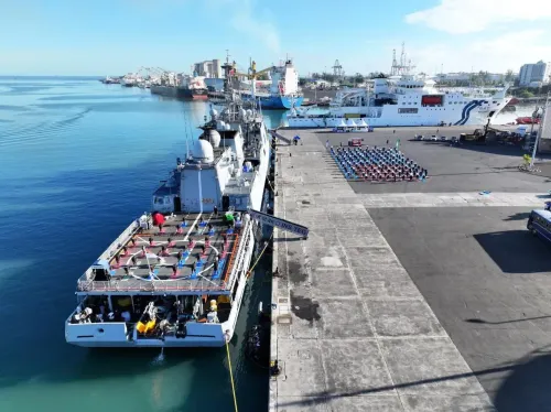
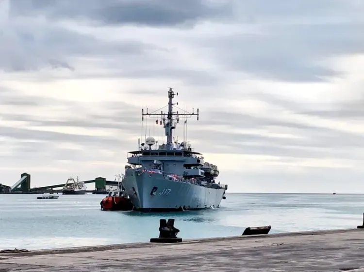
INS Sutlej, a dedicated hydrographic survey vessel of the Indian Navy, docked at Port Louis to initiate the 18th Joint Hydrographic Survey in Mauritius on September 29, 2025.
This survey was executed in close cooperation with national agencies under the existing Memorandum of Understanding (MoU) between India and Mauritius.
Officials indicate that this initiative will greatly enhance marine charting, coastal governance, resource management, and long-term environmental planning, thereby facilitating Mauritius’s Blue Economy ambitions.
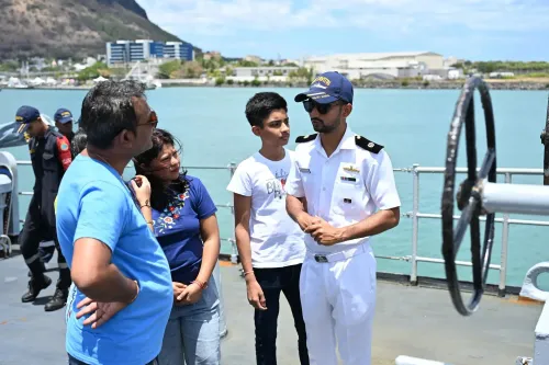
“In line with the mission’s capacity-building objectives, six personnel from various Mauritian ministries participated onboard INS Sutlej for practical training in contemporary hydrographic methodologies,” an official further elaborated.
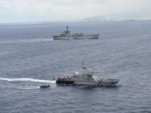
Additionally, INS Sutlej conducted joint Exclusive Economic Zone (EEZ) surveillance and anti-piracy patrols in collaboration with the Mauritius National Coast Guard, fortifying regional maritime security.
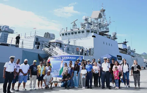
During a ceremony held onboard, the completed survey's fairsheet was officially presented to Mauritian authorities, attended by Shakeel Ahmed Yousuf Abdul Razack Mohamed, Minister of Housing and Lands, and Anurag Srivastava, High Commissioner of India to Mauritius.
This operation signifies the 18th joint hydrographic mission between India and Mauritius — exemplifying the enduring maritime partnership and shared dedication to safe navigation, sustainable ocean management, and regional collaboration.
The successful conclusion of this mission reaffirms the deep-rooted bonds of friendship between the two nations, in line with the vision of MAHASAGAR – Mutual and Holistic Advancement for Security and Growth Across Region.
A hydrographic survey is a specialized scientific endeavor where survey vessels and technical teams systematically chart and evaluate the physical characteristics of marine and coastal environments.
The primary aim is to produce accurate data on the underwater landscape to facilitate safe navigation and broader maritime operations.
Point of View
I emphasize the importance of fostering international maritime partnerships. The successful collaboration between India and Mauritius through the hydrographic survey epitomizes our commitment to enhancing regional security and promoting sustainable ocean management. Such endeavors not only strengthen diplomatic ties but also ensure safe navigation for all maritime stakeholders. Nation always stands by initiatives that foster cooperation and shared growth.
NationPress
6 Jul 2026
Frequently Asked Questions
What is the significance of the hydrographic survey?
The hydrographic survey enhances marine charting, supports coastal management, and contributes to sustainable resource utilization, aligning with Mauritius's Blue Economy goals.
How does this survey impact maritime security?
The survey strengthens maritime security through joint surveillance and anti-piracy efforts, fostering regional stability and cooperation.
Who participated in the training during the mission?
Six personnel from various Mauritian ministries received hands-on training in hydrographic techniques onboard INS Sutlej.
What does the MoU between India and Mauritius entail?
The MoU facilitates cooperation in hydrographic surveys, enhancing maritime safety and resource management between the two nations.
How many joint missions have been conducted between India and Mauritius?
This mission marks the 18th joint hydrographic survey, showcasing the long-standing partnership between India and Mauritius.