China's Tibet hydropower mega-project raises safety fears in earthquake zone
Synopsis
China is building a $170 billion, five-station hydropower cascade on the Yarlung Tsangpo — one of the most seismically active corridors on Earth. A magnitude 7.0 earthquake that killed 16 in Tibet on 22 October 2026, followed by a glacial collapse in August, has put the project's safety assumptions under a microscope. The river becomes the Brahmaputra the moment it crosses into India, making this an upstream engineering gamble with consequences stretching to Bangladesh.
Key Takeaways
A magnitude 7.0 earthquake struck Baqing County, Nagqu, Tibet on 22 October 2026 , killing at least 16 people and destroying hundreds of homes.
China's Yarlung Tsangpo hydropower complex — launched July 2025 — involves five cascading stations at an estimated cost of 1.2 trillion yuan ($170 billion) .
Since 1900 , the Tibetan Plateau and surrounds have experienced 29 earthquakes of magnitude 7.0 or greater .
A separate glacial collapse near the Nepal-Tibet border on 26 August 2026 triggered a destructive water, mud, and boulder surge.
Research in Palaeogeography, Palaeoclimatology, Palaeoecology (2026) documented six prehistoric megafloods in the Yarlung Tsangpo Gorge from historic natural dam failures.
The Yarlung Tsangpo becomes the Brahmaputra on entering India and eventually flows into Bangladesh , linking upstream dam safety to millions downstream.
China's ₹1.2 trillion yuan (approximately $170 billion) hydropower complex on the Yarlung Tsangpo River in southeastern Tibet faces mounting safety scrutiny, according to a report in The National Interest, as a succession of natural disasters highlights the extreme geological hazards of the Himalayan region — and the downstream risks they pose to millions of people in India and Bangladesh.
The October Earthquake That Renewed the Alarm
On 22 October 2026, a magnitude 7.0 earthquake struck Baqing County in Nagqu, Tibet, killing at least 16 people, injuring dozens, and destroying hundreds of homes. According to the US Geological Survey (USGS), the earthquake resulted from movement along a normal fault within the Tibetan Plateau, where the ongoing collision of the Indian and Eurasian tectonic plates generates enormous geological stress, continuing to push the plateau upward while stretching it eastward and westward.
The report stresses that this was no isolated event. Since 1900, the Tibetan Plateau and surrounding areas have recorded 29 earthquakes of magnitude 7.0 or greater. The catastrophic 1950 Assam-Tibet earthquake reached magnitude 8.6 and killed 4,800 people, while the 2010 Yushu earthquake in neighbouring Qinghai claimed more than 2,500 lives. The Himalayas and Tibetan Plateau, according to the report, remain among the world's most geologically unstable regions.
A Second Disaster, a Compounding Pattern
The October earthquake came less than two months after a separate catastrophe in the same mountain system. On 26 August 2026, a massive collapse of glacier ice and rock near the Nepal-Tibet border triggered a destructive surge of water, mud, and boulders. The two events — one seismic, one glaciogenic — are described in the report as illustrating 'different aspects of the same underlying vulnerability.'
Notably, neither disaster occurred at the hydropower project site itself. Yet experts cited in the report argue that both underscore the range of geological and environmental hazards that major infrastructure throughout the Himalayas must be engineered to withstand.
The Scale of China's Yarlung Tsangpo Project
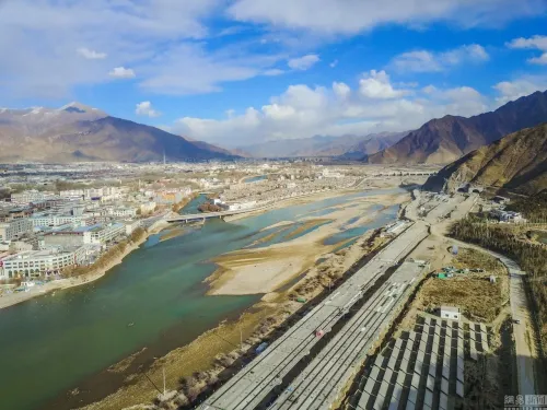
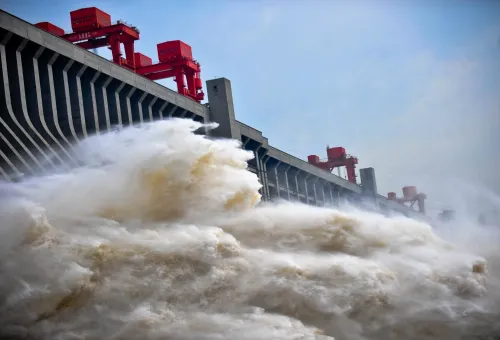
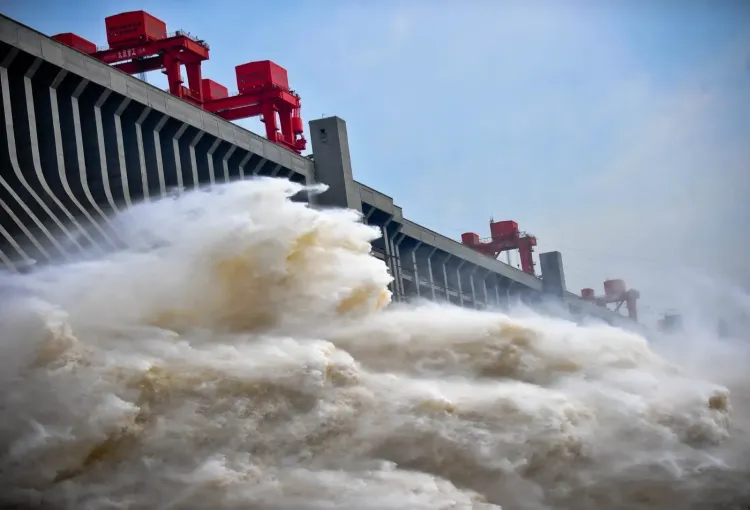
Launched in July 2025, China's Yarlung Tsangpo hydropower complex is described as one of the most ambitious infrastructure undertakings in recorded history. The project involves five cascading hydropower stations designed to exploit the river's extraordinary energy potential before it crosses into India, where it becomes the Brahmaputra River and flows through Bangladesh into the Bay of Bengal. The estimated investment stands at 1.2 trillion yuan (roughly $170 billion).
The report raises the central concern plainly: the safety of China's upstream engineering is directly linked to the lives and livelihoods of millions downstream across two sovereign nations.
Prehistoric Floods and What the Geological Record Shows
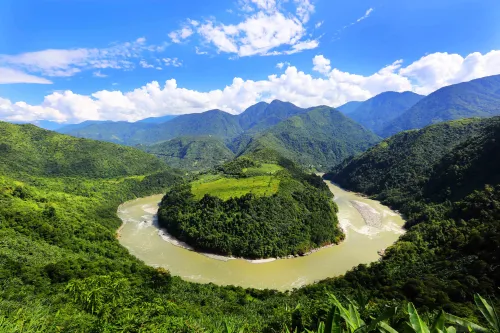
Research published in 2026 in the journal Palaeogeography, Palaeoclimatology, Palaeoecology — cited in The National Interest report — identified six devastating prehistoric floods in the Yarlung Tsangpo Gorge system, each triggered by natural dam failures. The findings suggest that the threat of exceptionally large floods is not a hypothetical engineering scenario but a pattern embedded in the river's geological past.
This comes amid broader international concerns about transparency in the project's design and safety protocols, with India having repeatedly sought assurances from Beijing over the Brahmaputra's downstream flow management.
What Comes Next
With construction under way and the first of the five stations yet to come online, scrutiny from hydrologists, geophysicists, and downstream governments is only expected to intensify. Whether China will share real-time seismic and hydrological monitoring data with India and Bangladesh — as international norms for transboundary rivers suggest — remains an open and unresolved question.
Point of View
India and Bangladesh have every right to demand that answer before the first turbine spins.
NationPress
31 Oct 2026
Frequently Asked Questions
What is China's Yarlung Tsangpo hydropower project?
Launched in July 2025 , it is a five-station cascading hydropower complex on the Yarlung Tsangpo River in southeastern Tibet, estimated to cost 1.2 trillion yuan (approximately $170 billion) . It is designed to harness the river's energy potential before it crosses into India, where it is known as the Brahmaputra.
Why is the Tibet earthquake alarming for downstream countries?
A magnitude 7.0 earthquake on 22 October 2026 killed at least 16 people in Nagqu, Tibet , underscoring that seismic activity in the region is ongoing and severe. Because the Yarlung Tsangpo flows into India and Bangladesh, any structural failure of upstream dams could have catastrophic consequences for millions of people downstream.
How seismically active is the Tibetan Plateau?
Since 1900 , the Tibetan Plateau and surrounding regions have experienced 29 earthquakes of magnitude 7.0 or greater , according to the report. The 1950 Assam-Tibet earthquake reached magnitude 8.6 and killed 4,800 people ; the 2010 Yushu earthquake in Qinghai killed more than 2,500 .
What did the 2026 glacier collapse add to the safety debate?
On 26 August 2026 , a collapse of glacier ice and rock near the Nepal-Tibet border sent a destructive surge of water, mud, and boulders down the mountain. The report argues this event, combined with the October earthquake, illustrates two distinct but overlapping hazard types — seismic and glaciogenic — that any Himalayan mega-infrastructure must be designed to withstand simultaneously.
What does historical research say about flood risk on the Yarlung Tsangpo?
A 2026 study in Palaeogeography, Palaeoclimatology, Palaeoecology identified six prehistoric megaflood events in the Yarlung Tsangpo Gorge caused by natural dam failures. The research indicates that the risk of exceptionally large floods is rooted in the river's geological history, not merely a theoretical engineering scenario.