Assam CMO: Flood fighting under way in Jorhat, Sivasagar
Synopsis
The Chief Minister's Office of Assam on 20 July 2026 confirmed active flood-fighting operations across Jorhat, Charaideo and Sivasagar, including sandbagging along the Dikhow embankment, geobag deployment at Santipur on the Disang riverbank, and piping repairs at Baruahchuk, as the Jhanji river begins to recede.
Key Takeaways
Flood-fighting operations are active across Jorhat , Charaideo , and Sivasagar districts as of 20 July 2026 .
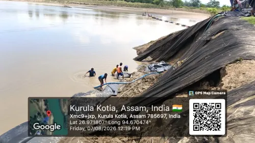
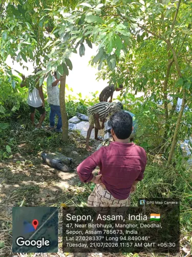
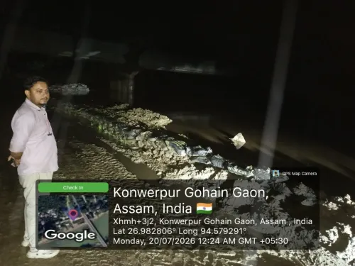
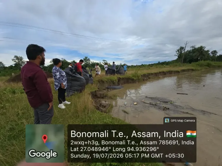
Sand-filled bags are being laid along the Dikhow embankment and piping at the Disang embankment in Baruahchuk is being repaired.
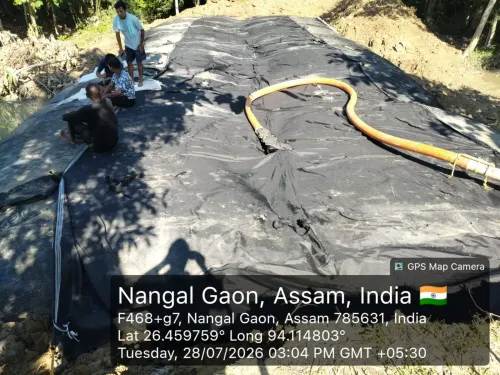
Type-B geobags are being deployed at Santipur to restore the eroded Disang riverbank .
Flood-fighting work continues at the Jhanji embankment in Norakonwar Bailung Gaon .
The Jhanji river is on a receding trend, with water level falling by 0.04 metres since the morning reading.
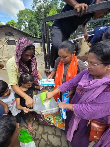
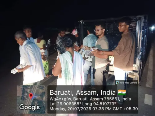
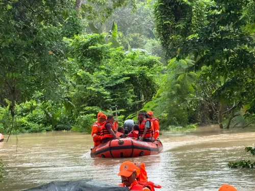
The CMO released 4 photographs documenting on-ground operations at the affected sites.
The Chief Minister's Office of Assam on Monday, 20 July 2026 issued a flood-response update confirming active embankment protection operations across vulnerable stretches in Jorhat, Charaideo, and Sivasagar districts, with the Jhanji river showing a receding water level.
Context
The official update states that sand-filled bags are being laid along the Dikhow embankment, while piping at the Disang embankment in Baruahchuk is being addressed. Type-B geobags are being deployed at Santipur to restore the Disang riverbank, and flood-fighting work continues at the Jhanji embankment in Norakonwar Bailung Gaon. The Jhanji river's water level has fallen by 0.04 metres since the morning reading, indicating a receding trend. The CMO shared 4 photographs alongside the update, offering visual documentation of on-ground operations at the affected sites.Policy Backdrop
Assam has conducted annual pre-monsoon and monsoon embankment-strengthening operations since the 1950s as part of its state disaster management framework. The Disang, a major tributary of the Brahmaputra, flows through Sivasagar and Charaideo districts and is a recurring source of embankment stress during the monsoon season. Charaideo, carved out as a separate district in 2015, has inherited the flood vulnerability of the upper Assam region. Flood-fighting measures such as sandbagging and geobag dumping are standard short-term interventions deployed by the state water resources department during periods of high river discharge. These sit alongside longer-term embankment modernisation programmes that successive state governments have pursued. Real-time situation reports from the Chief Minister's Office are a routine feature of Assam's public communication strategy during the flood season.Stakeholders and Impact
The most directly affected communities are riverine villages and agricultural households in the upper Assam belt. Embankment breaches in this region can inundate cropland and displace families, making timely flood-fighting interventions critical to limiting livelihood losses. Norakonwar Bailung Gaon, specifically named in the update, is among the settlements at immediate risk from the Jhanji embankment situation. The deployment of Type-B geobags at Santipur to restore the Disang riverbank signals that erosion, not merely overtopping, is a concern at that stretch — a pattern common across Assam's sandy, braided river systems during peak monsoon discharge.What's Next
Daily bulletins from the Central Water Commission on Brahmaputra and tributary levels will indicate whether the receding trend on the Jhanji holds or reverses with upstream rainfall. State authorities are expected to issue post-flood damage assessments and compensation announcements once water levels stabilise across the affected districts. The pace of geobag and sandbag deployment at the remaining vulnerable stretches will determine how much agricultural land and how many households are protected before the monsoon's peak intensity passes.Point of View
Site-specific flood update — naming individual embankments, villages, and even a precise 0.04-metre water-level change — reflects a deliberate shift toward real-time transparency in Assam's disaster communication, a pattern that has intensified over recent monsoon seasons. By anchoring the update in measurable river data alongside operational details, the state government signals administrative readiness while managing public anxiety during peak flood risk. The focus on three contiguous upper Assam districts points to concentrated vulnerability in the Brahmaputra tributary belt, where embankment ageing and riverbank erosion compound seasonal flood risk. This kind of iterative public reporting also creates a documented accountability trail that can inform post-season damage assessments and future embankment investment decisions.
NationPress
20 Oct 2026
Frequently Asked Questions
Which districts in Assam are affected by floods on 20 July 2026?
Jorhat , Charaideo , and Sivasagar districts in upper Assam are the focus of active flood-fighting operations as of 20 July 2026, according to the Chief Minister's Office.
What is the current status of the Jhanji river flood level?
The Jhanji river is on a receding trend, with the water level having fallen by 0.04 metres since the morning reading on 20 July 2026, per the CMO update.
What are Type-B geobags and why are they used in Assam floods?
Type-B geobags are heavy-duty geotextile bags filled with sand or earth and used to reinforce eroding riverbanks and embankments. In Assam, they are a standard flood-fighting tool deployed to restore riverbanks damaged by the fast-flowing Brahmaputra and its tributaries.
What is the Disang river and where does it flow?
The Disang is a major tributary of the Brahmaputra that flows through Sivasagar and Charaideo districts in upper Assam, and is a recurring source of embankment stress during the monsoon season.
How does the Assam government communicate during floods?
The Chief Minister's Office of Assam issues real-time situation updates on social media platforms during the flood season, providing site-specific operational details and river-level readings as part of the state's standard public disaster communication.