Assam Engineers Work Through Night on Mitong River Flood Defence

Synopsis
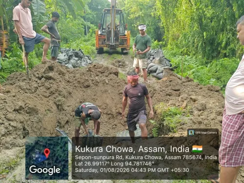
Engineers and field staff of the Sivasagar Water Resources Division are working through the night on flood protection works along the left bank of the Mitong River in upper Assam, the Chief Minister's Office announced on 22 July 2026, as monsoon pressure on vulnerable embankments intensifies.
Key Takeaways
The Chief Minister's Office of Assam confirmed overnight flood protection operations on 22 July 2026 .
Flood Response Engineers of the Sivasagar Water Resources Division are deployed along the left bank of the Mitong River .
The Mitong River is a tributary of the Brahmaputra system and poses recurring flood risk to villages and farmland in Sivasagar district .
Operations fall under a framework that includes the Brahmaputra Board (est.
1980 ) and multiple phases of the Flood Management Programme from the 2000s onward.
Riverine villagers and paddy farmers along the left bank are the primary communities at risk from a potential embankment breach.
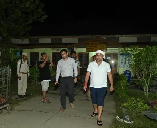
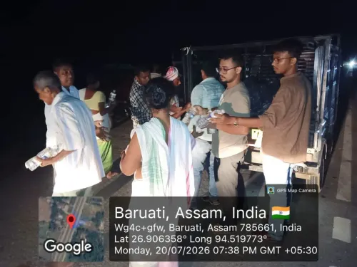
The Chief Minister's Office of Assam announced on Wednesday, 22 July 2026 that Flood Response Engineers and field staff of the Sivasagar Water Resources Division are conducting overnight flood protection operations along the left bank of the Mitong River to secure vulnerable stretches against monsoon inundation.
Context
The overnight deployment underscores the urgency of the situation along the Mitong River, a tributary in upper Assam that drains into the Brahmaputra system and periodically threatens adjacent villages and farmland. The CMO's update stated that 'flood protection works continue along the left bank of the Mitong River to safeguard vulnerable stretches,' signalling that pressure on embankments remains active. Riverine villagers and paddy farmers in Sivasagar district are the most immediately at risk.
Policy Backdrop
The Sivasagar Water Resources Division is a field unit under Assam's Water Resources Department, responsible for embankment maintenance and anti-erosion works in the district. Its operations sit within a long-standing national framework: the Brahmaputra Board, constituted in 1980, was set up to plan and coordinate flood-control infrastructure across the Brahmaputra basin and its tributaries. Successive phases of the Flood Management Programme from the 2000s onward have channelled central assistance into embankment strengthening and bank-protection works across Assam.
Assam records major flood events nearly every monsoon season, driven by high rainfall, river siltation, and upstream catchment degradation. Structural interventions — embankments, spurs, and bank-protection works — have been the primary response tool for successive state administrations, complemented by early-warning systems under India's national disaster-risk-reduction framework.
Stakeholders and Impact
The communities most exposed along the Mitong River's left bank include riverine villagers and paddy farmers whose crops and homesteads are vulnerable to embankment breaches during peak monsoon discharge. A breach or overtopping event can inundate agricultural land within hours, causing crop losses that ripple through local livelihoods for months. The round-the-clock presence of engineers signals that authorities consider the current water levels a credible threat to these communities.
The Brahmaputra valley as a whole sees millions of residents affected by annual flooding, making district-level interventions such as those in Sivasagar a critical first line of defence before floodwaters reach larger population centres downstream.
What's Next
Observers will watch for progress reports on embankment repairs through the remainder of the 2026 monsoon season, as well as any supplementary budget allocations announced for water-resources divisions in the state. The pace of overnight works and the structural integrity of the left-bank embankment in the coming days will determine whether downstream communities face a wider flood emergency. Any breach would likely trigger a formal disaster-response escalation under Assam's State Disaster Management Authority protocols.
Point of View
Round-the-clock disaster communication during monsoon crises — part accountability signal, part public reassurance. The Mitong River intervention fits a decades-long pattern in Assam where structural embankment works remain the dominant flood-response tool despite persistent critiques about long-term sustainability and siltation. The fact that field staff are working through the night suggests water levels are at or near a critical threshold, raising questions about whether existing embankment capacity is adequate for intensifying monsoon cycles. Progress on these works — and any supplementary funding that follows — will be a litmus test for the state's preparedness posture heading into the peak of the 2026 flood season.
NationPress
20 Oct 2026
Frequently Asked Questions
Why are engineers working through the night on the Mitong River?
The Chief Minister's Office of Assam stated that flood protection works along the left bank of the Mitong River are ongoing to safeguard vulnerable stretches, indicating that water levels pose an active threat requiring round-the-clock intervention.
Where is the Mitong River located in Assam?
The Mitong River is a tributary in upper Assam that drains into the Brahmaputra system, flowing through Sivasagar district where it periodically threatens villages and agricultural land.
What is the Sivasagar Water Resources Division?
The Sivasagar Water Resources Division is a field unit under Assam's Water Resources Department responsible for embankment maintenance, anti-erosion works, and flood protection in Sivasagar district.
How does Assam manage floods along Brahmaputra tributaries?
Assam relies on structural measures such as embankments, spurs, and bank-protection works under the Flood Management Programme, coordinated at the basin level by the Brahmaputra Board constituted in 1980, alongside early-warning systems under India's national disaster-risk-reduction framework.
Who is most affected by flooding along the Mitong River?
Riverine villagers and paddy farmers along the left bank of the Mitong River face the greatest risk, as an embankment breach can rapidly inundate homes and crop land, causing prolonged livelihood disruption.