

CM Himanta scouts Kayatol site for Brahmaputra land reclaim
Synopsis
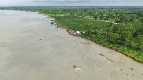
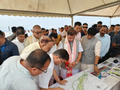
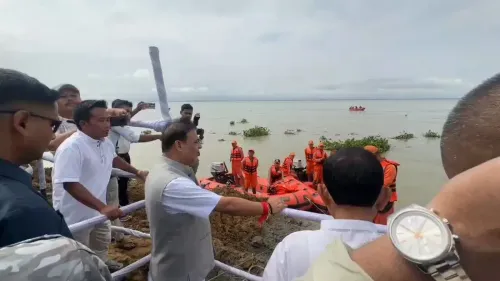
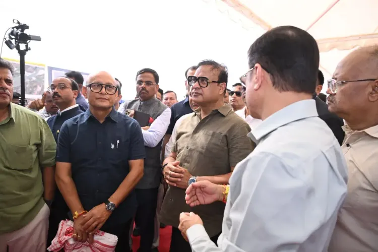
Chief Minister Himanta Biswa Sarma visited the Kayatol project site in Kamrup on November 10 to explore scientific reclamation of over 2,000 bighas of land exposed by the Brahmaputra's shifting course, targeting agriculture, industry, and habitation.
Key Takeaways
CM Himanta Biswa Sarma personally visited the Kayatol project site in Kamrup district on November 10, 2026 .
The initiative targets scientific reclamation of over 2,000 bighas (approximately 650+ acres) of land exposed by the Brahmaputra's shifting course.
Reclaimed land is proposed for agriculture, industry, and habitation — serving farmers, industrial developers, and riverine communities.
The emphasis on 'scientific' reclamation points toward structured soil, flood, and land-use assessments before allocation.
Next steps expected include land surveys, environmental assessments, and a formal allocation policy for the reclaimed areas.
The project fits within Assam's broader historical pattern of converting Brahmaputra river dynamics into development opportunities.
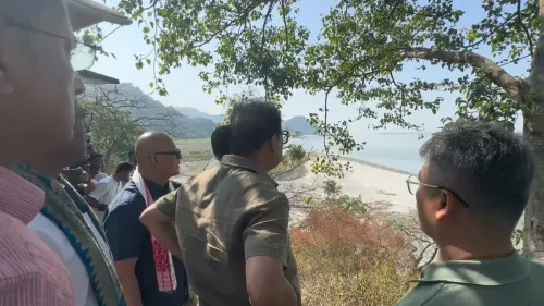
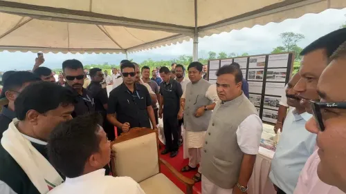
Over 2,000 bighas of land — quietly surrendered to the Brahmaputra over decades of erosion and channel migration — could soon be pulled back into productive life. Chief Minister Dr. Himanta Biswa Sarma visited the proposed Kayatol project site in Kamrup district on Tuesday, November 10, to personally assess the feasibility of scientifically reclaiming this riverine land exposed by the Brahmaputra's ever-shifting course.
What the Brahmaputra's retreat has left behind
The Brahmaputra is one of the world's most dynamic rivers — its braided channels migrate seasonally, carving away established settlements on one bank while quietly depositing new land on another. Kamrup district, sitting directly in the river's floodplain, has watched this cycle play out for generations. What the Kayatol site represents is the reverse of the more-reported erosion story: land that the river has, through its own movement, effectively handed back to the state.
The scale matters. 2,000-plus bighas — roughly equivalent to over 650 acres — is not a marginal strip of silt. That is a contiguous landmass large enough to anchor agricultural settlements, host small-scale industrial clusters, or absorb displaced riverine communities in need of permanent ground beneath their feet.
Scientific reclamation — not just a bulldozer job
The Chief Minister's Office emphasised the word 'scientific' in its framing of the initiative, signalling that the state is looking beyond ad hoc land-grabbing. Proper reclamation of Brahmaputra-exposed land demands soil-stability assessments, flood-return period modelling, and careful decisions about what category of use — agriculture, industry, or habitation — each sub-zone can safely sustain. CM Sarma's on-site visit suggests the government wants political ownership of that process from the ground up, not just a bureaucratic file note.
Assam has attempted similar char-land and riverine-land utilisation efforts under successive administrations, but systematic, state-driven scientific reclamation at this scale is a step beyond routine embankment repair or seasonal farming on exposed sandbars.
Who stands to gain — and what comes next
The stated beneficiaries span a wide arc: local farmers seeking cultivable land in a state where arable plots remain scarce for many riverine communities, industrial developers looking for accessible flat land near Guwahati's economic corridor, and families currently living on the precarious margins of eroding riverbanks. Each constituency has a different set of requirements — and potentially competing claims — on the same reclaimed acreage.
Watchers of the project will now look for the follow-through: land surveys, environmental impact assessments, and a clear allocation policy that determines who gets access on what terms. The site visit is the opening frame; the policy architecture that follows will determine whether Kayatol becomes a replicable model for river-delta development or remains a one-off announcement.
The Brahmaputra gives, and it takes away. Assam is now betting it can make the giving count.
Point of View
CM Sarma signals that land availability — perennially fraught in Assam's riverine geography — is a governance priority, not just a revenue-department matter. It also feeds into a wider pattern of northeastern states seeking to convert environmental liabilities (erosion, flooding, channel migration) into development assets, blunting criticism that river mismanagement only displaces communities. The 'scientific reclamation' framing is strategically important — it pre-empts accusations of ad hoc land distribution while leaving the government room to design an allocation policy that rewards chosen beneficiaries. Whether the environmental due-diligence matches the political ambition will be the real test.
NationPress
10 Nov 2026
Frequently Asked Questions
What is the Kayatol project in Assam?
The Kayatol project is a proposed initiative by the Assam government to scientifically reclaim over 2,000 bighas of land in Kamrup district that has been exposed by the shifting course of the Brahmaputra river, with the aim of using it for agriculture, industry, and habitation.
Why is the Brahmaputra exposing new land in Kamrup?
The Brahmaputra is one of the world's most geomorphically active rivers. Its braided channels shift seasonally, eroding land on some banks while depositing and exposing new land — known as char land — on others. Kamrup district sits directly in this dynamic floodplain.
What will the reclaimed Brahmaputra land be used for?
According to the Chief Minister's Office, the reclaimed land is intended for productive use across three categories: agriculture, industry, and habitation — benefiting local farmers, industrial developers, and displaced riverine communities.
What does 'scientific reclamation' of the land mean?
'Scientific reclamation' implies that the state plans to conduct soil-stability testing, flood-risk assessments, and structured land-use planning before allocating the exposed Brahmaputra land, rather than allowing unregulated or ad hoc settlement.
What are the next steps for the Kayatol land reclamation project?
Following CM Sarma's site visit, the key milestones to watch are formal land surveys, environmental impact assessments, and the announcement of an allocation policy that defines who gets access to the reclaimed land and on what terms.