

CM Himanta Reviews Assam's Fight Against Brahmaputra Erosion
Synopsis
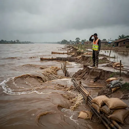
Assam Chief Minister Himanta Biswa Sarma visited riverbank sites on November 10, 2026 to assess a two-pronged plan: reinforcing embankments against Brahmaputra erosion that claims an estimated 8,000 hectares annually, while developing newly formed silt land for agriculture and tourism.
Key Takeaways
Assam loses an estimated 8,000 hectares of land annually to riverbank erosion driven by the Brahmaputra and its tributaries.
CM Himanta Biswa Sarma visited two riverbank sites on November 10, 2026 to review ground-level progress.
The state strategy has two tracks: strengthening existing embankments and developing newly formed silt land for agriculture and tourism .
The Brahmaputra Board , set up in 1980 , was mandated for flood and erosion master planning but chronic land loss has persisted for decades.
Char land communities — among Assam's most marginalised — are the primary stakeholders in the land-development component of the strategy.
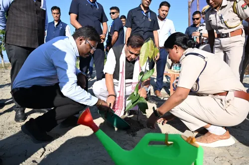
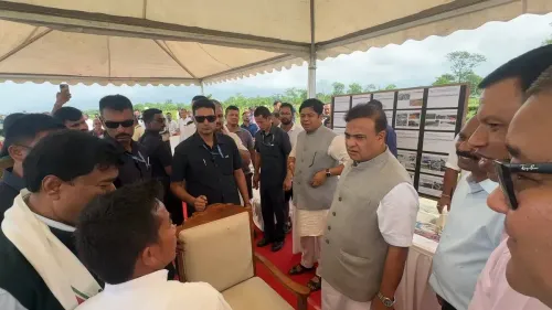
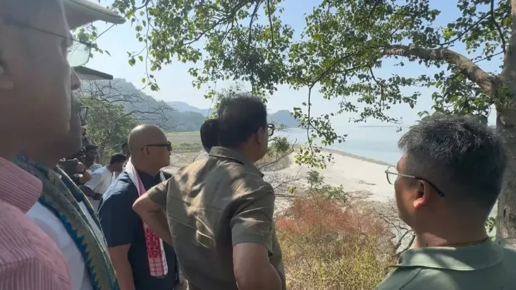
Every year, the Brahmaputra quietly swallows 8,000 hectares of Assam — farmland, settlements, livelihoods — while depositing new silt-born islands elsewhere. Assam Chief Minister Himanta Biswa Sarma took that paradox to the field on Tuesday, November 10, 2026, visiting two riverbank sites to personally review the state's dual-track strategy for managing land loss and land gain.
A river that takes and gives — but unevenly
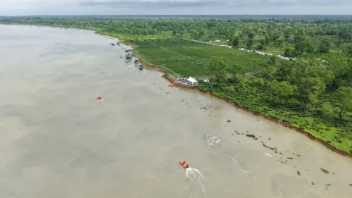
The Brahmaputra is one of the world's highest-sediment rivers. Its annual silt load constantly reshapes Assam's floodplain — eroding established villages on one bank while throwing up new char (sandbar) land elsewhere. The result is a chronic, low-visibility crisis: communities lose legally titled, cultivated ground and are sometimes left with access to newly formed parcels whose ownership and use remain disputed for years.
Sarma's post spells out the two-part state response plainly: strengthen embankments along erosion-prone stretches to protect what already exists, and bring newly formed land into productive use — specifically in agriculture and tourism. The Chief Minister stated, 'Our strategy has two parts: strengthening embankments to protect vulnerable areas from erosion, and developing newly formed land for productive use in agriculture and tourism.'
Embankments: a colonial inheritance still bearing weight
Assam's reliance on earthen embankments as the primary defence against the Brahmaputra dates back to the British colonial period — a structural approach that successive state and central governments have inherited rather than fundamentally reimagined. The Brahmaputra Board, established by the central government in 1980, was mandated to prepare master plans for flood and erosion control across the Brahmaputra and Barak valleys, yet large-scale erosion has persisted across decades.
Reinforcing those embankments remains the fastest lever available to protect the densest riverine communities. The harder, longer question is what happens to the char land that accumulates on the other side of the ledger.
Char land development: the contested frontier
Newly formed char lands represent a genuine economic opportunity — but also a governance challenge. These parcels carry uncertain legal status, are often inhabited informally by landless riverine farmers, and lack the infrastructure to attract investment. By framing char land development as a tourism and agriculture opportunity, the Sarma administration is signalling an intent to formalise and monetise what has historically been contested and neglected terrain.
Riverine farming communities and char dwellers — among Assam's most economically marginalised groups — stand to gain most if the land-development arm of this strategy translates into clear titling, agricultural inputs, and connectivity. The site visits by the Chief Minister suggest ground-level progress assessments are underway, though specific project details and budgetary commitments are yet to be publicly announced.
What the field visit signals
Chief ministerial site visits, when followed by budget allocations or policy notifications, tend to accelerate bureaucratic timelines. The ones to watch now: embankment-strengthening tenders, any pilot designation of char land parcels for agriculture or eco-tourism, and whether the Brahmaputra Board framework gets updated to align with the state's newer development framing.
Assam has been losing ground to its greatest river for generations. Whether a two-part strategy — protect one bank, develop the other — can finally break that cycle is the question every char community along the Brahmaputra is waiting to have answered.
Point of View
Sarma is signalling that riverbank management — long treated as a technical backwater — is now a political priority in Assam. The dual framing of protection plus development is a departure from the state's historically embankment-only approach, and it aligns with the BJP's broader push to monetise natural assets in the Northeast. The critical test will be whether char land titling and tourism investment follow the optics of a field visit, or whether this remains a repackaging of old structural spending. With the Brahmaputra Board's mandate largely unfulfilled since 1980, institutional credibility for any new push remains low.
NationPress
10 Nov 2026
Frequently Asked Questions
How much land does Assam lose to erosion every year?
Assam loses an estimated 8,000 hectares of land annually to riverbank erosion, primarily driven by the shifting channels and high silt load of the Brahmaputra river.
What is char land in Assam?
Char land refers to new land parcels formed by river siltation along the Brahmaputra floodplain. These areas are often inhabited informally by landless riverine farmers and carry uncertain legal ownership status.
What is Assam's strategy to deal with Brahmaputra erosion?
The Assam government under CM Himanta Biswa Sarma is pursuing a two-part approach: reinforcing embankments along erosion-prone riverbanks to protect existing settlements, and developing newly formed silt land for agriculture and tourism.
What is the Brahmaputra Board and what does it do?
The Brahmaputra Board is a central government body established in 1980 to prepare master plans for flood and erosion control across the Brahmaputra and Barak river valleys in northeastern India.
Why does the Brahmaputra cause so much erosion in Assam?
The Brahmaputra carries one of the world's highest sediment loads, and its constantly shifting braided channels erode established banks while depositing new silt islands, creating a cycle of land loss and land gain across Assam's floodplain.