CM Sawant Backs IWAI Plan to Open River Sal for Navigation

Synopsis
Goa Chief Minister Pramod Sawant has welcomed IWAI's proposal to develop River Sal for navigation in 2026-27, with planned facilities at Betul Fort, Betul Lighthouse, and Cavelossim aimed at boosting inland connectivity and regional tourism.
Key Takeaways
The Inland Waterways Authority of India (IWAI) has proposed developing River Sal in South Goa for navigation during 2026–27 .
Facilities are planned at three sites: Betul Fort , Betul Lighthouse , and Cavelossim .
Goa CM Pramod Sawant publicly welcomed the initiative on 4 August 2026 , signalling state-centre coordination.
The project is expected to strengthen inland water connectivity and open new heritage and eco-tourism routes in South Goa .
River Sal flows through Salcete taluka and has historically supported local fishing but lacks formal waterway infrastructure.
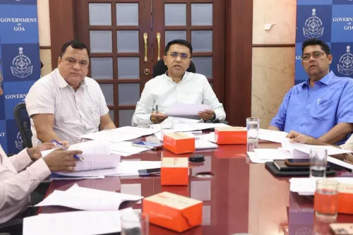
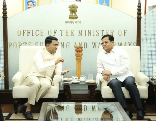
A quiet river in south Goa is about to find its place on India's inland waterways map. Goa Chief Minister Pramod Sawant on Tuesday, 4 August 2026 welcomed the Inland Waterways Authority of India (IWAI)'s proposal to develop the River Sal for navigation in 2026–27, calling it a move that will 'strengthen inland water connectivity while unlocking the tourism and economic potential of the region.'
Three Landmarks, One Waterway Corridor
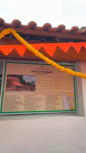
The IWAI plan centres on infrastructure at three heritage-adjacent sites along the Sal estuary: Betul Fort, Betul Lighthouse, and Cavelossim. Together, these points trace the river's lower reach toward the Arabian Sea, an area better known to tourists for its beaches than for boat traffic. Developing navigation facilities here would create a new water-transit corridor linking an old Portuguese-era fortification and a working lighthouse with one of Goa's most visited coastal stretches.
Why River Sal, Why Now
The River Sal flows through South Goa's Salcete taluka before emptying near Mobor and Cavelossim. The estuary is navigable for small and medium craft and has historically supported local fishing and ferry crossings, but lacks formal waterway status or passenger infrastructure. An IWAI-backed development would bring it into the national inland waterways framework — potentially opening it to regulated ferry services, water taxis, and tourism boats under a structured safety and ticketing regime.
For Goa, the timing aligns with a broader state push to diversify tourism beyond beach shacks and casinos. A river cruise past Betul Fort — a 17th-century Portuguese bastion — and the lighthouse offers a distinctly different product for heritage and eco-tourism travellers, a segment the state has been actively courting.
What IWAI Development Typically Unlocks
When IWAI designates and develops a waterway, it typically funds jetty construction, navigational aids, dredging where required, and safety equipment. Local operators then apply for licences to run services. The economic ripple — boat operators, guides, hospitality at landing points — tends to be felt quickly in communities along the bank. For Betul and Cavelossim, villages that sit slightly off the main tourist circuit, that could mean a meaningful new income stream.
Chief Minister Sawant's public endorsement signals the state government's intent to coordinate with the central body, smoothing the approvals and land-access questions that often slow such projects at the last mile.
River Sal's navigation future now has a timeline, a nodal agency, and a chief minister on record — the next stop is the waterline itself.
Point of View
Endorsing the project publicly is a calculated alignment with New Delhi's infrastructure agenda while delivering a tangible economic promise to South Goa's coastal communities ahead of election cycles. The heritage angle — Betul Fort and the lighthouse — gives the project a differentiated tourism pitch that Goa's planners have struggled to articulate beyond its beach economy. Whether IWAI's 2026-27 timeline holds will depend on how swiftly land-access and environmental clearances move through the state machinery.
NationPress
4 Aug 2026
Frequently Asked Questions
What is the IWAI plan for River Sal in Goa?
The Inland Waterways Authority of India has proposed developing River Sal in South Goa for navigation during 2026-27, with facilities planned at Betul Fort, Betul Lighthouse, and Cavelossim to improve inland water connectivity and boost tourism.
Where is River Sal located in Goa?
River Sal flows through Salcete taluka in South Goa, emptying near Mobor and Cavelossim close to the Arabian Sea coast.
What facilities will be built under the River Sal navigation project?
The proposed development includes navigation and passenger facilities at three locations: Betul Fort, Betul Lighthouse, and Cavelossim, which will support ferry services, water taxis, and tourism boats.
What did Goa CM Pramod Sawant say about the River Sal project?
CM Pramod Sawant welcomed the IWAI initiative on 4 August 2026, stating it will 'strengthen inland water connectivity while unlocking the tourism and economic potential of the region.'
How will the River Sal waterway project benefit Goa's tourism?
Navigating the Sal estuary past Betul Fort — a 17th-century Portuguese fortification — and the Betul Lighthouse offers a new heritage and eco-tourism product, helping diversify Goa's tourism beyond beaches and casinos.