

Cyclone Murasu makes landfall near Ongole, intensifies northeast monsoon in TN

Synopsis
Severe Cyclonic Storm Murasu crossed the Andhra Pradesh coast near Ongole in the early hours of 3 November, packing gusts of 120 kmph and triggering heavy rain across Tamil Nadu and Puducherry. The landfall adds a fresh cyclonic jolt to an already-active northeast monsoon season, with coastal communities on high alert and residual rainfall set to continue inland.
Key Takeaways
Severe Cyclonic Storm Murasu made landfall near Ongole, Andhra Pradesh between 3.30 am and 5.30 am IST on 3 November 2026 .
Landfall coordinates were latitude 15.53°N, longitude 80.22°E ; sustained winds reached 100–110 kmph with gusts of 120 kmph .
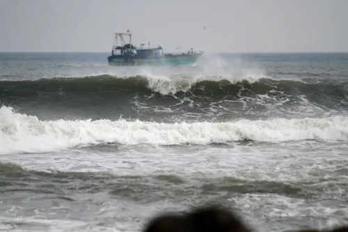
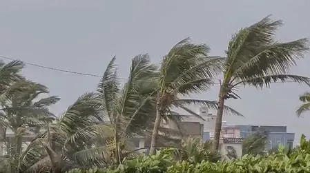
Strong winds uprooted trees in Chirala ; high waves battered the Andhra Pradesh coastline.
Puducherry recorded continuous rainfall from midnight; northern Tamil Nadu saw intensified monsoon activity.
The storm had been positioned 160 km from Chennai and 180 km from Nellore before advancing to landfall.
Residual rainfall and inland disruption are expected to continue over the next 24–48 hours .
Severe Cyclonic Storm Murasu crossed the southern Andhra Pradesh coast near Ongole in the early hours of Tuesday, 3 November, bringing heavy rainfall, powerful winds, and rough sea conditions to coastal regions of Andhra Pradesh, northern Tamil Nadu, and Puducherry. The landfall, confirmed by the India Meteorological Department (IMD), occurred between 3.30 am and 5.30 am IST, intensifying an already active northeast monsoon season across the region.
Landfall Details and Wind Intensity
According to the IMD, the cyclone made landfall between Nellore and Narsapur, near Ongole, at approximately latitude 15.53°N and longitude 80.22°E. Sustained wind speeds at landfall were recorded at 100–110 kmph, with gusts reaching 120 kmph. The system had developed over the southwest and adjoining west-central Bay of Bengal before intensifying into a severe cyclonic storm early on Monday, subsequently tracking northwestwards and then west-northwest towards the Andhra Pradesh coastline.
Impact on Andhra Pradesh and Puducherry
Southern Andhra Pradesh bore the brunt of the storm's approach on Monday night, with Ongole and its surrounding coastal areas experiencing powerful winds and intense rainfall. In Chirala, strong winds uprooted trees, while high waves battered several stretches of the coastline. Sea conditions grew increasingly rough as the cyclone's central circulation neared Ongole, raising concerns over flooding, infrastructure damage, and disruption to daily life in coastal settlements.
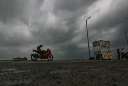
Puducherry recorded continuous rainfall from midnight, with the union territory's weather conditions significantly affected by the cyclonic system's outer bands.
Effect on Tamil Nadu's Northeast Monsoon
Although the cyclone's centre moved towards Andhra Pradesh, its influence extended southward, unsettling weather across northern Tamil Nadu. The storm's approach amplified the northeast monsoon's intensity over the state, which was already entering an active phase driven by successive Bay of Bengal systems. Prior to landfall, Murasu had been positioned approximately 160 km from Chennai and 180 km from Nellore.
Broader Monsoon Context
This comes amid a historically active northeast monsoon cycle, with cyclonic systems over the Bay of Bengal repeatedly influencing rainfall patterns across Tamil Nadu and neighbouring coastal states. The northeast monsoon, which typically accounts for the bulk of Tamil Nadu's annual precipitation, has been gaining strength through late October and early November. Notably, coastal communities remain on alert as post-landfall remnants of such systems can continue to deliver heavy rain well inland.
Authorities in both Andhra Pradesh and Tamil Nadu are monitoring the situation closely as the weakening system moves further inland, with residual rainfall expected to continue over the next 24–48 hours.
Point of View
And that Andhra Pradesh's long, exposed coastline offers little natural buffer. What deserves scrutiny beyond the storm track is preparedness infrastructure: early warning lead times, evacuation compliance rates, and the resilience of coastal power and road networks. Tamil Nadu's northeast monsoon dependency on Bay systems also means that every such cyclone is simultaneously a water-security event — too much in one coastal strip, potentially too little elsewhere. The pattern of successive November Bay systems is not new; the question is whether disaster response frameworks are scaling as fast as the storms are arriving.
NationPress
3 Nov 2026
Frequently Asked Questions
Where did Cyclone Murasu make landfall?
Cyclone Murasu made landfall on the southern Andhra Pradesh coast near Ongole, between Nellore and Narsapur, at approximately latitude 15.53°N and longitude 80.22°E. The landfall was confirmed by the IMD as occurring between 3.30 am and 5.30 am IST on 3 November 2026.
How intense was Cyclone Murasu at landfall?
At the time of landfall, Murasu carried sustained wind speeds of 100–110 kmph with gusts reaching 120 kmph, classifying it as a Severe Cyclonic Storm according to the IMD. These conditions brought heavy rainfall, rough seas, and structural damage to coastal areas.
How did Cyclone Murasu affect Tamil Nadu?
Although Murasu's centre made landfall in Andhra Pradesh, its outer circulation intensified northeast monsoon conditions across northern Tamil Nadu. The storm also triggered continuous overnight rainfall in Puducherry, amplifying an already active monsoon phase across the region.
What damage was reported in Andhra Pradesh?
In Chirala, strong winds uprooted trees, and high waves battered several stretches of the Andhra Pradesh coastline. Ongole and surrounding coastal areas experienced powerful winds and intense rainfall, raising concerns over flooding and infrastructure disruption.
What happens after Cyclone Murasu makes landfall?
Post-landfall, the system is expected to weaken progressively as it moves inland, but residual heavy rainfall is anticipated to continue across affected regions for 24–48 hours. Authorities in both Andhra Pradesh and Tamil Nadu are monitoring conditions as the remnant system tracks further inland.