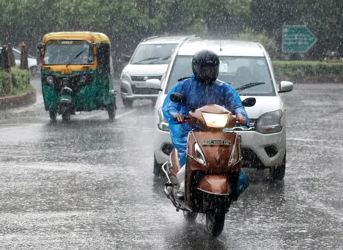
Delhi-NCR dry on 22 Sep as IMD forecasts 34°C; red alert for Odisha

Synopsis
Delhi gets a brief dry reprieve on 22 September with clear skies and a 34°C high — but the bigger weather story is off the coast. A Bay of Bengal deep depression is bearing down on Odisha, triggering red alerts for over 20 cm of rain in multiple districts, while thunderstorms are expected to reach Delhi-NCR itself by week's end.
Key Takeaways
Delhi-NCR will remain dry on 22 September with a maximum temperature of 34°C and minimum of 24°C .
Relative humidity in Delhi is likely to stay near 60 per cent ; The Ridge records the coolest minimum at 22.5°C .
A deep depression over the Bay of Bengal is tracking towards the South Odisha–North Andhra Pradesh coast, expected to arrive around 23 September morning.
The IMD has issued a red alert for rainfall exceeding 20 cm in Kandhamal, Gajapati, Ganjam and Puri on 23 September ; Kalahandi, Kandhamal and Rayagada face a red alert on 24 September .
Thunderstorms and squally conditions are forecast for Delhi, Haryana and Chandigarh between 25 and 27 September .
Heavy rainfall alerts are also active for Kerala, Assam, Meghalaya, Sub-Himalayan West Bengal, Sikkim and parts of Uttar Pradesh over the coming days.
The India Meteorological Department (IMD) has forecast clear skies and dry conditions for Delhi-NCR on 22 September 2026, with a maximum temperature of around 34°C and a minimum of approximately 24°C. The relatively settled weather marks a departure from the cloudy spells and intermittent showers that have gripped the capital over recent weeks.
Delhi Weather: What to Expect on Tuesday
Relative humidity is expected to hover near 60 per cent, keeping conditions broadly comfortable, though afternoon temperatures will feel warmer before easing by evening. Among the capital's weather stations, Palam is likely to log a minimum of around 23°C, while Lodi Road and Ayanagar may record minimums of 24.3°C and 24.2°C respectively. The Ridge is expected to be the coolest pocket in the city, with a morning minimum of roughly 22.5°C.
The dryness across Delhi, Noida, Gurugram, Ghaziabad and Faridabad is being driven by the ongoing withdrawal of the southwest monsoon from northwest India — a seasonal transition that typically sets in during the second half of September. However, this calm is not expected to last through the week.
Red Alert Issued for Odisha as Bay of Bengal System Intensifies
While Delhi stays dry, a deep depression over the Bay of Bengal is rapidly organising and is forecast to track towards the South Odisha–North Andhra Pradesh coast, reaching the west-central and adjoining northwest Bay of Bengal near the shoreline around the morning of 23 September.
The IMD has issued a red alert for extremely heavy rainfall exceeding 20 cm in Kandhamal, Gajapati, Ganjam and Puri on 23 September. A second red alert covers Kalahandi, Kandhamal and Rayagada on 24 September. Rainfall is expected to remain active across Odisha through 27 September, with districts placed under red, orange and yellow alerts based on anticipated intensity. Residents in low-lying and landslide-prone zones have been advised to follow instructions from local authorities.
Kerala, Northeast and Eastern India on Watch
In Kerala, light to moderate rainfall is forecast across several districts between 21 and 25 September, with isolated heavy showers possible in Pathanamthitta, Kottayam, Alappuzha, Ernakulam, Idukki and Thrissur. Further east, Assam and Meghalaya are bracing for thunderstorms and lightning on 22 September, followed by heavy rainfall between 23 and 25 September.
Sub-Himalayan West Bengal and Sikkim could see thunderstorms, lightning and squally conditions on 22 September, with heavy rainfall on 23–24 September and very heavy showers possible on 25 September. East Uttar Pradesh is expected to see intensifying rainfall from 24 September, with West Uttar Pradesh following from 25 September.
Late-Week Shift: Thunderstorms Likely in Delhi Region
Delhi-NCR's dry spell may not extend through the week. The IMD has forecast thunderstorms, lightning and squall-like conditions over Haryana, Chandigarh and Delhi between 25 and 27 September, as the developing Bay of Bengal system's indirect influence begins reaching northwest India. The weather agency has described the deepening Bay system as the primary driver of rainfall activity across multiple regions in the coming days.
Point of View
And the system now tracking toward South Odisha follows a well-worn, destructive path. What often gets undercovered is the preparedness gap: red alerts are issued routinely, but evacuation logistics and last-mile communication to fishing communities and low-lying coastal villages remain inconsistent. Delhi's brief dry spell should not crowd out the Odisha story — by midweek, it will be the dominant weather headline.
NationPress
22 Sept 2026
Frequently Asked Questions
What is the weather forecast for Delhi on 22 September 2026?
Delhi is forecast to have clear skies and dry conditions on 22 September, with a maximum temperature of around 34°C and a minimum of approximately 24°C. Relative humidity is expected to stay near 60 per cent, making conditions broadly comfortable despite the warm afternoon.
Why has the IMD issued a red alert for Odisha?
A deep depression forming over the Bay of Bengal is moving toward the South Odisha–North Andhra Pradesh coast and is expected to arrive around the morning of 23 September. The IMD has issued red alerts for extremely heavy rainfall exceeding 20 cm in several Odisha districts, including Ganjam, Puri, Kandhamal and Gajapati on 23 September, and Kalahandi, Kandhamal and Rayagada on 24 September.
Will Delhi-NCR see rain this week?
Delhi-NCR is expected to remain dry through most of the week as the southwest monsoon withdraws from northwest India. However, the IMD has forecast thunderstorms, lightning and squall-like conditions over Delhi, Haryana and Chandigarh between 25 and 27 September as the Bay of Bengal weather system's influence extends inland.
Which other states face heavy rain warnings this week?
Apart from Odisha, heavy rainfall warnings are in place for Kerala (21–25 September), Assam and Meghalaya (22–25 September), Sub-Himalayan West Bengal and Sikkim (22–25 September), and East and West Uttar Pradesh from 24–25 September onwards. The Bay of Bengal deep depression is the primary driver of this widespread activity.
What precautions has the IMD advised for affected areas?
The IMD has advised residents in areas vulnerable to waterlogging and landslides to remain alert and follow instructions from local authorities. Coastal and low-lying districts of Odisha under red alerts should pay particular attention to official advisories as the depression approaches the coast on 23 September.