Will Heavy Rain and Thunderstorms Hit TN, Puducherry, and Andhra Today?
Synopsis
As a deep depression approaches the southern coasts of India, heavy rainfall and thunderstorms are expected to impact Tamil Nadu, Puducherry, and Andhra Pradesh. The government ramps up preparations for potential flooding and safety measures, urging residents to stay alert and safe.
Key Takeaways
Deep depression forming over southwest Bay of Bengal.
Heavy rain and thunderstorms expected in Tamil Nadu and surrounding regions.
Government preparedness includes deployment of personnel and relief camps.
Residents are urged to stay cautious and follow advisories.
Potential for re-intensification of the system post-landfall.
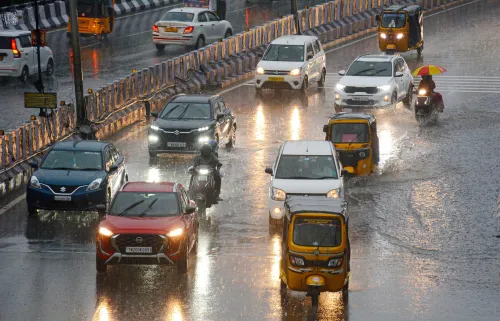
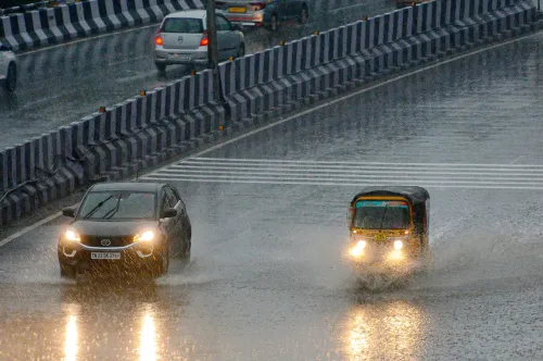
Chennai, Oct 23 (NationPress) A significant deep depression has developed over the southwest Bay of Bengal and is forecasted to advance towards the northern coasts of Tamil Nadu, Puducherry, and southern Andhra Pradesh within the next 24 hours, according to the Regional Meteorological Centre (RMC) in Chennai.
The RMC noted that this system, which began as a low-pressure area, has gained strength to become a deep depression.
While it was initially expected to evolve into a cyclone, its proximity to land altered its structure, halting further intensification. As the system nears the coastline, the associated rainfall patterns have shifted.
Expect widespread rainfall, coupled with thunderstorms and lightning, across Tamil Nadu, Puducherry, and Karaikal in the days ahead.
The RMC has forecasted moderate to heavy rain in several areas and issued alerts for five districts: Chennai, Tiruvallur, Chengalpattu, Kancheepuram, and Ranipet, where isolated heavy showers are anticipated today.
Meteorologists indicate that after making landfall, the deep depression could move inland, slightly weaken, and potentially drift back to the sea around October 26 (Sunday). If this occurs, the system may re-strengthen over water, leading to another wave of rainfall early next week.
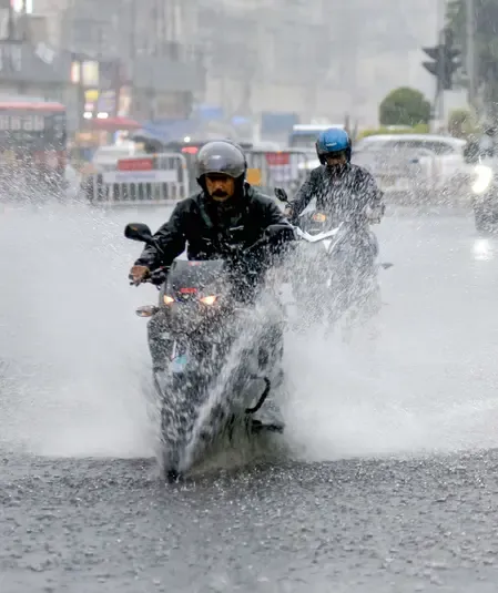
As of Thursday morning, Chennai and surrounding areas are already experiencing steady and at times intense rainfall.
The northeast monsoon, which commenced on October 16, has been actively impacting the northern coastal districts for several days.
In preparation for heavy rainfall, the Tamil Nadu government has heightened its readiness. The Greater Chennai Corporation (GCC) has deployed over 24,000 personnel for relief and rescue operations, established 215 relief camps, and opened 106 community kitchens. Control rooms and helplines have been activated to manage public concerns and coordinate flood relief efforts.
The Water Resources Department has increased monitoring at key reservoirs like Chembarambakkam and Poondi, regulating water release to avert flooding.
The police and fire service departments are on high alert, with rescue teams positioned at vulnerable spots.
Officials have urged residents in low-lying and coastal areas to remain vigilant, avoid unnecessary travel, and heed advisories as the system continues to bring widespread rain across Tamil Nadu.
Point of View
It's crucial to highlight the importance of preparedness in light of the approaching weather system. The safety of residents in Tamil Nadu and surrounding regions must be prioritized as the government takes proactive measures to mitigate potential flooding and ensure timely rescue operations. Accurate and timely communication will be vital in navigating this challenging situation.
NationPress
20 Jun 2026
Frequently Asked Questions
What regions are expected to be affected by the heavy rain?
The regions of Tamil Nadu, Puducherry, and southern Andhra Pradesh are expected to experience heavy rain and thunderstorms.
What measures is the Tamil Nadu government taking?
The Tamil Nadu government has deployed over 24,000 personnel for relief operations, set up relief camps, and activated control rooms to manage public concerns.
When is the heavy rainfall expected?
Heavy rainfall is expected to begin within the next 24 hours as the deep depression approaches the coast.
How can residents prepare for the upcoming weather?
Residents in low-lying areas should avoid unnecessary travel, stay informed about weather updates, and adhere to safety advisories.
What is the forecast after the deep depression makes landfall?
After landfall, the deep depression may weaken slightly but could drift back into the sea, potentially re-intensifying and causing further rainfall.