IMD warns of thunderstorms, hail and gusty winds in MP till May 8
Synopsis
The IMD Bhopal centre has put dozens of Madhya Pradesh districts on alert for thunderstorms, hail, and winds of up to 70 kmph through 8 May. A western disturbance and dual cyclonic circulations are driving the multi-day spell, raising serious concerns for standing crops, livestock, and public safety across the state.
Key Takeaways
IMD Bhopal has issued a multi-day weather warning for Madhya Pradesh valid until 8 May 2025 .
Moderate thunderstorms with hail and winds up to 60 kmph expected over Sidhi , Sanjay Dubri National Park , East Anuppur , North Neemuch , and Singrauli .
Gusty winds of 60–70 kmph forecast for Datia , Bhind , Rewa , Chhatarpur , Tikamgarh , and Niwari .
Hailstorms may damage standing crops, fruits, vegetables, and fragile structures; farmers advised to harvest early or cover crops.
A western disturbance and cyclonic circulations over Haryana and East Madhya Pradesh are sustaining the storm activity.
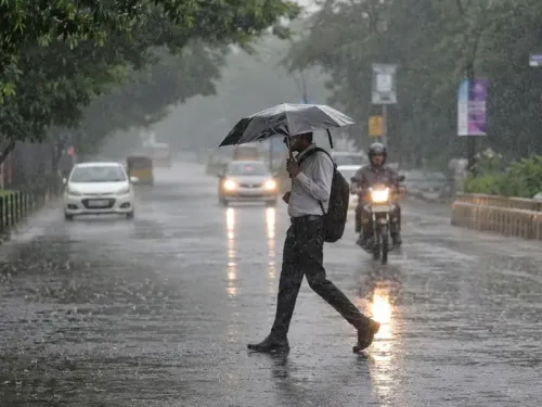
Residents urged to stay indoors, unplug appliances, and avoid trees and power lines during thunderstorms.
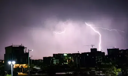
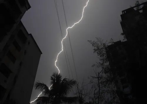
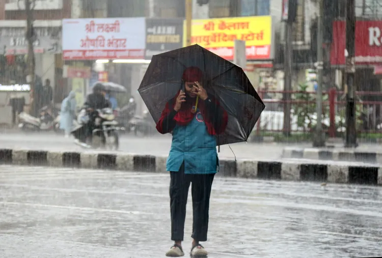
The India Meteorological Department (IMD) Bhopal centre has issued a warning of thunderstorms, lightning, hail, and gusty winds across several districts of Madhya Pradesh, with the turbulent weather spell expected to persist until 8 May. The alert, issued on 4 May, covers a large swathe of the state and urges residents, farmers, and livestock owners to take immediate precautions.
Districts on High Alert
Moderate thunderstorm activity with lightning, hail, and wind speeds up to 60 kmph is forecast over Sidhi, Sanjay Dubri National Park, East Anuppur, and North Neemuch. Singrauli is also forecast to experience moderate thunderstorms with lightning and hail.
Light thunderstorms with lightning are likely during evening hours in South Neemuch, West Anuppur, Amarkantak, North-East Mandsaur, Vidisha, Bhopal, Agar, Rajgarh, North Badwani, South Rewa, Mauganj, Shahdol, Bansagar Dam, Sagar, Damoh, North Seoni, North Mandla, and West Raisen.
Gusty Winds and Widespread Watch Zones
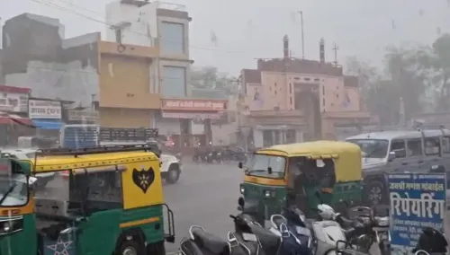
Gusty winds reaching 60–70 kmph may strike parts of Datia, Bhind, Rewa, Chhatarpur, Tikamgarh, and Niwari. A broader set of districts — including Gwalior, Morena, Jabalpur, Chhindwara, Balaghat, Katni, Panna, Narmadapuram, Betul, and Sheopur, among others — are under watch for thunderstorms and winds between 40–60 kmph.
What Is Driving the Weather
According to the IMD bulletin, the stormy conditions are being sustained by a western disturbance appearing as a trough in the middle and upper tropospheric westerlies, combined with cyclonic circulations over Haryana and East Madhya Pradesh. These synoptic systems are expected to keep storm activity alive across the state through 8 May. Notably, this kind of multi-day severe weather episode in early May is consistent with the pre-monsoon convective pattern that has intensified over central India in recent years.
Impact on Agriculture and Infrastructure
The IMD has specifically flagged that hailstorms may damage standing crops, fruits, vegetables, and fragile structures. Farmers have been advised to cover crops or harvest early where feasible. Livestock should be sheltered, and vehicles kept under cover to minimise hail damage. Crop losses from unseasonal hailstorms in Madhya Pradesh have been a recurring concern, with farmers in several districts still recovering from similar events earlier this season.
Safety Advisory for Residents
Citizens have been urged to remain indoors during thunderstorms, unplug electrical appliances, and avoid sheltering under trees or near power lines. The IMD has stressed that precautions are essential to minimise risks to life, property, and agriculture during this volatile weather phase. Residents are advised to monitor official IMD updates closely as conditions evolve over the next four days.
Point of View
Many of whom have standing rabi crops and summer vegetables vulnerable to hail damage. The breadth of the warning, covering well over 30 districts, underscores how the pre-monsoon convective season has grown more intense and geographically widespread in central India. What is often missing from such advisories is a robust last-mile communication mechanism to reach farmers in remote districts like Dindori or Sanjay Dubri before the hail hits. The IMD's science is sound; the delivery chain remains the weak link.
NationPress
20 Jun 2026
Frequently Asked Questions
Which districts in Madhya Pradesh are under thunderstorm warning?
The IMD Bhopal warning covers over 30 districts, including Bhopal, Jabalpur, Gwalior, Sidhi, Singrauli, Rewa, Sagar, Damoh, Shahdol, Chhindwara, Balaghat, and many others. Moderate to light thunderstorms with lightning and hail are forecast across these areas through 8 May 2025.
How long will the bad weather last in Madhya Pradesh?
According to the IMD bulletin, the storm activity is expected to persist until 8 May 2025 — a span of approximately four days from the warning issued on 4 May. A western disturbance and cyclonic circulations are sustaining the weather system.
What precautions should farmers take during the hailstorm warning?
The IMD has advised farmers to cover standing crops or harvest early where possible, shelter livestock, and keep vehicles under cover to minimise hail damage. Farmers should also monitor official IMD updates for district-specific alerts.
What safety measures should residents follow during thunderstorms?
Residents are urged to stay indoors during thunderstorms, unplug electrical appliances, and avoid sheltering under trees or near power lines. Citizens should follow official advisories issued by the IMD and local authorities throughout the warning period.
What is causing the thunderstorms in Madhya Pradesh?
The IMD attributes the stormy conditions to a western disturbance manifesting as a trough in middle and upper tropospheric westerlies, combined with cyclonic circulations over Haryana and East Madhya Pradesh. These systems together are generating sustained convective activity across the state.