ISRO launches NVS-03 satellite on GSLV-F18 to strengthen NavIC GPS system
Synopsis
ISRO called it a 'rescue mission for NavIC' — and that framing matters. With atomic clock failures having quietly eroded India's indigenous GPS system, the NVS-03 launch on 31 October is not just an upgrade; it is a course correction. The addition of the L1 signal and a homegrown atomic clock signals that India is hardening NavIC against both technical failure and foreign dependency.
Key Takeaways
ISRO launched the NVS-03 navigation satellite on GSLV-F18 from Sriharikota at 11:51 pm IST on 31 October .
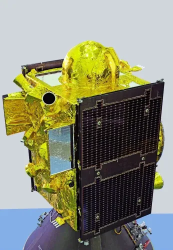
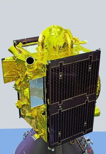
The 2,232 kg satellite is the third in the second-generation NVS series , part of a planned set of five next-gen NavIC satellites.
NVS-03 adds the L1 navigation signal to existing L5 and S signals , boosting compatibility and accuracy.
The satellite carries an indigenous atomic clock , reducing dependence on foreign timing hardware.
NavIC coverage spans India and a region extending approximately 1,500 km beyond its geopolitical boundary.
ISRO described the mission as a 'rescue mission for NavIC' , addressing clock failures that had weakened the constellation.
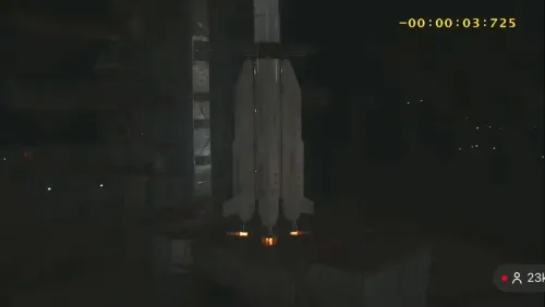
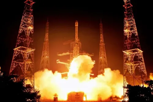
The Indian Space Research Organisation (ISRO) on Friday, 31 October launched its next-generation navigation satellite, NVS-03, aboard the GSLV-F18 rocket from the Satish Dhawan Space Centre in Sriharikota, Andhra Pradesh, at 11:51 pm IST. The mission aims to strengthen India's indigenous regional navigation system, NavIC, and ensure continuity of navigation services over the Indian subcontinent and surrounding region.
The Launch at a Glance
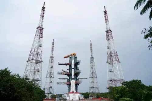
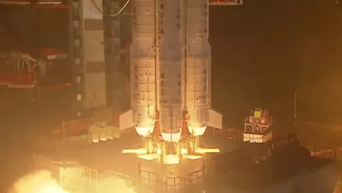
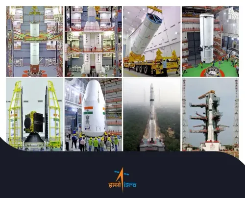
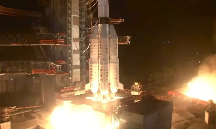
The 50-metre-tall, three-stage GSLV-F18 rocket lifted off from the Second Launch Pad at Sriharikota, carrying the 2,232 kg NVS-03 satellite into a Geosynchronous Transfer Orbit (GTO). ISRO described the mission as a 'rescue mission for NavIC', signalling its urgency in reinforcing an ageing constellation. Once in GTO, the satellite will perform a series of orbit-raising manoeuvres to reach its final geosynchronous slot at 32.5 degrees East.
What NVS-03 Brings to NavIC
NVS-03 is the third satellite in ISRO's second-generation NVS series, a planned set of five next-generation navigation satellites designed to augment and modernise the existing NavIC constellation. Notably, the satellite introduces the L1 navigation signal in addition to the existing L5 and S signals, a significant enhancement that broadens compatibility with civilian receivers and improves overall positioning accuracy. The satellite also carries an indigenous atomic clock alongside procured atomic clocks — a step toward reducing reliance on foreign timing hardware in India's space infrastructure.
According to ISRO, coverage extends over the Indian landmass and a region stretching approximately 1,500 km beyond India's geopolitical boundary, making NavIC relevant not just domestically but across South Asia and parts of the Indian Ocean region.
What NavIC Does and Why It Matters
NavIC — Navigation with Indian Constellation — is India's independent regional satellite navigation system, providing Position, Velocity and Timing (PVT) services. ISRO operates two service tiers: the Standard Positioning Service (SPS) for civilian users, and the Restricted Service (RS), an encrypted channel for authorised — typically strategic and government — users. India developed NavIC to reduce dependence on the US-controlled GPS, Russia's GLONASS, and other foreign systems, particularly for defence and critical infrastructure applications. This comes amid a broader global push by mid-sized space powers to establish sovereign navigation capabilities.
Context: Why This Is Described as a 'Rescue Mission'
ISRO's use of the phrase 'rescue mission for NavIC' points to an underlying vulnerability in the constellation. Several older NavIC satellites have experienced atomic clock failures in recent years, degrading the system's precision. The NVS series — with upgraded hardware and the addition of the L1 band — is intended to restore full operational capacity and future-proof the system. NVS-03 follows NVS-01 and NVS-02 in this replenishment effort, with two more second-generation satellites still to be launched under ISRO's roadmap.
What Comes Next
Mission controllers will monitor NVS-03's orbit-raising manoeuvres in the coming days before the satellite is commissioned into the NavIC constellation. Once operational, it is expected to improve navigation accuracy for millions of users — from fishermen relying on NavIC-enabled devices along India's coastline to defence and logistics operators. The remaining two NVS-series satellites are anticipated to complete the second-generation upgrade of NavIC within the next few years.
Point of View
And mainstream coverage has largely glossed over it. NavIC's atomic clock failures were a known vulnerability that received little public attention; NVS-03 is remediation as much as advancement. The addition of the L1 band is significant because it is the signal that most civilian smartphone chipsets are built to receive, meaning NavIC could finally move toward mass-market relevance. The deeper question is whether India can sustain the launch cadence needed to keep NavIC competitive — two more NVS satellites remain, and the gap between announcements and operational readiness has historically been wider than ISRO's timelines suggest.
NationPress
31 Oct 2026
Frequently Asked Questions
What is the NVS-03 satellite launched by ISRO?
NVS-03 is India's next-generation navigation satellite, the third in ISRO's second-generation NVS series, launched on 31 October aboard the GSLV-F18 rocket from Sriharikota. It is designed to augment the NavIC constellation with enhanced signals and an indigenous atomic clock, ensuring continuity of India's independent navigation services.
What is NavIC and why does India need it?
NavIC (Navigation with Indian Constellation) is India's independent regional satellite navigation system, providing positioning, velocity, and timing services across India and up to 1,500 km beyond its borders. India developed it to reduce strategic dependence on foreign systems such as the US-controlled GPS, particularly for defence and critical infrastructure.
What is new about NVS-03 compared to earlier NavIC satellites?
NVS-03 introduces the L1 navigation signal alongside existing L5 and S signals, broadening its compatibility with civilian receivers and improving accuracy. It also carries an indigenous atomic clock, a step toward greater self-reliance in the system's core timing hardware.
Why did ISRO call the NVS-03 mission a 'rescue mission for NavIC'?
The description refers to atomic clock failures on older NavIC satellites that had degraded the system's precision and reliability. The second-generation NVS series, including NVS-03, is intended to restore and upgrade the constellation's full operational capacity.
How many more NVS-series satellites does ISRO plan to launch?
ISRO has envisaged five second-generation NVS satellites in total. With NVS-01, NVS-02, and NVS-03 now launched, two more remain under the organisation's roadmap to complete the NavIC upgrade.