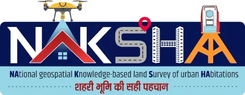
Will the Two-Day Workshop 'NAKSHA' Transform Urban Land Management in Bhopal?

Synopsis
Join us as Bhopal hosts the transformative two-day workshop 'NAKSHA' focused on revolutionizing urban land management. Discover how this initiative, backed by key government bodies, aims to enhance transparency and efficiency in land governance through innovative technology. Don't miss the chance to explore cutting-edge solutions that could reshape how we manage land in India!
Key Takeaways
'Naksha' Web-GIS platform can enhance urban property surveys.
Collaboration among government bodies is crucial for effective land management.
Hands-on training will be provided on drone-based analysis and ground surveys.
Real-time applications of the 'Naksha' app will be showcased.
Best practices from various states will be discussed to improve urban land governance.
Bhopal, June 5 (NationPress) A two-day national workshop focusing on the 'Naksha' web-Geographic Information System platform is set to commence at the Indian Institute of Science Education and Research (IISER), Bhopal, starting Thursday, according to an official announcement.
This event is a collaborative effort between the Department of Land Resources, Ministry of Rural Development, and the Madhya Pradesh State Electronics Development Corporation (MPSEDC).
The workshop aims to unite senior government officials, technical specialists, and land management professionals from across the nation to engage in constructive discussions, as shared by an official from the Rural Development Department.
“Our goal is to demonstrate the potential of the 'Naksha' Web-GIS solution, especially in urban property surveys and geospatial data management, while fostering transparency and technology-driven practices in land governance and administration,” the official noted.
On the first day, participants will attend technical presentations and live demonstrations showcasing the features of the 'Naksha' platform and its real-time applications in urban property surveys.
Experts from the Survey of India and MPSEDC are scheduled to conduct training on drone-based image analysis, feature extraction, and ground-level survey techniques.
Moreover, attendees will participate in a field visit to Sanchi, where they will gain practical experience with the mobile-based Naksha app for real-time surveys, including plot assessments, multi-ownership mapping, and record updates.
The second day (June 6) will emphasize reviewing the outcomes of the previous day's field surveys.
Topics of discussion will include data integration on the 'Naksha' platform, split-merge processes, and methodologies for updating land records.
The session will also showcase best practices from states like Kerala, Karnataka, Assam, and Andhra Pradesh in urban land surveys, according to the official.
“This workshop is anticipated to significantly advance modern, transparent, and efficient management of urban land rights through an indigenous digital platform, thereby contributing to the vision of a technologically empowered land administration system across India,” the official added.
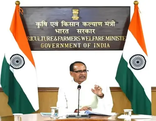
Several senior officials, including Shyam Kumar (Director, Department of Land Resources), Sanjay Dubey (Additional Chief Secretary, Department of Science and Technology), and Vivek Porwal (Principal Secretary in Revenue Department), are expected to attend the event.
Point of View
The 'NAKSHA' workshop signifies a pivotal step towards modernizing land administration in India. By leveraging technology, this initiative showcases the government's commitment to enhancing transparency and efficiency in urban land management, aligning with the nation's broader goals of digital empowerment and good governance.
NationPress
6 Jul 2026
Frequently Asked Questions
What is the purpose of the 'NAKSHA' workshop?
The workshop aims to demonstrate the capabilities of the 'Naksha' Web-GIS solution in urban property surveys and promote technology-driven practices in land governance.
Who is organizing the workshop?
The event is jointly organized by the Department of Land Resources, Ministry of Rural Development, and the Madhya Pradesh State Electronics Development Corporation (MPSEDC).
Where is the workshop taking place?
The workshop is being held at the Indian Institute of Science Education and Research (IISER) in Bhopal.
What activities are planned for the workshop?
The workshop will include technical presentations, live demonstrations, field visits, and discussions on urban land survey practices and data integration.
Who are the key speakers at the workshop?
Prominent officials such as Shyam Kumar, Sanjay Dubey, and Vivek Porwal will be attending and speaking at the event.