Is Tamil Nadu Ready for an Early Southwest Monsoon?

Synopsis
Tamil Nadu is on the brink of experiencing an early southwest monsoon, predicted to arrive nearly ten days ahead of schedule. With favorable conditions in the Andaman Sea, residents can expect relief from the searing heat and potential thunderstorms, making this weather event one to watch closely.
Key Takeaways
Tamil Nadu prepares for an early southwest monsoon .
Expected to arrive around May 13 .
Relief from intense heat anticipated.
Thunderstorms forecasted in multiple districts.
Recent cyclone caused significant damage.
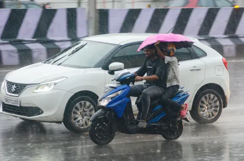
Chennai, May 6 (NationPress) Tamil Nadu is gearing up for the early arrival of the southwest monsoon, which is anticipated to occur nearly 10 days earlier than usual this year, according to the meteorological office.
The Regional Meteorological Centre (RMC) reports that favorable conditions have developed over the South Andaman Sea, the southeastern Bay of Bengal, and parts of the Nicobar Islands. This suggests that the southwest monsoon could commence around May 13—significantly ahead of the typical June start.
This early arrival is expected to provide relief from the severe heat currently affecting the state.
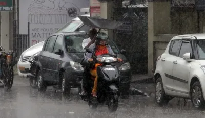
The RMC has also projected moderate thunderstorms and rainfall across areas including Tiruvallur, Ranipet, Tiruvannamalai, Kancheepuram, and Chengalpattu districts in the upcoming days.
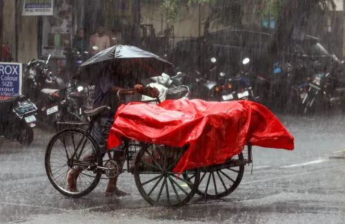
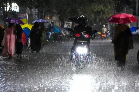
On Sunday, Chennai and surrounding regions experienced substantial rain coupled with thunderstorms and strong winds. Areas like Egmore, Perambur, Nungambakkam, Meenambakkam, Triplicane, Tondiarpet, Anna Nagar, Koyambedu, Velachery, Ambattur, and Avadi reported moderate to heavy showers.
The Nungambakkam weather station recorded 11 mm of rain, while Meenambakkam noted 8 mm.
The Weather Department attributes the current conditions to a north-south trough linked to a cyclonic circulation extending from northern Gangetic West Bengal to north coastal Andhra Pradesh, passing through coastal Odisha at approximately 0.9 km above mean sea level. For the next couple of days, light to moderate rainfall, along with thunderstorms, lightning, and gusty winds (30-40 kmph), is predicted across Tamil Nadu and Puducherry. Heavy rain is also expected in certain southern and delta districts, including Pudukottai, Thanjavur, Tiruvarur, Nagapattinam, and Mayiladuthurai, with some areas likely to experience significant downpours.
Meteorologists have noted that current forecasts indicate the system may shift towards Odisha and West Bengal, drawing winds from inland regions.
Tamil Nadu recently recorded a 14 percent surplus in rainfall during the northeast monsoon, with a total of 447 mm against an average of 393 mm. Chennai logged 845 mm—16 percent above normal—while Coimbatore noted a 47 percent increase.
These predictions follow the impact of Cyclone Fengal, which hit Tamil Nadu and Puducherry between November 29 and December 1, unleashing heavy rains. The cyclone resulted in 12 fatalities, inundated 2.11 lakh hectares of farmland, and affected 69 lakh families, impacting nearly 1.5 crore individuals. In response, the Centre allocated an additional Rs 522.34 crore in relief for Tamil Nadu and Rs 33.06 crore for Puducherry.
Point of View
It's important to recognize the implications of weather patterns on local communities. The early arrival of the southwest monsoon in Tamil Nadu offers a chance for respite from extreme temperatures and could significantly affect agricultural practices in the region. Overall, the timely response from the authorities is commendable, ensuring residents are prepared for the upcoming weather changes.
NationPress
10 Jul 2026
Frequently Asked Questions
When is the southwest monsoon expected to arrive in Tamil Nadu?
The southwest monsoon is expected to begin around May 13, nearly ten days ahead of the usual schedule.
What areas in Tamil Nadu are likely to experience rain?
Moderate thunderstorms and showers are forecasted for Tiruvallur, Ranipet, Tiruvannamalai, Kancheepuram, and Chengalpattu districts.
What impact did Cyclone Fengal have on Tamil Nadu?
Cyclone Fengal caused 12 fatalities, flooded agricultural lands, and affected millions of families, prompting relief efforts from the government.
How much rainfall did Tamil Nadu receive during the northeast monsoon?
Tamil Nadu recorded a 14% excess rainfall during the northeast monsoon, totaling 447 mm compared to the average of 393 mm.
What are the expected weather conditions in the coming days?
Light to moderate rainfall, along with thunderstorms and gusty winds, is expected across Tamil Nadu and Puducherry.