Very heavy rain alert in 13 Madhya Pradesh districts as depression persists

Synopsis
A depression parked over northeast Madhya Pradesh is battering 13 districts with very heavy rain, lightning, and 59 km/h gusts — Bichhia alone recorded 191.8 mm in 24 hours. Even as the system tracks toward UP, Sunday offers no real respite, with 20 districts still in the forecast firing line.
Key Takeaways
The IMD has issued a very heavy rainfall alert for 13 districts of Madhya Pradesh on 26 September 2026 .
A depression over northeast Madhya Pradesh and north Chhattisgarh is the driving system, centred 70 km south-southwest of Sidhi .
Highest 24-hour rainfall: Bichhia (191.8 mm) , Ajaigarh (180.2 mm) , and Amarkantak (148.0 mm) .
Gusty winds peaked at 59 km/h at Anuppur and 52 km/h at Sagar .
Temperatures are 4.5–8 degrees C below normal across several divisions.
The depression is expected to move toward southeast Uttar Pradesh by Saturday evening and weaken; heavy rain is still forecast across 20 districts on Sunday, 27 September .
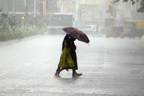
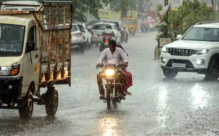
The India Meteorological Department (IMD) has issued a very heavy rainfall alert for 13 districts of Madhya Pradesh on Saturday, 26 September 2026, as a depression over northeast Madhya Pradesh and adjoining north Chhattisgarh continues to drive widespread, intense rainfall across large parts of the state.
Districts Under Alert
According to the Bhopal Weather Centre, very heavy downpours accompanied by thunderstorms, lightning, and gusty winds of 40–50 km/h are likely at isolated places in Datia, Bhind, Sidhi, Rewa, Satna, Umaria, Katni, Jabalpur, Panna, Damoh, Chhatarpur, Tikamgarh, and Niwari.
A second tier of heavy rainfall is expected at isolated places in Shivpuri, Gwalior, Morena, Singrauli, Mauganj, Anuppur, Shahdol, Narsinghpur, Mandla, Sagar, and Maihar.
Rainfall Recorded in the Past 24 Hours
The highest rainfall totals in the preceding 24 hours were logged at Bichhia (191.8 mm), Ajaigarh (180.2 mm), Amarkantak (148.0 mm), Panna (143.2 mm), and Bajag (143.0 mm). Significant amounts were also recorded at Rajnagar (112.6 mm) and Niwas (110.8 mm).
Gusty winds peaked at 59 km/h at Anuppur and 52 km/h at Sagar. Thunderstorms with lightning struck across Shahdol, Jabalpur, Narmadapuram, Sagar, Rewa, Chambal, and Gwalior divisions, as well as in districts including Vidisha, Raisen, Ratlam, Jhabua, Dhar, Barwani, and Khargone.
Temperature Impact Across Divisions
The relentless cloud cover and rainfall have pushed temperatures markedly below seasonal norms. Maximum temperatures in Gwalior and Sagar divisions were 4.5–5.1 degrees Celsius below normal, while Bhopal, Chambal, and Jabalpur divisions saw deficits of 2.0–3.8 degrees C. Minimum temperatures in Gwalior, Rewa, Jabalpur, Shahdol, and Sagar divisions ran 5.9–8.0 degrees C below normal.
What the Depression Is Doing Next
The depression, centred approximately 70 km south-southwest of Sidhi district, is very likely to track north-northwestwards toward southeast Uttar Pradesh by Saturday evening before weakening into a well-marked low-pressure area. Despite this expected movement, the IMD forecast for Sunday, 27 September still indicates rainfall or thunderstorms with lightning at most places across 20 districts, including Datia, Bhind, Singrauli, Sidhi, Rewa, Satna, Anuppur, Shahdol, Umaria, Dindori, Katni, Jabalpur, Mandla, Panna, Damoh, Sagar, Chhatarpur, Tikamgarh, Niwari, and Maihar.
Safety Advisories for Residents
Authorities have advised residents to stay away from low-lying and flood-prone areas, avoid underpasses and overflowing bridges, and secure temporary structures. For Bhopal and its surrounding areas, skies are expected to remain generally cloudy with the possibility of thunderstorms accompanied by lightning and rain, with maximum and minimum temperatures around 29 degrees C and 21 degrees C respectively.
With the system set to weaken, conditions may gradually ease from Monday — but Sunday remains a day of caution across the affected eastern and central belts of the state.
Point of View
Not just an advisory. The IMD's forecast track, which moves the depression into Uttar Pradesh, is cold comfort: Madhya Pradesh's eastern belt is already saturated, and even weakening systems can trigger flash flooding on water-logged ground. State disaster machinery should be on pre-positioned standby, not reactive mode. The broader pattern — repeated deep depressions forming over north Chhattisgarh–MP corridors in late September — warrants a long-term land-use and drainage audit in the most affected districts.
NationPress
26 Sept 2026
Frequently Asked Questions
Which 13 districts are under the very heavy rain alert in Madhya Pradesh?
The 13 districts under the very heavy rainfall alert on 26 September 2026 are Datia, Bhind, Sidhi, Rewa, Satna, Umaria, Katni, Jabalpur, Panna, Damoh, Chhatarpur, Tikamgarh, and Niwari. These areas face thunderstorms, lightning, and gusty winds of 40–50 km/h alongside the heavy rain.
What is causing the heavy rainfall in Madhya Pradesh?
A depression centred approximately 70 km south-southwest of Sidhi district, over northeast Madhya Pradesh and adjoining north Chhattisgarh, is the primary driver. It has brought widespread rainfall across the state, with several stations recording over 100 mm in 24 hours.
How much rainfall has been recorded in the last 24 hours?
Bichhia recorded the highest amount at 191.8 mm, followed by Ajaigarh (180.2 mm), Amarkantak (148.0 mm), Panna (143.2 mm), and Bajag (143.0 mm). Rajnagar and Niwas also recorded over 110 mm each.
Will the heavy rain continue on Sunday, 27 September?
Yes. Despite the depression expected to weaken and move toward southeast Uttar Pradesh by Saturday evening, the IMD still forecasts rainfall or thunderstorms with lightning at most places across 20 districts on Sunday, 27 September 2026, including Jabalpur, Rewa, Sagar, Chhatarpur, and others.
What safety measures have authorities advised?
Authorities have advised residents to stay away from low-lying and flood-prone areas, avoid underpasses and overflowing bridges, and secure temporary structures. People in Bhopal and nearby areas should expect cloudy skies and possible thunderstorms, with temperatures around 29°C and 21°C.