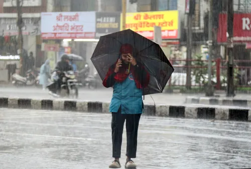
MP weather alert: Thunderstorms, hail and 60 kmph winds forecast for 5 days

Synopsis
The Bhopal Met Centre has put more than 35 Madhya Pradesh districts on a multi-hazard alert — thunderstorms, hail, lightning and gusts up to 60 kmph — for five straight days. Sehore already clocked 91 kmph winds, and hailstorms threaten standing crops in Bhopal, Dewas and Jhabua, even as the southwest monsoon advances steadily northward.
Key Takeaways
The Meteorological Centre, Bhopal has issued a 5-day warning for thunderstorms, lightning, hailstorms and gusty winds across Madhya Pradesh from 5 June .
Bardanagar recorded 58 mm of rainfall; Sehore logged gusts of 91 kmph — the highest wind speed reported.
Moderate thunderstorms with winds up to 60 kmph are forecast for Bhopal , Vidisha and the Raisen-Sanchi belt.
More than 35 districts are under gusty wind alerts of 40-50 kmph , stretching from western to eastern MP.
Hailstorms may damage crops, fruits and vegetables in Bhopal , Dewas , Jhabua and Shajapur ; farmers advised to halt harvesting.
The southwest monsoon has advanced into Maharashtra, Goa, Andhra Pradesh, Karnataka and Tamil Nadu, with further northward progress expected.
The Meteorological Centre in Bhopal has issued a multi-hazard weather warning for Madhya Pradesh, cautioning residents across several districts of thunderstorms, lightning, hailstorms and gusty winds of up to 50-60 kmph over the next five days starting 5 June. The alert comes as widespread rainfall has already lashed multiple parts of the state, with some areas recording significant accumulations.
Rainfall and Wind Recordings
Bardanagar received the highest recorded rainfall at 58 mm, followed by Sailana at 50 mm and Kolar at 40 mm. Wind intensity was equally striking: Sehore logged gusts of 91 kmph, Bhopal recorded 59 kmph, and the Guna-Ashoknagar region clocked 50 kmph, underscoring the severity of the ongoing weather activity across the state.
District-Level Alerts
Moderate thunderstorms with lightning and winds of up to 60 kmph are forecast for Bhopal, Bairagarh, Vidisha and the Raisen-Sanchi belt. Light thunderstorms with winds up to 40 kmph are expected in Bhind, Gwalior, Datia, Niwari, Tikamgarh, Chhatarpur-Khajuraho, Ashoknagar, Shivpuri, Mandla, Dindori, Khargone, Burhanpur, Sehore, Narmadapuram, Panna and Anuppur-Amarkantak during midnight hours.
Districts including Mandsaur, Neemuch, Chhindwara, Seoni, Shyopur, Damoh and Sagar are also under warning for thunderstorms with gusty winds. A broader gusty wind alert covering speeds of 40-50 kmph spans more than 35 districts, stretching from Indore and Ujjain in the west to Jabalpur and Balaghat in the east.
Hailstorm and Crop Damage Risk
Officials have cautioned that hailstorms may damage crops, fruits, vegetables and weak structures in districts such as Bhopal, Dewas, Jhabua and Shajapur. Dust storms are additionally expected in Bhopal, Dewas, Khargone, Damoh, Jabalpur, Jhabua, Mandsaur, Rajgarh, Sehore and Shajapur. The weather department has advised farmers to postpone harvesting and storage activities until conditions normalise.
Advisories for Residents
The India Meteorological Department (IMD) has urged citizens to stay indoors during thunderstorms, avoid open fields, water bodies and temporary structures, secure loose objects, and ensure livestock are sheltered safely. Local authorities have been asked to issue area-specific advisories to minimise risk.
Monsoon Advance Context
This spell of intense pre-monsoon and early-monsoon activity coincides with the southwest monsoon advancing into parts of Maharashtra, Goa, Andhra Pradesh, Karnataka, Tamil Nadu and the Bay of Bengal. Conditions remain favourable for further northward progress in the coming days, which could sustain or intensify weather activity over central India, including Madhya Pradesh.
Point of View
Spanning both pre-monsoon and early-monsoon systems — points to a convergence of weather patterns that central India's agricultural belt is particularly ill-equipped to absorb mid-harvest. Sehore recording 91 kmph winds is not a footnote; it is close to cyclonic-gust territory for an inland district. What is missing from official advisories is granular, taluka-level guidance for farmers who cannot simply 'postpone harvesting' when crops are already cut and lying in fields. The IMD's district-wide alerts are necessary but increasingly insufficient for last-mile risk communication.
NationPress
20 Oct 2026
Frequently Asked Questions
Which Madhya Pradesh districts are under weather alert for the next 5 days?
More than 35 districts are under alert, including Bhopal, Vidisha, Sehore, Gwalior, Indore, Ujjain, Jabalpur, Balaghat, Mandsaur, Neemuch, Dewas, Jhabua and Shajapur, among others. Alerts range from moderate thunderstorms with 60 kmph winds to lighter storms with gusts up to 40 kmph, depending on the district.
What kind of weather is forecast for Madhya Pradesh over the next 5 days?
The forecast includes thunderstorms, lightning, hailstorms, dust storms and gusty winds reaching 50-60 kmph across various districts. Moderate thunderstorms are expected in Bhopal and Vidisha, while lighter storms are forecast for eastern and northern districts during midnight hours.
How much rainfall has already been recorded in Madhya Pradesh?
Bardanagar received 58 mm of rainfall, Sailana 50 mm and Kolar 40 mm, according to the weather office. Wind speeds of 91 kmph were recorded in Sehore, indicating the intensity of the ongoing weather activity.
What precautions has the IMD advised for residents and farmers?
The IMD has advised residents to stay indoors during thunderstorms, avoid open fields, water bodies and temporary structures, and secure loose objects. Farmers have been specifically asked to postpone harvesting and storage activities until weather conditions normalise, as hailstorms may damage standing crops and produce.
Is the southwest monsoon connected to the current weather activity in MP?
The current spell coincides with the southwest monsoon advancing into Maharashtra, Goa, Andhra Pradesh, Karnataka, Tamil Nadu and the Bay of Bengal. Conditions remain favourable for further northward progress, which could sustain intense weather activity over Madhya Pradesh in the coming days.