MP thunderstorm alert: Hail, lightning and 60 kmph winds in 24 hours

Synopsis
The IMD has placed large parts of Madhya Pradesh on storm alert, warning of hail, lightning, and winds up to 60 kmph across dozens of districts — from Bhopal to Balaghat. With a western disturbance anchored over Kashmir and storm activity forecast through 9 May, farmers with standing crops face the most immediate risk.
Key Takeaways
The Meteorological Centre, Bhopal issued a severe weather alert for Madhya Pradesh on 5 May 2025 .
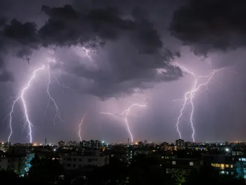
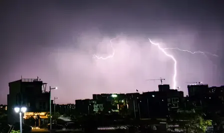
Thunderstorms, lightning, and hail with winds up to 60 kmph are forecast across districts including Seoni, Balaghat, Mandla, Dindori , and Bhind .
Hailstorms are specifically expected in Khandwa, Khargone, Datia, Singrauli, Sidhi , and Niwari .
A western disturbance over Kashmir is driving storm activity, expected to sustain until 9 May .
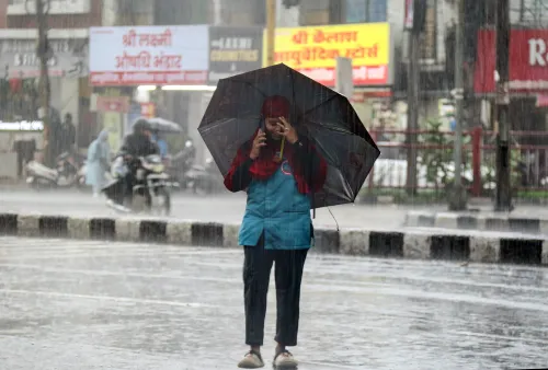
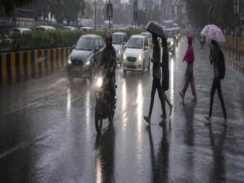
Farmers advised to harvest early or cover crops; citizens urged to stay indoors and away from trees and power lines.
A fresh western disturbance may affect the western Himalayas from 10 May , prolonging unsettled weather.
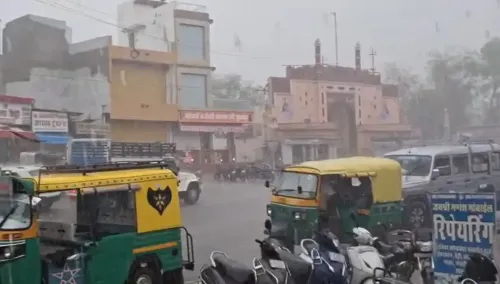
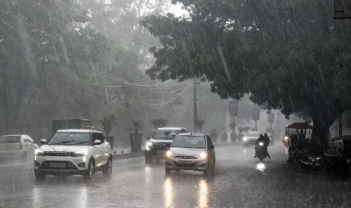
The Meteorological Centre, Bhopal on Tuesday, 5 May issued a severe weather warning for Madhya Pradesh, forecasting thunderstorms, lightning, hail, and gusty winds across several districts over the next 24 hours. The alert covers a wide swathe of the state, from eastern tribal belts to the Gwalior-Chambal region, with storm activity expected to persist until 9 May.
Districts on High Alert
Moderate thunderstorm activity with lightning, hail, and wind speeds up to 60 kmph is likely over Seoni, Balaghat, Mandla, Kanha, Dindori, Anuppur, Amarkantak, South Umaria, South Shahdol, East Gwalior, and Bhind. Light thunderstorms with lightning are forecast for Morena, West Gwalior, Datia, North Umaria, North Shahdol, Chhatarpur, South Sidhi, and South Shahdol during evening hours.
Gusty winds of 50–60 kmph may strike parts of Bhopal, Vidisha, Raisen, Sehore, Rajgarh, Narmadapuram, Betul, Barwani, Dhar, Guna, Ashoknagar, Shivpuri, Gwalior, Bhind, Morena, Sheopur, Rewa, Satna, Narsinghpur, Chhindwara, Seoni, Balaghat, Panna, and Sagar, according to the IMD bulletin. Winds of 40–50 kmph are also forecast for Indore, Shajapur, Jabalpur, Mandla, Umaria, Dindori, Katni, and Damoh.
Hailstorms are specifically likely in Khandwa, Khargone, Datia, Singrauli, Sidhi, Shahdol, Chhatarpur, Tikamgarh, and Niwari.
Agricultural and Structural Risk
The India Meteorological Department (IMD) bulletin has flagged that hailstorms may damage standing crops, fruits, vegetables, and fragile structures. Farmers have been advised to take protective measures — including covering crops or harvesting early where possible — to limit agricultural losses. Livestock should be sheltered and vehicles kept under cover.
This alert comes at a critical point in the crop calendar, when standing produce in central India is particularly vulnerable to unseasonal hail. Damage to horticultural crops such as vegetables and fruits can translate into immediate market price pressures in the region.
What Is Driving the Weather
According to the IMD, the synoptic situation shows a western disturbance manifesting as a cyclonic circulation over Kashmir and adjoining areas, with troughs extending across Haryana, Rajasthan, Uttar Pradesh, and Madhya Pradesh. These systems are expected to sustain storm activity across the state until 9 May.
A fresh western disturbance is likely to affect the western Himalayan region from 10 May, which could further influence weather patterns across northern India in the days that follow.
Safety Advisories for Residents
The IMD has urged citizens to remain indoors during thunderstorms, unplug electrical appliances, and avoid sheltering under trees or near power lines. Authorities have stressed that precautions are essential to minimise risks to life, property, and agriculture during this volatile weather phase. Residents across affected districts are advised to stay alert and follow official bulletins closely.
With storm systems forecast to remain active through 9 May and a fresh disturbance approaching from 10 May, weather conditions in Madhya Pradesh and neighbouring states are likely to remain unsettled well into next week.
Point of View
But the geographic spread of this alert — covering everything from the Vindhya belt to the Gwalior-Chambal corridor — is notable. What the bulletin does not address is the state government's preparedness on the ground: whether district administrations have activated crop-loss assessment protocols or pre-positioned relief teams. For farmers already navigating input cost pressures, an unseasonal hailstorm without a swift compensation mechanism can be as damaging as the storm itself. The IMD's advisory is necessary; the administrative follow-through is the real test.
NationPress
23 Jun 2026
Frequently Asked Questions
Which districts in Madhya Pradesh are under thunderstorm alert on 5 May 2025?
Dozens of districts are covered, including Seoni, Balaghat, Mandla, Dindori, Anuppur, Bhind, Morena, Gwalior, Bhopal, Indore, Rewa, Satna, and Jabalpur, among others. The IMD has warned of varying intensity — from moderate thunderstorms with hail to light lightning activity — depending on the district.
How long will the storm activity last in Madhya Pradesh?
According to the IMD bulletin, storm activity driven by the current western disturbance is expected to persist across Madhya Pradesh until 9 May 2025. A fresh western disturbance approaching from 10 May could extend unsettled weather further.
What precautions should farmers take during the hailstorm alert?
The IMD has advised farmers to cover standing crops or harvest early where possible to minimise hail damage. Livestock should be sheltered, and farm equipment and vehicles kept under cover to avoid damage from hail and gusty winds.
What is causing the thunderstorms in Madhya Pradesh?
The storms are being driven by a western disturbance manifesting as a cyclonic circulation over Kashmir and adjoining areas, with troughs extending through Haryana, Rajasthan, Uttar Pradesh, and Madhya Pradesh. This synoptic setup is sustaining widespread storm activity across central India.
What safety steps should residents follow during thunderstorms?
The IMD has urged residents to stay indoors during thunderstorms, unplug electrical appliances, and avoid sheltering under trees or near power lines. Citizens should follow official advisories and monitor IMD bulletins for updates.